Difference between revisions of "2009-01-16 -33 151"
imported>Gormster (New page: {{meetup graticule | map=<map lat="-33" lon="151" date="2009-01-16" /> | lat=-33 | lon=151 | date=2009-01-16 | graticule_name=Sydney | graticule_link=Sydney, Australia}} == About == The h...) |
m (More specific location) |
||
| (2 intermediate revisions by 2 users not shown) | |||
| Line 49: | Line 49: | ||
Image:Geohash_Sydney_2009-01-16_-_43.jpg|Almost back at the car. I was going to investigate where the road came out, but I'd neglected to bring my water bottle and was dying of thirst. | Image:Geohash_Sydney_2009-01-16_-_43.jpg|Almost back at the car. I was going to investigate where the road came out, but I'd neglected to bring my water bottle and was dying of thirst. | ||
</gallery> | </gallery> | ||
| + | |||
| + | |||
| + | [[Category:Expeditions]] | ||
| + | [[Category:Expeditions with photos]] | ||
| + | [[Category:Coordinates reached]] | ||
| + | {{location|AU|NSW|WB}} | ||
Latest revision as of 11:33, 1 August 2020
| Fri 16 Jan 2009 in Sydney: -33.7898837, 151.2118638 geohashing.info google osm bing/os kml crox |
About
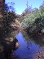
The hash fell just off the North Arm Track in Castle Cove.
Expeditions
Gormster
Gormster earned the Land geohash achievement
|
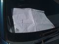
A little sign to let other hashers know I have gone on ahead.
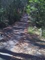
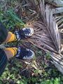
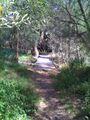
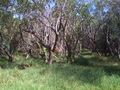
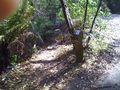
The beginning of the trail. I am immediately glad I opted not to bring my dog; she has hip dysplasia.
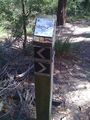
A helpful sign to point me in the right direction.
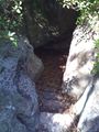
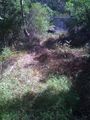
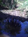
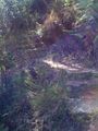
Some rather disappointing falls. I thought this might be the humble beginnings of the river.
Wait a second, is that a road?
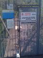
Suddenly the road runs out at a Sydney Water facility, the edge of which can be seen in this photo.
ARE YOU FUCKING SERIOUS
I climb up a ladder I'm not sure I should be climbing to get a better view of the area.
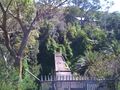
There's a pretty good view of the valley from up here.
Wait, is that a bridge? That looks like a bridge down there, under the big one I can't cross.
Artsy. iPhones take pretty good photos sometimes.
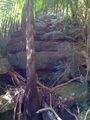
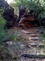
This is the "trail" I had to come down after crossing the little wooden bridge.
I think I need to get over to that causeway.
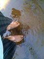
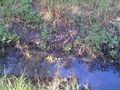
Time to go swimming, I guess.
On the causeway, I realise the trail does not continue from - IS THAT ANOTHER GOD DAMN BRIDGE
Back on dry land, with purpose and a bearing. Head south, to the bridge I glimpsed in the distance.
How the hell did I not see these stairs.
Here is the bridge over the river, looking like something straight out of a Myst game.
Some fire damage to the bridge. It still smells like smoke. I make sure to jump over it.
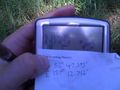
Here it is: the piece of paper with the co-ords written on, and my GPS device. It's not exactly right but my GPS isn't that accurate.
The view from the hash point. It's pretty nice.
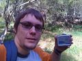
Myself at the hash with GPS.
The hash point itself.
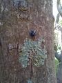
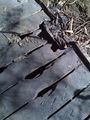
This was the only piece of interesting fauna I saw all day.
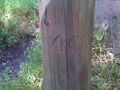
Making my mark.
This, it turns out, is where the steps came out.
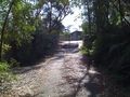
The Sydney Water facility that necessitates the sealed road. The path I took is the gravel one in the left of this image.
Almost back at the car. I was going to investigate where the road came out, but I'd neglected to bring my water bottle and was dying of thirst.


