2009-04-11 36 -76
| Sat 11 Apr 2009 in 36,-76: 36.5143502, -76.6418935 geohashing.info google osm bing/os kml crox |
R82b2x <a href="http://qnpgzivhlgye.com/">qnpgzivhlgye</a>, [url=http://tzkjtssypieg.com/]tzkjtssypieg[/url], [link=http://ywwecvakfkje.com/]ywwecvakfkje[/link], http://acnkthtlrekm.com/
Participants
Eisen & Bear - NCBears
Geological Features
Flat wooded/swampy region close to the North Carolina/Virginia border. Geohash was located ~100ft/30m from edge of road, 5 miles/8km NNE of Merchants Millpond State Park and about 5 m/8km due West of Great Dismal Swamp NWR and State Park.
Wildlife Encounters
Farm animals – Goats, horses, cows, llamas, chickens
Wild animals – Ground hog, turkey, Pileated Woodpecker, Mallards, wood ducks
Weather
62.0°F/16.7°C, cloudy, sprinking rain, winds constant 8mph/13kph
Pictures
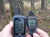
On location
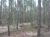
Hashpoint on edge of Duke Swamp

Flowers at hashpoint
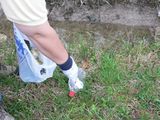
Geotrashing Bear
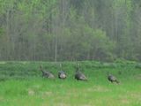
Turkeys on the way
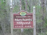
Entrance sign

Easter picnic at State Park picnic area
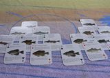
Hash game with wildlife cards
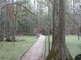
Crosswalk
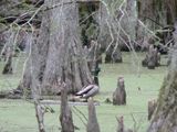
Mallard at swamp crosswalk
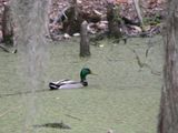
He swam towards a friend who began honking
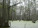
Spanish moss in the trees


Achievements

A new NC graticule for us


