Difference between revisions of "2009-05-08 49 -120"
From Geohashing
imported>Robyn (+virgin graticule ribbon) |
imported>Rhonda (→Photos) |
||
| Line 36: | Line 36: | ||
==Photos== | ==Photos== | ||
<gallery> | <gallery> | ||
| + | Image:2009-05-08_49_-120.fraser-valley.jpg|Starting our trip on highway 1 (trans-canada) | ||
| + | Image:2009-05-08_49_-120.crowsnest-hwy.jpg|Continuing along highway 3 (crowsnest) | ||
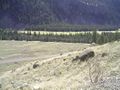
| + | Image:2009-05-08 49 -120.stemwinder.jpg|The closest legal parking spot... | ||
| + | Image:2009-05-08 49 -120.heading-out.jpg|Not waiting any longer | ||
| + | Image:2009-05-08 49 -120.past-first-switchback.jpg|The first part was easy | ||
| + | Image:2009-05-08 49 -120.up-slope.jpg|the next part a little less so | ||
Image:2009-05-08 49 -120.rhondaup.JPG|Rhonda walking up the slope to the geohash | Image:2009-05-08 49 -120.rhondaup.JPG|Rhonda walking up the slope to the geohash | ||
| + | Image:2009-05-08 49 -120.rock-face.jpg|Sometimes it wasn't really a slope | ||
Image:2009-05-08 49 -120.grouppose2.JPG|Robyn, Juventas and Rhonda at the geohash | Image:2009-05-08 49 -120.grouppose2.JPG|Robyn, Juventas and Rhonda at the geohash | ||
Image:2009-05-08 49 -120.gps.JPG|T-Rex shows proof of our arrival | Image:2009-05-08 49 -120.gps.JPG|T-Rex shows proof of our arrival | ||
| + | Image:2009-05-08 49 -120.twister1.jpg|Twister, anyone? | ||
Image:2009-05-08 49 -120.shadowsdown.JPG|Our shadows precede us down the access road | Image:2009-05-08 49 -120.shadowsdown.JPG|Our shadows precede us down the access road | ||
</gallery> | </gallery> | ||
Revision as of 00:35, 12 May 2009
| Fri 8 May 2009 in 49,-120: 49.3822991, -120.1317194 geohashing.info google osm bing/os kml crox |
People met here. Played Twister. Saw deer. Write up later.
Contents
Location
Up a hill, across Highway 3 (Crowsnest) from Stemwinder Provincial Park campsite, east of Princeton.
Participants
Planning
Expedition
Robyn
Rhonda
Juventas
Hiking up
Success
Hiking down
On to the next hash point.
Photos
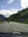
Starting our trip on highway 1 (trans-canada)
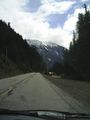
Continuing along highway 3 (crowsnest)
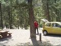
The closest legal parking spot...
Not waiting any longer
The first part was easy
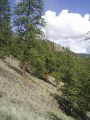
the next part a little less so
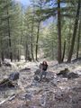
Rhonda walking up the slope to the geohash
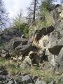
Sometimes it wasn't really a slope
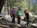
Robyn, Juventas and Rhonda at the geohash
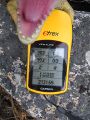
T-Rex shows proof of our arrival
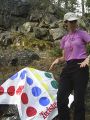
Twister, anyone?
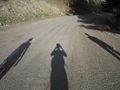
Our shadows precede us down the access road


