2009-05-08 49 -119
A painful late night decision to forgo achieving the geohash to avoid greater pain.
| Fri 8 May 2009 in 49,-119: 49.3822991, -119.1317194 geohashing.info google osm bing/os kml crox |
Contents
Location
On a steep, tree-covered slope about 3 km from Beaverdell, near a logging road.
Participants
Planning
Our original plan was to visit this hashpoint after the same day's Princeton one and then camp at a forest service campsite within a kilometre, to earn Juventas a Camping geohash achievement. We were going to drive up the forest service road, which Juventas knew, and then from it find logging roads leading to almost to the geohash, bushwhack the last few hundred metres, and then set up camp. This section probably should have been longer. But that is the drawback of having only a few hours to plan an adventure before you have to leave to get there.
Expedition
Highways and switchbacks
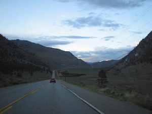
We were in Juventas' territory and he knew the way to the access road, so Rhonda and Robyn followed him through the winding mountain roads from valley to valley. Because the Princeton expedition had started two hours later than planned and taken a little longer than expected, this expedition started under a little cloud of doubt. A literal cloud also shadowed the expedition for a time, pouring some rain on us as we approached Keremeos, but we outdrove the rain and returned to mostly blue skies overhead.
We stopped for gas and bought sandwiches and breakfast supplies, then continued down the Similkameen valley south almost to the border crossing for "Nighthawk, USA," north around some more mountains, and back south to Osoyoos. Somewhere between Osoyoos and Rock Creek we went through some switchbacks that were so startlingly sharp that the two lanes of the road were on different tiers against the hills. The sun set as we turned north through another valley, and we switched from following Juventas' red car to following his slightly slanted tail lights. He was an excellent convoy leader, never losing us at stoplights or merge points, always remembering to tell us where we would be stopping next, and making sure to check that we were okay when we stopped to change drivers.
Forest Service Road
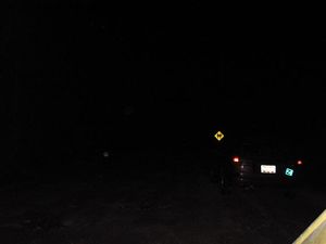
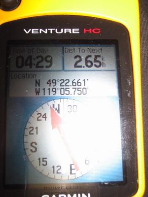
Eventually he turned off highway 33 into a pothole-studded dirt road and we stopped to talk. We were on Tuzo Creek Forest Service Road, the beginning of our access road and 2.65 km from the geohash. Robyn took one look at the road and said "no" on behalf of her teeny little car, but we had planned for that and were prepared to move all the gear to the hardier station wagon before proceeding. We had a little conference. The geohash was near to a switchback but not right on the road, one or two hundred metres into the bush, by Juventas' estimate. We are all experienced geohashers and know that rarely means a short, painless stroll. Robyn remembered a previous expedition, conducted in fading daylight, on level, agricultural land, with snow on the ground and close to a major city. (A city puts so much light up into the sky that it never gets really dark, and snow reflects that light, enhancing its effect). Here it was already darker than the end of that expedition, in rugged terrain in a mountain valley containing no cites and few towns, and with contour lines showing the geohash to be on a very steep slope. Not everyone had a flashlight. It was late and we were tired. Robyn submitted a veto against walking through an unknown mountainous area in the dark and no one called her a wuss.
As the camping achievement requires reaching the point before camping out within a kilometre, we elected not to try and find the Forest Service campsite in the dark, but instead to continue along the highway, and find a place to camp that was closer to tomorrow's first planned geohash.
Camping
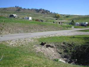
We returned to our Juventas-led convoy through another pass, down to Kelowna and between the Okanagan and Kalamalka Lakes to a campground just outside Vernon, shortly after 11 p.m. We drove through the loop of the campground and every spot was taken, all with RVs. Then we found a side road with an empty campsite. It had a reserved sign on the post but we reasoned that if they weren't here by now, they probably weren't coming, and we'd be leaving in the morning. We parked the vehicles, set up the tents, finished our sandwich leftovers and went right to sleep.
In the morning Robyn fired up the stove, but it wasn't burning properly and she couldn't figure out why. It had worked perfectly the weekend before. She pumped it, primed it with extra gas, swore at it, talked nicely to it, turned it upside-down and shook it ... all the standard remedies, but it kept going out and didn't put out much heat when it was lit. By this time there were some other campers awake, so Robyn and Rhonda wandered down to see if someone would lend us a source of cooking energy. We found a crew of friendly campers with a roaring breakfast fire and a texas-sized frying pan who not only offered us the use of a stove, but offered to fix our recalcitrant one. As Rhonda said, "You don't say you'll fix something unless you're pretty sure you can," and our stove malfunction proved especially easy to remedy. See, it wasn't a stove malfunction, so much as a stove knowledge malfunction. Robyn had somehow lit and extinguished the stove a number of times on the previous weekend, preparing rice, soup, tea and scrambled eggs on it without difficulty, while priming it incorrectly. The things you learn while geohashing.
With the stove roaring, we cooked a pound of bacon and a dozen eggs, divided them three ways, added a few Ryvita crackers, and called it breakfast. It had to sustain us through another day of geohashing.
Postscript
Looking at the Google Maps satellite imagery of the area, one can see that the switchback-heavy road we needed to access the geohash was one of a spiderweb of little roads or road-appearing openings in the trees. It looks to be substantially narrower than the Forest Service road where we made our no-go decision, and in the dark we would have had a very difficult time distinguishing among different unsigned dirt roads and the edges of cliffs. We did not have turn-by-turn GPS coordinates to follow, and considering that two days later in daylight we missed turnoffs for more prominently mapped roads, in an area with fewer total roads, we likely would not have found the correct road, let alone walked safely to the geohash through the woods. And back. And then set up camp. And had the stove not work.
It's probably a very good thing we chose a different adventure.


