Difference between revisions of "2010-08-17 40 -74"
imported>Jevanyn (Created page with '{{subst:Expedition|date=2010-08-17 |lat=40 |lon=-74}}') |
m (Replacing http://wiki.xkcd.com/geohashing/User_talk:Jevanyn with User talk:Jevanyn) |
||
| (7 intermediate revisions by 3 users not shown) | |||
| Line 1: | Line 1: | ||
| − | |||
| − | |||
| − | |||
| − | |||
| − | |||
| − | |||
| − | |||
| − | |||
| − | |||
| − | |||
{{meetup graticule | {{meetup graticule | ||
| lat=40 | | lat=40 | ||
| Line 18: | Line 8: | ||
__NOTOC__ | __NOTOC__ | ||
== Location == | == Location == | ||
| − | + | Stelton Rd., Edison | |
== Participants == | == Participants == | ||
| − | + | [[User:Jevanyn|Jevanyn]] | |
== Plans == | == Plans == | ||
| − | + | I'm planning on biking there after work, getting there between 6PM and 7PM. Plans require someone to pick me up; I know I don't have it in me (or [http://www.youtube.com/watch?v=id-9fUJuJQo on me]) to do a round trip. | |
| + | |||
| + | If anyone else would like to join us, there is a gas station at the intersection of Stelton and Henry where we can meet, and we can decide what to do once we're there. Leave me a [[User talk:Jevanyn|message]] and let me know if you're coming. | ||
== Expedition == | == Expedition == | ||
| − | + | *Left work at about 5:15PM. Planned on meeting Gwynnath and Kyukket at the gas station (Exxon) across the street from the geohash. | |
| − | + | *Stopped at all turns and several landmarks to take pictures. | |
| − | + | *Realized about half way there that I couldn't find the directions I'd printed out. Spent 10-15 minutes on side of road re-calculating directions. | |
| − | + | *Arrived at about 6:55PM. The folks living in the house immediately adjacent to the geohash were home and hanging out on front porch, so I didn't stay long at the geohash itself. | |
| + | *Kyukket was waiting ... at a different gas station (Gulf) about four blocks away. | ||
| + | *Gwynnath caught up with us at the Gulf station at about 7:20, and we went to Red Robin (Yummm!™) for dinner. | ||
== Photos == | == Photos == | ||
| − | |||
| − | |||
| − | |||
<gallery perrow="5"> | <gallery perrow="5"> | ||
| + | File:2010-08-17 40 -74 Img648.jpg | Pre-ride silly grin | ||
| + | File:2010-08-17 40 -74 Img649.jpg | Vehicle of Choice | ||
| + | File:2010-08-17 40 -74 Img651.jpg | Leaving The Courtyard | ||
| + | File:2010-08-17 40 -74 Img652.jpg | I took this exit from US 206... | ||
| + | File:2010-08-17 40 -74 Img653.jpg | And turned right onto Dukes Parkway E. | ||
| + | File:2010-08-17 40 -74 Img655.jpg | "Dukes Parkway" | ||
| + | File:2010-08-17 40 -74 Img656.jpg | "N Main Street" (turn left) | ||
| + | File:2010-08-17 40 -74 Img657.jpg | Secret message for cyclists! | ||
| + | File:2010-08-17 40 -74 Img658.jpg | Give the steepness and traffic, I'm more than willing to comply | ||
| + | File:2010-08-17 40 -74 Img659.jpg | Which gave me a chance to shoot the passing NJ Transit train | ||
| + | File:2010-08-17 40 -74 Img660.jpg | Turn right where (N) Main Street meets ... (E) Main Street. | ||
| + | File:2010-08-17 40 -74 Img661.jpg | Where they are building ... | ||
| + | File:2010-08-17 40 -74 Img662.jpg | ... a retirement home ... | ||
| + | File:2010-08-17 40 -74 Img663.jpg | ... walking distance from a [http://www.somersetpatriots.com baseball stadium]. | ||
| + | File:2010-08-17 40 -74 Img664.jpg | Main Street becomes Lincoln Blvd., where there is a statue of Lincoln. (Damn, I cut off his head :-( ) | ||
| + | File:2010-08-17 40 -74 Img665.jpg | I missed the turn on Cedar Rd., so I turned right on Mountain Rd., which re-connected with my original route. | ||
| + | File:2010-08-17 40 -74 Img668.jpg | Mountain Rd. changed names to Jarrard St., where I turned right onto N. Randolphville Rd. | ||
| + | File:2010-08-17 40 -74 Img671.jpg | Then left on Old New Brunswick Rd. | ||
| + | File:2010-08-17 40 -74 Img674.jpg | Then right on Stelton Rd. (finally!) | ||
| + | File:2010-08-17 40 -74 Img675.jpg | (Almost) [[Coffin Potato Achievement|coffin potatoes]] | ||
| + | File:2010-08-17 40 -74 Img676.jpg | How the hell did they land ''there''? | ||
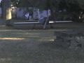
| + | File:2010-08-17 40 -74 Img677.jpg | Picture of the geohash | ||
| + | File:2010-08-17 40 -74 Img678.jpg | View of the gas station from the geohash, south of the hash | ||
| + | File:2010-08-17 40 -74 Img679.jpg | Intersection with Washington Ave., looking east from the hash | ||
| + | File:2010-08-17 40 -74 Img680.jpg | Post-hash silly grin. Two silly grins for the price of one! | ||
</gallery> | </gallery> | ||
| − | |||
| − | |||
| − | |||
| − | |||
| − | |||
| − | |||
| − | |||
| − | |||
| − | |||
| − | |||
| − | |||
| − | |||
| − | |||
| − | |||
| − | |||
[[Category:Expeditions]] | [[Category:Expeditions]] | ||
| − | |||
[[Category:Expeditions with photos]] | [[Category:Expeditions with photos]] | ||
| − | |||
| − | |||
| − | |||
| − | |||
| − | |||
[[Category:Coordinates reached]] | [[Category:Coordinates reached]] | ||
| − | + | {{location|US|NJ|MI}} | |
| − | |||
| − | |||
| − | |||
| − | |||
| − | |||
| − | |||
| − | |||
| − | |||
| − | |||
Latest revision as of 11:44, 19 February 2020
| Tue 17 Aug 2010 in 40,-74: 40.5622128, -74.4502247 geohashing.info google osm bing/os kml crox |
Location
Stelton Rd., Edison
Participants
Plans
I'm planning on biking there after work, getting there between 6PM and 7PM. Plans require someone to pick me up; I know I don't have it in me (or on me) to do a round trip.
If anyone else would like to join us, there is a gas station at the intersection of Stelton and Henry where we can meet, and we can decide what to do once we're there. Leave me a message and let me know if you're coming.
Expedition
- Left work at about 5:15PM. Planned on meeting Gwynnath and Kyukket at the gas station (Exxon) across the street from the geohash.
- Stopped at all turns and several landmarks to take pictures.
- Realized about half way there that I couldn't find the directions I'd printed out. Spent 10-15 minutes on side of road re-calculating directions.
- Arrived at about 6:55PM. The folks living in the house immediately adjacent to the geohash were home and hanging out on front porch, so I didn't stay long at the geohash itself.
- Kyukket was waiting ... at a different gas station (Gulf) about four blocks away.
- Gwynnath caught up with us at the Gulf station at about 7:20, and we went to Red Robin (Yummm!™) for dinner.
Photos
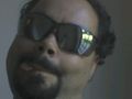
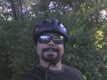
Pre-ride silly grin
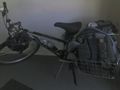
Vehicle of Choice
Leaving The Courtyard
I took this exit from US 206...
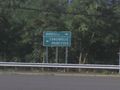
And turned right onto Dukes Parkway E.
"Dukes Parkway"
"N Main Street" (turn left)
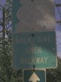
Secret message for cyclists!
Give the steepness and traffic, I'm more than willing to comply
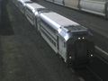
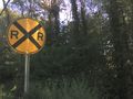
Which gave me a chance to shoot the passing NJ Transit train
Turn right where (N) Main Street meets ... (E) Main Street.
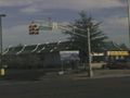
Where they are building ...
... a retirement home ...
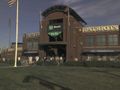
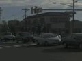
... walking distance from a baseball stadium.
Main Street becomes Lincoln Blvd., where there is a statue of Lincoln. (Damn, I cut off his head :-( )
I missed the turn on Cedar Rd., so I turned right on Mountain Rd., which re-connected with my original route.
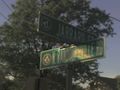
Mountain Rd. changed names to Jarrard St., where I turned right onto N. Randolphville Rd.
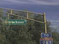
Then left on Old New Brunswick Rd.
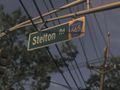
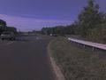
Then right on Stelton Rd. (finally!)
(Almost) coffin potatoes
How the hell did they land there?
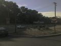
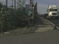
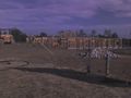
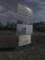
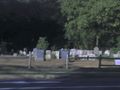
Picture of the geohash
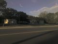
View of the gas station from the geohash, south of the hash
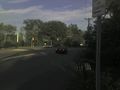
Intersection with Washington Ave., looking east from the hash
Post-hash silly grin. Two silly grins for the price of one!


