Difference between revisions of "2010-09-11 29 -95"
imported>Phineas (→Participants) |
m (Replacing http://wiki.xkcd.com/geohashing/2010-09-09_30_-94 with 2010-09-09 30 -94) |
||
| (6 intermediate revisions by 4 users not shown) | |||
| Line 1: | Line 1: | ||
| − | |||
| − | |||
| − | |||
| − | |||
| − | |||
| − | |||
| − | |||
| − | |||
| − | |||
| − | |||
{{meetup graticule | {{meetup graticule | ||
| lat=29 | | lat=29 | ||
| Line 29: | Line 19: | ||
Ralph (the naughty bear) | Ralph (the naughty bear) | ||
| − | + | Daughter Amy, age 7 | |
== Plans == | == Plans == | ||
<!-- what were the original plans --> | <!-- what were the original plans --> | ||
| − | After failing in my first geohashing attempt two days ago [ | + | After failing in my first geohashing attempt two days ago [[2010-09-09 30 -94|near Devers, TX]], this hash is a no brainer. |
It is a definite for a Speed Racer achievement. | It is a definite for a Speed Racer achievement. | ||
| Line 50: | Line 40: | ||
<!-- how it all turned out. your narrative goes here. --> | <!-- how it all turned out. your narrative goes here. --> | ||
| − | Well, after the debacle on Thursday regarding [ | + | Well, after the debacle on Thursday regarding [[2010-09-09 30 -94|my first geohashing attempt]], it was a relief to find such an approachable target today. In fact, it was almost un-sporting, old chap. Not only was this a simple thoroughfare about 20 miles from my hometown, but I could easily stay on streets and highways divided by medians the ENTIRE route, excepting a few blocks on either side of my home street. Tron achievement was easily in reach. |
Urban geohashing is a whole different matter than trekking the wild, I guess. | Urban geohashing is a whole different matter than trekking the wild, I guess. | ||
| Line 103: | Line 93: | ||
}} | }} | ||
| − | + | {{Speed racer | |
| − | + | | latitude = 29 | |
| − | + | | longitude = -95 | |
| − | [[ | + | | date = 2010-09-11 |
| − | + | | name = [[User:Phineas|Phineas]] | |
| − | + | | image = | |
| − | + | | speed = 40 mph | |
| − | + | }} | |
| − | |||
| − | |||
[[Category:Expeditions]] | [[Category:Expeditions]] | ||
| − | |||
[[Category:Expeditions with photos]] | [[Category:Expeditions with photos]] | ||
| − | |||
| − | |||
| − | |||
| − | |||
| − | |||
[[Category:Coordinates reached]] | [[Category:Coordinates reached]] | ||
| − | + | {{location|US|TX|RR}} | |
| − | |||
| − | |||
| − | |||
| − | |||
| − | |||
| − | |||
| − | |||
| − | |||
| − | |||
Latest revision as of 09:49, 19 February 2020
| Sat 11 Sep 2010 in 29,-95: 29.9314646, -95.4966417 geohashing.info google osm bing/os kml crox |
Location
Dead center in the southbound lane of Bammel North Houston Rd. in NW Houston, Texas.
Participants
Ralph (the naughty bear)
Daughter Amy, age 7
Plans
After failing in my first geohashing attempt two days ago near Devers, TX, this hash is a no brainer.
It is a definite for a Speed Racer achievement.
As to other designations, I began to think Picnic, Kite, Twister, and all manner of potential achievements. Then realized that being in the middle of a busy highway, not beside a busy highway, limits me a bit.
Potential achievements: - No Batteries - as I need no aids to reach this point, and could use my sextant for the final positioning. Rejected - I'll be going in daylight, and need at least one other celestial body to trinagulate my position. - GeoTrash - if there's trash nearby, consider it gone. - Drag-along - I've got three kids and a wife to choose from. Hmmm.
Of course, a target this easy will also be my first Land Geohash.
Expedition
Well, after the debacle on Thursday regarding my first geohashing attempt, it was a relief to find such an approachable target today. In fact, it was almost un-sporting, old chap. Not only was this a simple thoroughfare about 20 miles from my hometown, but I could easily stay on streets and highways divided by medians the ENTIRE route, excepting a few blocks on either side of my home street. Tron achievement was easily in reach.
Urban geohashing is a whole different matter than trekking the wild, I guess.
So to make this simple journey more enjoyable, I commandeered child #3, Amy, age 7. A resonable-distance, sunshine-laden drive on a Saturday afternoon was just the thing for a little dad/daughter time. That, and I couldn't leave her home alone.
Just off one of the two expressways we'd travel we would pass a favorite taqueria, at which I once observed a drug bust in process. Despite the shaky neighborhood, it should have been plenty safe on a lazy Saturday afternoon. A dozen homemade tamales in hand, we proceeded.
Despite the pleasant day and company, after the drama of fighting off several vicious, venomous snakes two days prior (hah), this trip was a little anticlimactic. We stopped a few hundred yards north of the hashpoint to snap a photo of the GPS (fuzzy, hard to take pix in sunlight - I'll figure that out soon enough). Then, having located the hashpoint in the left hand lane of Bammel North Houston Rd, southbound, we drove through it at just a few miles per hour over the speed limit.
A quick U-turn, and.....wait - I needed more photos. So I slowed and snapped a few through the windshield, as we re-approached from the south. Not a great picture, as the grass median even blocked the roadway. I also had wanted a picture with Amy and Ralph, my intrepid bear. So in a rush of bad judgement, I turned left across my original route, and traced back to the hashpoint, ruining my easily accomplished Tron.
Amy and I snapped a couple photos and I explained to her that the spot in the road behind her was the random destination we had been targeting all along.
"You were really serious about it being random, Dad", replied Amy. No lie. Her words exactly. I drove the first few miles of the return trip in silent awe of her.
Tracklog
Photos

Amy's dancing hair
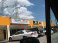
Quick stop at a taqueria
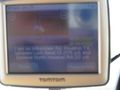
Fuzzy proof just north of hashpoint
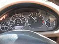
A couple mph over speed limit through first land hash
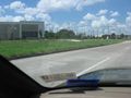
Repassing hash after U-turn
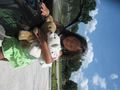
Amy, Ralph (L), Camembear, Puppy
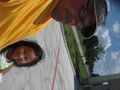
Phin and Amy, hashpoint in background


Achievements
Phineas earned the Land geohash achievement
|
Phineas earned the Drag-along achievement
|
