Difference between revisions of "2012-03-10 55 -3"
imported>Alexturgid (→Expedition) |
imported>Alexturgid |
||
| Line 1: | Line 1: | ||
| − | |||
| − | |||
| − | |||
| − | |||
| − | |||
| − | |||
| − | |||
| − | |||
| − | |||
| − | |||
{{meetup graticule | {{meetup graticule | ||
| lat=55 | | lat=55 | ||
| Line 48: | Line 38: | ||
</gallery> | </gallery> | ||
| − | |||
| − | |||
| − | |||
| − | |||
| − | |||
| − | |||
| − | |||
| − | |||
| − | |||
| − | |||
| − | |||
| − | |||
| − | |||
| − | |||
| − | |||
| − | |||
| − | |||
[[Category:Expeditions with photos]] | [[Category:Expeditions with photos]] | ||
| − | |||
| − | |||
| − | |||
| − | |||
| − | |||
| − | |||
| − | |||
| − | |||
| − | |||
[[Category:Coordinates not reached]] | [[Category:Coordinates not reached]] | ||
| − | |||
[[Category:Not reached - Mother Nature]] when there is a natural obstacle between you and the target | [[Category:Not reached - Mother Nature]] when there is a natural obstacle between you and the target | ||
| − | |||
| − | |||
[[Category:Not reached - Did not attempt]] when you went to an alternate location, or decided early on to abort the expedition. | [[Category:Not reached - Did not attempt]] when you went to an alternate location, or decided early on to abort the expedition. | ||
| − | |||
Revision as of 17:08, 10 March 2012
| Sat 10 Mar 2012 in 55,-3: 55.2001308, -3.3999547 geohashing.info google osm bing/os kml crox |
Location
North of Lockerbie, in a field adjacent to the railway line.
Participants
Alexturgid and his girlfriend Kerry.
Plans
No chance of actually getting to the hash as it's too far from the train.
Expedition
Team were heading to Edinburgh for a weekend away and noticed the hash would be spitting distance from the train. Unfortunately there were no windows to spit from, so the bodily fluid proxy wasn't possible. Shortly after Scrabble game was complete, the hash was near. GPS fix was wobbly inside the train so we even managed to get a photo of the hash inside the circle of uncertainty, but not close enough to claim this as a success. Saw the hash site from the train window, but not brave enough to jump out and get back in while the train was whizzing past.
Tracklog
Photos
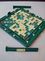
Board state at end of game. Alexturgid wins!

Kerry. And some trees.
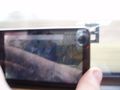
The Circle of Doubt

Alexturgid surveying the board


when there is a natural obstacle between you and the target when you went to an alternate location, or decided early on to abort the expedition.