Difference between revisions of "2012-07-22 55 -17"
From Geohashing
imported>Guzzby (→Tracklog) |
m (Reverted edits by I ❤️ Unicode (talk) to last revision by Fippe) (Tag: Rollback) |
||
| (12 intermediate revisions by 6 users not shown) | |||
| Line 62: | Line 62: | ||
<!-- =============== USEFUL CATEGORIES FOLLOW ================ | <!-- =============== USEFUL CATEGORIES FOLLOW ================ | ||
Delete the next line ONLY if you have chosen the appropriate categories below. If you are unsure, don't worry. People will read your report and help you with the classification. --> | Delete the next line ONLY if you have chosen the appropriate categories below. If you are unsure, don't worry. People will read your report and help you with the classification. --> | ||
| − | |||
<!-- Potential categories. Please include all the ones appropriate to your expedition --> | <!-- Potential categories. Please include all the ones appropriate to your expedition --> | ||
| Line 99: | Line 98: | ||
(Don't forget to delete this final close comment marker) --> | (Don't forget to delete this final close comment marker) --> | ||
| − | [[Category: | + | [[Category:Example]] |
| − | |||
| − | |||
[[Category:Not reached - Did not attempt]] | [[Category:Not reached - Did not attempt]] | ||
| + | {{location|XI}} | ||
Latest revision as of 00:04, 12 February 2022
| Sun 22 Jul 2012 in 55,-17: 55.5994754, -17.7209116 geohashing.info google osm bing/os kml crox |
Location
Somewhere in the north Atlantic.
Participants
Plans
Here are my plans.
Expedition
This is only an example.
Photos
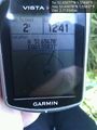
This is an example of good evidence

Achievements
Sourcerer earned the Water geohash achievement
|