Difference between revisions of "2014-04-12 50 11"
imported>Jens (→Juja, Anna and Jens) |
imported>GeorgDerReisende (expedition report added) |
||
| Line 28: | Line 28: | ||
== Expedition == | == Expedition == | ||
| − | |||
=== GeorgDerReisende === | === GeorgDerReisende === | ||
I am starting just now for Buchfart. One another geohasher maybe coming is enough reason for doing so. 9:00 MESZ. | I am starting just now for Buchfart. One another geohasher maybe coming is enough reason for doing so. 9:00 MESZ. | ||
| + | |||
| + | With two lifts I arrived at the western end of Weimar and I needed 50 minutes to walk to the southern end. After another short lift I arrived at the motorway junction. From there I walked across fields and forests and Buchfart to the hash. Suddenly I saw three geohashers on my way. After some talk I went onto the hill for the hash. Afterwards I climbed the hill to the top and then I walked to Kiliansroda and Mechelroda. On the street behind Mechelroda I got a lift to the service station Eichelborn and with two more cars I reached Kassel and I arrived at home at 21:30. | ||
=== Juja, Anna and Jens === | === Juja, Anna and Jens === | ||
| Line 40: | Line 41: | ||
However, Juja, Anna (our new geohasher in town) and Jens (the person just sitting at the keyboard) met at half past two at the edge of Jena to start the expedition on our bikes. We used the obvious way via Großschwabhausen and Mellingen. In Oettern I proposed to leave the road and start following the paths through the forest into the points direction. Since I remembered that the direct way from Buchfart crosses a lot of contour lines. I’m not sure whether this was the best choice, since there were enough contour lines on this way too, probably even more. And the way was longer, of course. So let’s quickly forget, who had this idea. However, we reached the point a quarter to 4. | However, Juja, Anna (our new geohasher in town) and Jens (the person just sitting at the keyboard) met at half past two at the edge of Jena to start the expedition on our bikes. We used the obvious way via Großschwabhausen and Mellingen. In Oettern I proposed to leave the road and start following the paths through the forest into the points direction. Since I remembered that the direct way from Buchfart crosses a lot of contour lines. I’m not sure whether this was the best choice, since there were enough contour lines on this way too, probably even more. And the way was longer, of course. So let’s quickly forget, who had this idea. However, we reached the point a quarter to 4. | ||
| − | We parked our bikes and started looking for Georg, but he had not arrived yet. So we decided to climb up the hill to the point in our group of three. We wandered around staring at our GPS devices to get the zero-distance photo, which was not easy under a cover of trees and clouds. Lucky Juja was the first to cry “I got it”. After this was done, we went back to our bikes, where we left a mark for Georg, for the case that he would be | + | We parked our bikes and started looking for Georg, but he had not arrived yet. So we decided to climb up the hill to the point in our group of three. We wandered around staring at our GPS devices to get the zero-distance photo, which was not easy under a cover of trees and clouds. Lucky Juja was the first to cry “I got it”. After this was done, we went back to our bikes, where we left a mark for Georg, for the case that he would be too late. But while we were creating our mark, I noticed him in the distance. After some minutes of small talk he started climbing up the hill and we left the point to go back to Jena again. This time the direct way down, which was made of terrible stones. Finally Juja had the idea to go back via Magdala and Bucha. So at the end we had a nice down hill run to complete a nice expedition. |
| − | |||
| − | |||
| − | |||
== Photos == | == Photos == | ||
| Line 55: | Line 53: | ||
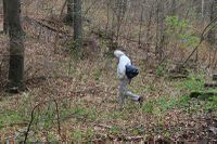
|Image:140412 50 11 06.JPG|Georg starts climbing up the hill | |Image:140412 50 11 06.JPG|Georg starts climbing up the hill | ||
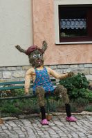
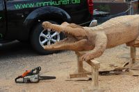
|Image:140412 50 11 07.JPG|Some artwork I met on my way home | |Image:140412 50 11 07.JPG|Some artwork I met on my way home | ||
| + | }} | ||
| + | |||
| + | === GeorgDerReisende === | ||
| + | {{gallery|width=200|height=200|lines=2 | ||
| + | |Image:2014-04-12 50 11 GeorgDerReisende 8207.jpg|View from the Holzdorfer Kreuz to the hash | ||
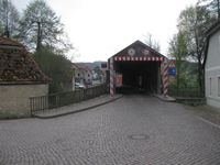
| + | |Image:2014-04-12 50 11 GeorgDerReisende 8263.jpg|The bridge over the river Ilm in Buchfart | ||
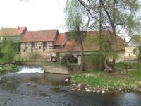
| + | |Image:2014-04-12 50 11 GeorgDerReisende 8268.jpg|A watermill in Buchfart | ||
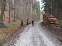
| + | |Image:2014-04-12 50 11 GeorgDerReisende 8278.jpg|Three geohashers in a forest | ||
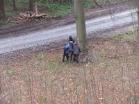
| + | |Image:2014-04-12 50 11 GeorgDerReisende 8288.jpg|Three geohashers preparing for their way home | ||
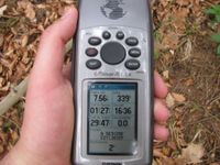
| + | |Image:2014-04-12 50 11 GeorgDerReisende 8290.jpg|At the point | ||
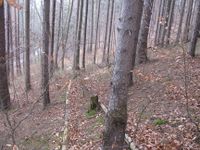
| + | |Image:2014-04-12 50 11 GeorgDerReisende 8291.jpg|View to the valley | ||
| + | |Image:2014-04-12 50 11 GeorgDerReisende 8292.jpg|View to the west | ||
| + | |Image:2014-04-12 50 11 GeorgDerReisende 8293.jpg|View to the north | ||
| + | |Image:2014-04-12 50 11 GeorgDerReisende 8294.jpg|View to the east | ||
| + | |Image:2014-04-12 50 11 GeorgDerReisende 8295.jpg|A geohasher | ||
| + | |Image:2014-04-12 50 11 GeorgDerReisende 8296.jpg|A mark | ||
| + | |Image:2014-04-12 50 11 GeorgDerReisende 8297.jpg|The dance of the pointer | ||
}} | }} | ||
| Line 61: | Line 76: | ||
<!-- Add any achievement ribbons you earned below, or remove this section --> | <!-- Add any achievement ribbons you earned below, or remove this section --> | ||
| + | {{Thumbs Up | latitude = 50 | longitude = 11 | date = 2014-04-12 | name = GeorgDerReisende }} | ||
| − | + | {{XKCD Centurion | count = 12 | name = GeorgDerReisende }} | |
| − | |||
| − | |||
| − | + | [[Category:Expeditions]] | |
| − | + | [[Category:Expeditions with photos]] | |
| − | |||
| − | [[Category: | ||
| − | |||
| − | |||
| − | |||
| − | |||
| − | |||
| − | |||
| − | |||
| − | |||
| − | |||
| − | |||
[[Category:Coordinates reached]] | [[Category:Coordinates reached]] | ||
| − | |||
| − | |||
| − | |||
| − | |||
| − | |||
| − | |||
| − | |||
| − | |||
| − | |||
| − | |||
| − | |||
| − | |||
| − | |||
| − | |||
| − | |||
| − | |||
| − | |||
| − | |||
Revision as of 20:42, 12 April 2014
| Sat 12 Apr 2014 in 50,11: 50.9129615, 11.3410758 geohashing.info google osm bing/os kml crox |
Location
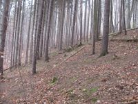
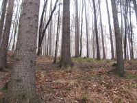
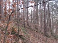
The hash lies in the forest of Buchfart, about one kilometer southeast of the village.
Participants
Plans
I can hitchhike to this place! But I will do this only, if other geohashers are announcing their coming until Saturday morning, about 9 o'clock! This can become a xkcd-meetup. Otherwise I will go to [[2014-04-12 52 7]].
I want to go there by bike, but I won't go if it's raining. If any other Jenaer geohashers want to go by bike, I'm open to meeting in Jena and going together. Maybe start out at 2pm to be there at 4? ScepticAnna (talk)
Juja and Jens will also join the meeting. We will go there by bike and start at 2.30pm on the bike path at Papiermühle.
Expedition
GeorgDerReisende
I am starting just now for Buchfart. One another geohasher maybe coming is enough reason for doing so. 9:00 MESZ.
With two lifts I arrived at the western end of Weimar and I needed 50 minutes to walk to the southern end. After another short lift I arrived at the motorway junction. From there I walked across fields and forests and Buchfart to the hash. Suddenly I saw three geohashers on my way. After some talk I went onto the hill for the hash. Afterwards I climbed the hill to the top and then I walked to Kiliansroda and Mechelroda. On the street behind Mechelroda I got a lift to the service station Eichelborn and with two more cars I reached Kassel and I arrived at home at 21:30.
Juja, Anna and Jens
After the last hash on Monday has been an accumulation of single person expeditions this time we tried this coordination stuff once again and - believe it or not – 3 persons met in Jena to cycle together to the point. I guess Georg Der Reisende accidentally caused this incident by announcing his presence for today.
However, Juja, Anna (our new geohasher in town) and Jens (the person just sitting at the keyboard) met at half past two at the edge of Jena to start the expedition on our bikes. We used the obvious way via Großschwabhausen and Mellingen. In Oettern I proposed to leave the road and start following the paths through the forest into the points direction. Since I remembered that the direct way from Buchfart crosses a lot of contour lines. I’m not sure whether this was the best choice, since there were enough contour lines on this way too, probably even more. And the way was longer, of course. So let’s quickly forget, who had this idea. However, we reached the point a quarter to 4.
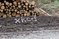
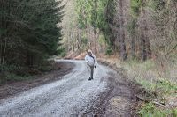
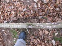
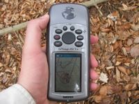
We parked our bikes and started looking for Georg, but he had not arrived yet. So we decided to climb up the hill to the point in our group of three. We wandered around staring at our GPS devices to get the zero-distance photo, which was not easy under a cover of trees and clouds. Lucky Juja was the first to cry “I got it”. After this was done, we went back to our bikes, where we left a mark for Georg, for the case that he would be too late. But while we were creating our mark, I noticed him in the distance. After some minutes of small talk he started climbing up the hill and we left the point to go back to Jena again. This time the direct way down, which was made of terrible stones. Finally Juja had the idea to go back via Magdala and Bucha. So at the end we had a nice down hill run to complete a nice expedition.
Photos
Juja, Anna and Jens
|
GeorgDerReisende
|
Achievements
GeorgDerReisende earned the Thumbs Up Geohash Achievement
|
GeorgDerReisende earned the xkcd Decurion achievement
|
