Difference between revisions of "2014-06-08 46 10"
imported>LeslieHapablap |
m (per Renaming Proposal) |
||
| (19 intermediate revisions by 4 users not shown) | |||
| Line 1: | Line 1: | ||
| + | [[Image:panorama_20140608_132020_width_px2559.jpg|left|900px]] | ||
<!-- If you did not specify these parameters in the template, please substitute appropriate values for IMAGE, LAT, LON, and DATE (YYYY-MM-DD format) | <!-- If you did not specify these parameters in the template, please substitute appropriate values for IMAGE, LAT, LON, and DATE (YYYY-MM-DD format) | ||
| Line 14: | Line 15: | ||
| date=2014-06-08 | | date=2014-06-08 | ||
}} | }} | ||
| − | + | {{ClearLeft}} | |
<!-- edit as necessary --> | <!-- edit as necessary --> | ||
__NOTOC__ | __NOTOC__ | ||
== Location == | == Location == | ||
<!-- where you've surveyed the hash to be --> | <!-- where you've surveyed the hash to be --> | ||
| + | Close to the Lake Reschen, in the tri-state area AT-CH-IT. | ||
== Participants == | == Participants == | ||
| Line 24: | Line 26: | ||
--> | --> | ||
* [[User:EleanorAbernathy|EleanorAbernathy]] | * [[User:EleanorAbernathy|EleanorAbernathy]] | ||
| − | * [[User:LeslieHapablap|LeslieHapablap]] | + | * [[User:LeslieHapablap|LeslieHapablap]] ([[2014-05-28 47 11|previous]]|[[2014-06-09 47 11|next]]) |
* [[User:LeslieHapablap/Waltraud|Waltraud]] the hashkiwi | * [[User:LeslieHapablap/Waltraud|Waltraud]] the hashkiwi | ||
== Plans == | == Plans == | ||
<!-- what were the original plans --> | <!-- what were the original plans --> | ||
| − | This one is just too tempting. I've been waiting for good locations in the virgin graticules of either [[46,10]] or [[46, | + | This one is just too tempting. I've been waiting for good locations in the virgin graticules of either [[46,10]] or [[46,12]] for quite some time now. This one is well accessible from Reschen, which one can reach from Innsbruck in just 1h30 by car or 2h30 by public transport. It is in the tri-state area: still in Austria, but only about 50 m away from Italy, and about 2 km away from Switzerland. Sunday, a beautiful landscape with a scenic lake, a nice weather forecast (except for a chance of thunderstorms)... it is on! |
| + | |||
== Expedition == | == Expedition == | ||
<!-- how it all turned out. your narrative goes here. --> | <!-- how it all turned out. your narrative goes here. --> | ||
| + | A perfect expedition and a perfect location for a geohash. Even though the point was higher up then the one where I was walking through snow [[2014-05-24 47 11|only a few weeks ago]], this one was a lot easier to reach, because we started already at about 1400 m a.s.l. and because the terrain was very geohasher-friendly. To be honest, for a point in the Alps this was really ridiculously convenient, on an only slightly descending meadow with a picnic area near by. But with [[User:EleanorAbernathy|EleanorAbernathy]] having to carry the weight of one and a half, this was just perfect :) | ||
| − | + | We had to walk a little more than 3 km to the hashpoint, ascending about 400 m. It was a beautiful landscape with meadows full of flowers, the lake in the background and the perfect weather to complete it all. We met several mountain-bikers, two of them were missing the hashpoint only by 20 m. On our way we came across an abandoned stronghold or bunker, presumably protecting the border in less peaceful times then the ours. We were approaching from the Italian side because there are no trails leading to the hashpoint from Austria. The point where we crossed the border between Italy and Austria was marked with a border stone. On our way back we saw a little frog who let us take his picture before jumping into the water to hide. | |
| − | |||
| − | |||
| − | |||
| − | |||
| − | |||
| − | |||
| − | |||
| − | |||
| − | |||
| − | |||
| − | |||
| − | |||
| + | When we got back to Reschen and its lake, we certainly had our share of sun for the day! | ||
<!-- =============== USEFUL CATEGORIES FOLLOW ================ | <!-- =============== USEFUL CATEGORIES FOLLOW ================ | ||
| Line 57: | Line 50: | ||
[[Category:Expedition planning]] | [[Category:Expedition planning]] | ||
--> | --> | ||
| − | [[Category: | + | [[Category:Expeditions]] |
| + | [[Category:Expeditions with photos]] | ||
<!-- An actual expedition: | <!-- An actual expedition: | ||
[[Category:Expeditions]] | [[Category:Expeditions]] | ||
| Line 86: | Line 80: | ||
(Don't forget to delete this final close comment marker) --> | (Don't forget to delete this final close comment marker) --> | ||
| + | |||
| + | == Photos == | ||
| + | |||
| + | <gallery perrow="5" widths=200px heights=150> | ||
| + | Image:20140608113915028_width_px800.jpg| Beautiful day for geohashing. | ||
| + | Image:IMG_20140608_114257_width_px800.jpg| The village Reschen. | ||
| + | Image:IMG_20140608_114755_width_px800.jpg| [[User:EleanorAbernathy|EleanorAbernathy]] with hat. | ||
| + | Image:IMG_20140608_115303_width_px800.jpg| We came across many little mountain streams. | ||
| + | Image:IMG_20140608_115516_width_px800.jpg| Grassland. | ||
| + | Image:IMG_20140608_115723_width_px800.jpg| A skiing slope for beginners. | ||
| + | Image:IMG_20140608_120005_width_px800.jpg| Reschen and the lake. | ||
| + | Image:IMG_20140608_123810_width_px800.jpg| Remains from a time when we needed to guard the borders in Central Europe. | ||
| + | Image:IMG_20140608_124241_width_px800.jpg| Nothing special to see here... | ||
| + | Image:IMG_20140608_124252_width_px800.jpg| ... or here. | ||
| + | Image:IMG_20140608_124449_width_px800.jpg| Enzian. | ||
| + | Image:IMG_20140608_124920_width_px800.jpg| More grassland and a hut. | ||
| + | Image:IMG_20140608_125145_width_px800.jpg| Trollblume. | ||
| + | Image:IMG_20140608_125352_width_px800.jpg| Sometimes it was difficult to find the trail. | ||
| + | Image:IMG_20140608_125358_width_px800.jpg| Brave [[User:EleanorAbernathy|EleanorAbernathy]]... | ||
| + | Image:IMG_20140608_125721_width_px800.jpg| ... still going up. | ||
| + | Image:IMG_20140608_125859_width_px800.jpg| More Enzian. | ||
| + | Image:20140608130558705_width_px800.jpg| A quite modern hut. | ||
| + | Image:20140608131112220_width_px800.jpg| Looking back to the lake. | ||
| + | Image:IMG_20140608_132322_width_px800.jpg| Almost there. | ||
| + | Image:IMG_20140608_132403_width_px800.jpg| The hashpoint (and Windows XP wallpaper). | ||
| + | Image:IMG_20140608_132409_width_px800.jpg| | ||
| + | Image:IMG_20140608_133018_width_px800.jpg| [[User:EleanorAbernathy|EleanorAbernathy]] and [[User:LeslieHapablap/Waltraud|Waltraud]]... | ||
| + | Image:IMG_20140608_133145_width_px800.jpg| ... sitting at the hashpoint. | ||
| + | Image:IMG_20140608_133210_width_px600.jpg| Our marker. | ||
| + | Image:IMG_20140608_133320_width_px800.jpg| Obligatory silly grin. | ||
| + | Image:IMG_20140608_133614_width_px800.jpg| A convenient picnic table almost directly at the hashpoint. | ||
| + | Image:IMG_20140608_134659_width_px800.jpg| A stone marking the border between Austria and Italy. | ||
| + | Image:IMG_20140608_134901_width_px600.jpg| [[User:LeslieHapablap|LeslieHapablap]] standing in Austria and Italy at the same time. | ||
| + | Image:IMG_20140608_134952_width_px600.jpg| [[User:ScepticAnna|ScepticAnna]] can probably tell us what this is. | ||
| + | Image:IMG_20140608_135014_width_px600.jpg| A frog. | ||
| + | Image:IMG_20140608_135045_width_px800.jpg| On our way back. | ||
| + | Image:IMG_20140608_135223_width_px800.jpg| The lake. | ||
| + | Image:screenshot_2014-06-08-13-25-56.png| Obligatory proof | ||
| + | </gallery> | ||
| + | |||
| + | == Achievements == | ||
| + | {{#vardefine:ribbonwidth|800px}} | ||
| + | |||
| + | {{land geohash | ||
| + | | latitude = 46 | ||
| + | | longitude = 10 | ||
| + | | date = 2014-06-08 | ||
| + | | name = [[User:EleanorAbernathy|EleanorAbernathy]] and [[User:LeslieHapablap|LeslieHapablap]] | ||
| + | |||
| + | }} | ||
| + | |||
| + | {{Minesweeper geohash | ||
| + | | name = [[User:EleanorAbernathy|EleanorAbernathy]] and [[user:LeslieHapablap|LeslieHapablap]] | ||
| + | | graticule = Livigno, Italy | ||
| + | | ranknumber = 3 | ||
| + | | nw = true | ||
| + | | n = true | ||
| + | | ne = true | ||
| + | |||
| + | }} | ||
| + | {{Border geohash achievement | ||
| + | |||
| + | | latitude = 46 | ||
| + | | longitude = 10 | ||
| + | | date = 2014-06-08 | ||
| + | | country1 = Austria | ||
| + | | country2 = Italy | ||
| + | | name = [[User:EleanorAbernathy|EleanorAbernathy]] and [[user:LeslieHapablap|LeslieHapablap]] | ||
| + | | image = IMG 20140608 134659 width px800.jpg | ||
| + | |||
| + | }} | ||
| + | {{graticule unlocked | ||
| + | | latitude = 46 | ||
| + | | longitude = 10 | ||
| + | | date = 2014-06-08 | ||
| + | | name = [[User:EleanorAbernathy|EleanorAbernathy]] and [[User:LeslieHapablap|LeslieHapablap]] | ||
| + | |||
| + | }} | ||
| + | |||
| + | [[Category:Coordinates reached]] | ||
| + | {{location|AT|T|LA}} | ||
Latest revision as of 05:12, 20 March 2024

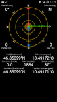
| Sun 8 Jun 2014 in 46,10: 46.8509933, 10.4917226 geohashing.info google osm bing/os kml crox |
Location
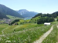
Close to the Lake Reschen, in the tri-state area AT-CH-IT.
Participants
- EleanorAbernathy
- LeslieHapablap (previous|next)
- Waltraud the hashkiwi
Plans
This one is just too tempting. I've been waiting for good locations in the virgin graticules of either 46,10 or 46,12 for quite some time now. This one is well accessible from Reschen, which one can reach from Innsbruck in just 1h30 by car or 2h30 by public transport. It is in the tri-state area: still in Austria, but only about 50 m away from Italy, and about 2 km away from Switzerland. Sunday, a beautiful landscape with a scenic lake, a nice weather forecast (except for a chance of thunderstorms)... it is on!
Expedition
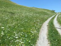
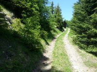
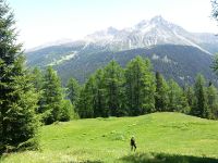
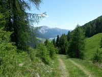
A perfect expedition and a perfect location for a geohash. Even though the point was higher up then the one where I was walking through snow only a few weeks ago, this one was a lot easier to reach, because we started already at about 1400 m a.s.l. and because the terrain was very geohasher-friendly. To be honest, for a point in the Alps this was really ridiculously convenient, on an only slightly descending meadow with a picnic area near by. But with EleanorAbernathy having to carry the weight of one and a half, this was just perfect :)
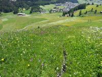
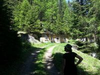
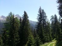
We had to walk a little more than 3 km to the hashpoint, ascending about 400 m. It was a beautiful landscape with meadows full of flowers, the lake in the background and the perfect weather to complete it all. We met several mountain-bikers, two of them were missing the hashpoint only by 20 m. On our way we came across an abandoned stronghold or bunker, presumably protecting the border in less peaceful times then the ours. We were approaching from the Italian side because there are no trails leading to the hashpoint from Austria. The point where we crossed the border between Italy and Austria was marked with a border stone. On our way back we saw a little frog who let us take his picture before jumping into the water to hide.
When we got back to Reschen and its lake, we certainly had our share of sun for the day!
Photos
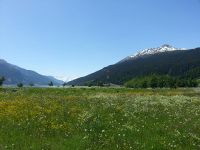
Beautiful day for geohashing.
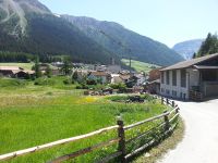
The village Reschen.
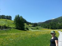
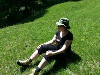
EleanorAbernathy with hat.
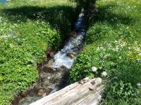
We came across many little mountain streams.
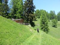
Grassland.
A skiing slope for beginners.
Reschen and the lake.
Remains from a time when we needed to guard the borders in Central Europe.
Nothing special to see here...
... or here.
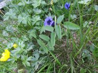
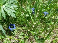
Enzian.
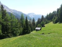
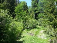
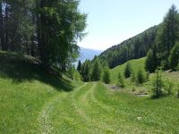
More grassland and a hut.
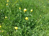
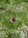
Trollblume.
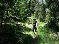
Sometimes it was difficult to find the trail.
Brave EleanorAbernathy...
... still going up.
More Enzian.
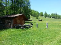
A quite modern hut.
Looking back to the lake.

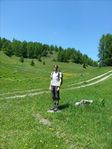
Almost there.
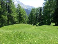
The hashpoint (and Windows XP wallpaper).
EleanorAbernathy and Waltraud...
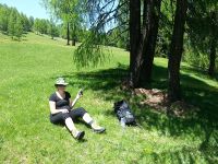
... sitting at the hashpoint.
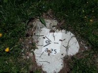
Our marker.
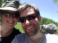
Obligatory silly grin.
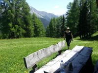
A convenient picnic table almost directly at the hashpoint.
A stone marking the border between Austria and Italy.
LeslieHapablap standing in Austria and Italy at the same time.
ScepticAnna can probably tell us what this is.
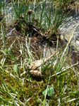
A frog.
On our way back.
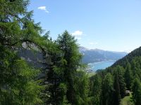
The lake.
Obligatory proof


Achievements
EleanorAbernathy and LeslieHapablap earned the Land geohash achievement
|
EleanorAbernathy and LeslieHapablap achieved level 3 of the Minesweeper Geohash achievement
|
EleanorAbernathy and LeslieHapablap earned the Border geohash achievement
|
EleanorAbernathy and LeslieHapablap earned the Graticule Unlocked Achievement
|