Difference between revisions of "2015-12-28 52 1"
From Geohashing
imported>Sourcerer m (→New expedition) |
imported>Sourcerer m ([live picture] Proof photo. [http://www.openstreetmap.org/?lat=52.01584876&lon=1.22592509&zoom=16&layers=B000FTF @52.0158,1.2259]) |
||
| Line 26: | Line 26: | ||
== Photos == | == Photos == | ||
<gallery> | <gallery> | ||
| + | |||
| + | Image:2015-12-28_52_1_Sourcerer_1451330994413.jpg | Proof photo. [http://www.openstreetmap.org/?lat=52.01584876&lon=1.22592509&zoom=16&layers=B000FTF @52.0158,1.2259] | ||
</gallery> | </gallery> | ||
Revision as of 19:31, 28 December 2015
| Mon 28 Dec 2015 in Norwich, UK: 52.0158495, 1.2259183 geohashing.info google osm bing/os kml crox |
Location
1) In a field, west of Nacton, Suffolk, UK.
Participants
Plans
One of three today - 2015-12-28 52 1 - 2011-02-20 52 0 Retro - 2015-12-28 52 0
Expedition
Temporarily aborted due to traffic congestion. Perhaps try later.
Photos
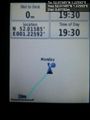
Proof photo. @52.0158,1.2259

Achievements
Expeditions and Plans
| 2015-12-28 | ||
|---|---|---|
| Bairnsdale, Australia | Felix Dance, Stevage, Lachie, Mdixon4, Rhonda | Off a walking track near Dinner Plain, adjacent to Mount Hotham, in the Vic... |
| Seattle, Washington | Thomcat | A creek next to a church parking lot just north of Lake Ballinger. |
| Mannheim, Germany | DODO | In the middle of the L540 near Hagenbach. |
| Erfurt, Germany | Klaus, his brother | Forest near Fesselsdorf, Germany |
| Dortmund, Germany | Burgman | The edge between a wood and a meadow behind Miebach, near Kürten. |
| Cambridge, United Kingdom | Sourcerer | 2) In a field west of Saffron Walden, Essex, UK. (1 was a retro). |
| Norwich, United Kingdom | Sourcerer | 3) In a field, west of Nacton, Suffolk, UK. |
Sourcerer's Expedition Links
2015-12-27 52 1 - 2015-12-28 52 1 - 2015-12-28 52 0 - KML file download of Sourcerer's expeditions for use with Google Earth.