Difference between revisions of "2016-05-07 -41 174"
imported>Hughdavenport (→Achievements) |
imported>Hughdavenport (→Achievements) |
||
| Line 67: | Line 67: | ||
| longitude = 174 | | longitude = 174 | ||
| date = 2016-05-07 | | date = 2016-05-07 | ||
| − | | | + | | partner = Mike, Connor and Toni |
}} | }} | ||
Revision as of 05:35, 8 May 2016
| Sat 7 May 2016 in -41,174: -41.2197150, 174.9132433 geohashing.info google osm bing/os kml crox |
Location
Just up the road from Woburn Station in Lower Hutt.
Participants
- Jacksonhcnz
- Hugh
- Adelle
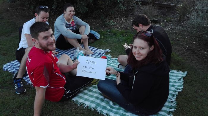
- Mike, Toni and Connor (Muggles so to speak)
Plans
All came about while Hugh and Jackson were talking about geohashing the night before, and Jackson noticed that it was actually on land. Decided to head out for the party at 4pm, and organised a few people to join for a picnic.
Expedition
Hugh and Adelle drove out, while Jackson drove with the muggles. Had a picnic on the side of the road just next to the train tracks. GPS said ~3 meters from the spot, which we thought was legit, but technically we couldn't reach it exactly.
Hugh and Adelle drove past it at the legal speed of 50, but would have been ~4-5 meters away, so may not get the Speed racer achievement?
Afterwards, we went geocaching just up the road (~100 meters), to get the Hash collision achievement achievement.
Tracklog
None tacken.
Photos
Achievements
This user earned the Picnic achievement
|
This user earned the Drag-along achievement
|
