Difference between revisions of "2017-04-12 -37 145"
From Geohashing
imported>Thunk (An expedition message sent via Geohash Droid for Android.) |
m (More specific location) |
||
| (9 intermediate revisions by 3 users not shown) | |||
| Line 31: | Line 31: | ||
<!-- how it all turned out. your narrative goes here. --> | <!-- how it all turned out. your narrative goes here. --> | ||
| + | |||
| + | *Hashpoint found and reached. A pretty easy roadside walk. -- [[User:Thunk|Thunk]] ([[User talk:Thunk|talk]]) [http://www.openstreetmap.org/?lat=-37.84753800&lon=145.31236220&zoom=16&layers=B000FTF @-37.8475,145.3124] 06:17, 12 April 2017 (GMT+00:00) | ||
== Tracklog == | == Tracklog == | ||
<!-- if your GPS device keeps a log, you may post a link here --> | <!-- if your GPS device keeps a log, you may post a link here --> | ||
| Line 39: | Line 41: | ||
--> | --> | ||
<gallery perrow="5"> | <gallery perrow="5"> | ||
| + | |||
| + | Image:2017-04-12_-37_145_thunk_1491977930253.jpg|Proof | ||
| + | |||
| + | Image:2017-04-12_-37_145_thunk_1491977952859.jpg|Trees near hash. [http://www.openstreetmap.org/?lat=-37.84751680&lon=145.31240220&zoom=16&layers=B000FTF @-37.8475,145.3124] | ||
| + | |||
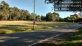
| + | Image:2017-04-12_-37_145_thunk_1491977976479.jpg|Roadside south [http://www.openstreetmap.org/?lat=-37.84754310&lon=145.31241560&zoom=16&layers=B000FTF @-37.8475,145.3124] | ||
| + | |||
| + | Image:2017-04-12_-37_145_thunk_1491978002782.jpg|Roadaide north [http://www.openstreetmap.org/?lat=-37.84754650&lon=145.31243250&zoom=16&layers=B000FTF @-37.8475,145.3124] | ||
| + | |||
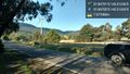
| + | Image:2017-04-12_-37_145_thunk_1491978031895.jpg|A better view of the mountain from the south side of Liverpool Road. [http://www.openstreetmap.org/?lat=-37.84757590&lon=145.31245090&zoom=16&layers=B000FTF @-37.8476,145.3125] | ||
| + | |||
| + | Image:2017-04-12_-37_145_thunk_1491978642277.jpg|Proper squishying procedure- be blonde. [http://www.openstreetmap.org/?lat=-37.85043820&lon=145.30675990&zoom=16&layers=B000FTF @-37.8504,145.3068] | ||
</gallery> | </gallery> | ||
| Line 45: | Line 59: | ||
<!-- Add any achievement ribbons you earned below, or remove this section --> | <!-- Add any achievement ribbons you earned below, or remove this section --> | ||
| − | |||
| − | |||
| − | |||
| − | |||
| − | |||
| − | |||
| − | |||
| − | |||
| − | |||
| − | |||
| − | |||
| − | |||
| − | |||
| − | |||
[[Category:Expeditions]] | [[Category:Expeditions]] | ||
| − | |||
[[Category:Expeditions with photos]] | [[Category:Expeditions with photos]] | ||
| − | |||
| − | |||
| − | |||
| − | |||
| − | |||
[[Category:Coordinates reached]] | [[Category:Coordinates reached]] | ||
| − | + | {{location|AU|VIC|KN}} | |
| − | |||
| − | |||
| − | |||
| − | |||
| − | |||
| − | |||
| − | |||
| − | |||
| − | |||
| − | |||
| − | |||
| − | |||
| − | |||
| − | |||
| − | |||
| − | |||
| − | |||
Latest revision as of 12:52, 1 August 2020
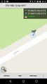
| Wed 12 Apr 2017 in -37,145: -37.8475072, 145.3123621 geohashing.info google osm bing/os kml crox |
Location
Participants
Plans
Expedition
- Hashpoint found and reached. A pretty easy roadside walk. -- Thunk (talk) @-37.8475,145.3124 06:17, 12 April 2017 (GMT+00:00)
Tracklog
Photos
Proof
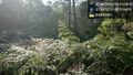
Trees near hash. @-37.8475,145.3124
Roadside south @-37.8475,145.3124
Roadaide north @-37.8475,145.3124
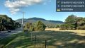
A better view of the mountain from the south side of Liverpool Road. @-37.8476,145.3125

Proper squishying procedure- be blonde. @-37.8504,145.3068


