Difference between revisions of "2017-05-12 -38 145"
From Geohashing
imported>Thunk (An expedition message sent via Geohash Droid for Android.) |
m (More specific location) |
||
| (4 intermediate revisions by 3 users not shown) | |||
| Line 31: | Line 31: | ||
<!-- how it all turned out. your narrative goes here. --> | <!-- how it all turned out. your narrative goes here. --> | ||
| + | |||
| + | *Weirdest hashspedition yet for me -- [[User:Thunk|Thunk]] ([[User talk:Thunk|talk]]) [http://www.openstreetmap.org/?lat=-38.06089660&lon=145.31822810&zoom=16&layers=B000FTF @-38.0609,145.3182] 08:40, 12 May 2017 (GMT+00:00) | ||
== Tracklog == | == Tracklog == | ||
<!-- if your GPS device keeps a log, you may post a link here --> | <!-- if your GPS device keeps a log, you may post a link here --> | ||
| Line 39: | Line 41: | ||
--> | --> | ||
<gallery perrow="5"> | <gallery perrow="5"> | ||
| + | |||
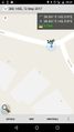
| + | Image:2017-05-12_-38_145_thunk_1494578442236.jpg|Proof | ||
</gallery> | </gallery> | ||
| Line 45: | Line 49: | ||
<!-- Add any achievement ribbons you earned below, or remove this section --> | <!-- Add any achievement ribbons you earned below, or remove this section --> | ||
| − | |||
| − | |||
| − | |||
| − | |||
| − | |||
| − | |||
| − | |||
| − | |||
| − | |||
| − | |||
| − | |||
| − | |||
| − | |||
| − | |||
[[Category:Expeditions]] | [[Category:Expeditions]] | ||
| − | |||
| − | |||
| − | |||
| − | |||
| − | |||
| − | |||
| − | |||
[[Category:Coordinates reached]] | [[Category:Coordinates reached]] | ||
| − | + | {{location|AU|VIC|CS}} | |
| − | |||
| − | |||
| − | |||
| − | |||
| − | |||
| − | |||
| − | |||
| − | |||
| − | |||
| − | |||
| − | |||
| − | |||
| − | |||
| − | |||
| − | |||
| − | |||
| − | |||
Latest revision as of 12:53, 1 August 2020
| Fri 12 May 2017 in -38,145: -38.0609050, 145.3182712 geohashing.info google osm bing/os kml crox |
Location
Participants
Plans
Expedition
- Weirdest hashspedition yet for me -- Thunk (talk) @-38.0609,145.3182 08:40, 12 May 2017 (GMT+00:00)
Tracklog
Photos
Proof
