Difference between revisions of "2019-09-11 31 -81"
Michael5000 (talk | contribs) (Created page with "{{subst:Expedition}}") |
Michael5000 (talk | contribs) (→Achievements) |
||
| (9 intermediate revisions by 3 users not shown) | |||
| Line 14: | Line 14: | ||
__NOTOC__ | __NOTOC__ | ||
== Location == | == Location == | ||
| − | + | ||
| + | On Rye Patch Road, in Long County. | ||
== Participants == | == Participants == | ||
| − | |||
| − | |||
| − | + | *[[User:Michael5000|Michael5000]] | |
| − | |||
== Expedition == | == Expedition == | ||
| − | |||
| − | + | This is one of three expeditions I made during a trip to the Southeast in September 2019. About that time, the original Geohashing wiki was compromised; and I figured the game was up. I discovered the new wiki in December 2021 and am writing this in February 2022. | |
| − | + | ||
| + | It was a high-mileage roadtrip, covering I think 10 states from Ohio to Florida. On this day I started and ended near the southern tip of South Carolina, traveling down the coast to Jacksonville, Florida, and then back up through inland Georgia. | ||
| + | |||
| + | It was a very hot and muggy day, and here's what I wrote home to [[user:Mrs.5000|Mrs.5000]]: "In the late evening the weather broke and the temperature and humidity plunged into the 80s, which let me roll down the windows and enjoy the smells and landscape a little better. Looping inland, I took a side road north of Jesup to visit the hashpoint at 31 N, 81 W, making Georgia the 16th state I've tried to geohash in and the 14th one I've succeeded in." It was very nearly dark by the time I pulled off the highway to the dirt road that was host to the hashpoint, so I got a nice peaceful sunset but not a lot of sightseeing. It's all good. | ||
== Photos == | == Photos == | ||
| − | |||
| − | |||
| − | |||
<gallery perrow="5"> | <gallery perrow="5"> | ||
| + | File:2019-09-11 31 -81 1.jpg|I think I shot this photo looking ahead as I drove over the hashpoint. | ||
| + | File:2019-09-11 31 -81 2.jpg|...and this one back the other way, having turned around and got out and stretch my legs. | ||
</gallery> | </gallery> | ||
== Achievements == | == Achievements == | ||
{{#vardefine:ribbonwidth|800px}} | {{#vardefine:ribbonwidth|800px}} | ||
| − | + | *My first expedition in Georgia. | |
| − | + | *My southernmost successful expedition. | |
| − | + | *My southernmost expedition to date in the continental U.S. | |
| − | + | *The second successful expedition (by anyone) to the [[Brunswick, Georgia]] graticule. The graticules are so square this far south! It's adorable. | |
| − | [[ | + | *Cruelly, and very belatedly, stripped [[User:Pedalpusher|Pedalpusher]] of his Last Man Standing achievement for [[2019-09-11 42 -78]]. |
| + | {{Dark Ages|date=2019-09-11|latitude=31|longitude=-81|name=[[User:Michael5000|Michael5000]]}} | ||
| − | |||
| − | |||
| − | |||
| − | |||
| − | |||
| − | |||
| − | |||
| − | |||
| − | |||
| − | |||
[[Category:Expeditions]] | [[Category:Expeditions]] | ||
| − | |||
| − | |||
| − | |||
| − | |||
| − | |||
| − | |||
| − | |||
[[Category:Coordinates reached]] | [[Category:Coordinates reached]] | ||
| − | + | {{location|US|GA|LG}} | |
| − | |||
| − | |||
| − | |||
| − | |||
| − | |||
| − | |||
| − | |||
| − | |||
| − | |||
| − | |||
| − | |||
| − | |||
| − | |||
| − | |||
| − | |||
| − | |||
| − | |||
Latest revision as of 04:53, 13 February 2022
| Wed 11 Sep 2019 in 31,-81: 31.7975694, -81.8180429 geohashing.info google osm bing/os kml crox |
Location
On Rye Patch Road, in Long County.
Participants
Expedition
This is one of three expeditions I made during a trip to the Southeast in September 2019. About that time, the original Geohashing wiki was compromised; and I figured the game was up. I discovered the new wiki in December 2021 and am writing this in February 2022.
It was a high-mileage roadtrip, covering I think 10 states from Ohio to Florida. On this day I started and ended near the southern tip of South Carolina, traveling down the coast to Jacksonville, Florida, and then back up through inland Georgia.
It was a very hot and muggy day, and here's what I wrote home to Mrs.5000: "In the late evening the weather broke and the temperature and humidity plunged into the 80s, which let me roll down the windows and enjoy the smells and landscape a little better. Looping inland, I took a side road north of Jesup to visit the hashpoint at 31 N, 81 W, making Georgia the 16th state I've tried to geohash in and the 14th one I've succeeded in." It was very nearly dark by the time I pulled off the highway to the dirt road that was host to the hashpoint, so I got a nice peaceful sunset but not a lot of sightseeing. It's all good.
Photos
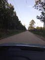
I think I shot this photo looking ahead as I drove over the hashpoint.
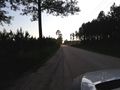
...and this one back the other way, having turned around and got out and stretch my legs.


Achievements
- My first expedition in Georgia.
- My southernmost successful expedition.
- My southernmost expedition to date in the continental U.S.
- The second successful expedition (by anyone) to the Brunswick, Georgia graticule. The graticules are so square this far south! It's adorable.
- Cruelly, and very belatedly, stripped Pedalpusher of his Last Man Standing achievement for 2019-09-11 42 -78.
