Difference between revisions of "2019-10-06 52 6"
(New Expedition) |
|||
| Line 51: | Line 51: | ||
{{xkcd-100-Honorable-Mention|latitude=52|longitude=6|date=2019-10-06|distance=207 kilometers|name=[[User:Fippe|Fippe]]}} | {{xkcd-100-Honorable-Mention|latitude=52|longitude=6|date=2019-10-06|distance=207 kilometers|name=[[User:Fippe|Fippe]]}} | ||
{{border geohash achievement|latitude=52|longitude=6|date=2019-10-06|name=[[User:Fippe|Fippe]]|country1=Germany|country2=Netherlands|image=2019-10-06 52 06 02 Border.jpg}} | {{border geohash achievement|latitude=52|longitude=6|date=2019-10-06|name=[[User:Fippe|Fippe]]|country1=Germany|country2=Netherlands|image=2019-10-06 52 06 02 Border.jpg}} | ||
| + | {{Dark Ages|latitude=52|longitude=6|date=2019-10-06|name=[[User:Fippe|Fippe]]}} | ||
__NOTOC__ | __NOTOC__ | ||
Revision as of 18:11, 31 March 2020
| Sun 6 Oct 2019 in Enschede: 52.2721183, 6.7832973 geohashing.info google osm bing/os kml crox |
Location
This Geohash is located on a street corner in Hengelo.
Participants
Expedition
Day 36 of the Geohashing Wiki being offline.
From Hannover, I took the train to Hengelo via Rheine early in the morning, and walked the rest of the distance from there.
In Hengelo I saw the Lambertus Church and some bear statues. I also saw many flags of Hengelo, and comparatively few flags of the Netherlands.
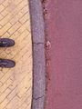
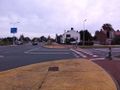
Eventually I arrived at the Weideweg/Bankastraat street corner. The coordinates were on an edge of the bike path, but there were not many people there (probably since it was a Sunday morning), so I did not have any problems locating the coordinates.
After recording proof, I walked back to the train station, and took the train back to Hannover.
Photos
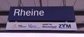
In Rheine
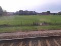
Crossing the border
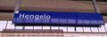
In Hengelo
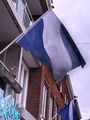
Flag of Hengelo
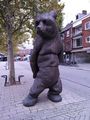
One of the bear statues
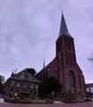
St. Lambertus

Flag of the Netherlands
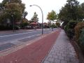
On the way to the Geohash
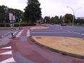
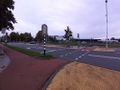
The geohash site from the other side of the road
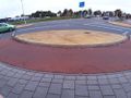
The geohash site
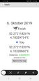
Proof
The Geohash
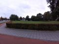
Surroundings
Surroundings
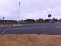
Surroundings
Surroundings
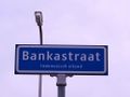
Banka Street


Ribbons
Fippe earned the Land geohash achievement
|
Fippe earned the Reverse regional achievement
|
Fippe earned the XKCD-100 Honorable Mention Achievement
|
Fippe earned the Border geohash achievement
|
