Difference between revisions of "2020-03-09 50 -2"
Macronencer (talk | contribs) (Co-ordinates reached, report to follow) |
Macronencer (talk | contribs) (→Photos: Add photos) |
||
| Line 38: | Line 38: | ||
--> | --> | ||
<gallery perrow="5"> | <gallery perrow="5"> | ||
| + | Image:2020-03-09 50 -2 Macronencer 01 WinfrithNewburghChurchStChristopher.jpg|St Christopher's Church, Winfrith Newburgh. | ||
| + | Image:2020-03-09 50 -2 Macronencer 02 ForkInRoad.jpg|A fork in the road, just like in a Fairy Tale. | ||
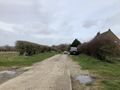
| + | Image:2020-03-09 50 -2 Macronencer 03 PleasantTrack.jpg|Quite a pleasant walk. Shame the day was cloudy! | ||
| + | Image:2020-03-09 50 -2 Macronencer 04 Signpost.jpg|Signpost. | ||
| + | Image:2020-03-09 50 -2 Macronencer 05 NearingTheHash.jpg|Getting close now - the hash is in a field just over that main road down there. | ||
| + | Image:2020-03-09 50 -2 Macronencer 06 Hashpoint.jpg|The hash point is just inside this field. | ||
| + | Image:2020-03-09 50 -2 Macronencer 07 ClosestICouldRecord.png|This was the best proof I could screenshot. I need to review my technology! | ||
| + | Image:2020-03-09 50 -2 Macronencer 08 RoadsideGeotrash.jpg|Roadside trash is just everywhere. People disgust me. | ||
| + | Image:2020-03-09 50 -2 Macronencer 09 NotReallyAGrin.jpg|I keep forgetting the stupid grin! Too serious. | ||
| + | Image:2020-03-09 50 -2 Macronencer 10 Beetle.jpg|Alexander Beetle. | ||
| + | Image:2020-03-09 50 -2 Macronencer 11 ErrorCarNotFound.png|404m to the car. Haha! | ||
| + | Image:2020-03-09 50 -2 Macronencer 12 DriveOverRiverWinFtw.jpg|These driveway bridges over the River Win... for the win! | ||
</gallery> | </gallery> | ||
Revision as of 17:37, 9 March 2020
| Mon 9 Mar 2020 in 50,-2: 50.6642585, -2.2875917 geohashing.info google osm bing/os kml crox |
Location
Just inside a field off the A352 near Winfrith Newburgh
Participants
Plans
Macronencer (talk) plans to drop by on a round trip that also includes a Displaced_origin_geohash_achievement near Dorchester. Probably this will be in the late morning, as the afternoon weather forecast is looking a little soggy...
Update: now planning to park by the church at Winfrith Newburgh 50.6589032,-2.2774992 - there's a footpath that goes past Wynards Farm and leads to the hash point. Much nicer than parking next to a busy road on the actual entrance to the field, and kinder to farm vehicles who might need to use the turning. --Macronencer (talk) 08:49, 9 March 2020 (UTC)
Expedition
Co-ordinates reached. Report to follow later!
Tracklog
Photos
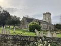
St Christopher's Church, Winfrith Newburgh.
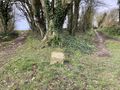
A fork in the road, just like in a Fairy Tale.
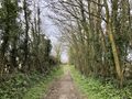
Quite a pleasant walk. Shame the day was cloudy!
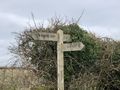
Signpost.
Getting close now - the hash is in a field just over that main road down there.
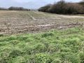
The hash point is just inside this field.

This was the best proof I could screenshot. I need to review my technology!
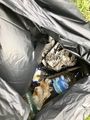
Roadside trash is just everywhere. People disgust me.
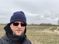
I keep forgetting the stupid grin! Too serious.
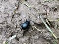
Alexander Beetle.

404m to the car. Haha!
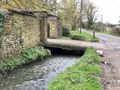
These driveway bridges over the River Win... for the win!


