Difference between revisions of "2020-10-01 45 4"
From Geohashing
(→Expedition) |
m (→Achievements: Update ribbon width) |
||
| (One intermediate revision by the same user not shown) | |||
| Line 17: | Line 17: | ||
== Photos == | == Photos == | ||
| − | <gallery | + | <gallery> |
Image:2020-10-01 45 4 01.jpg | At St-Romain-de-Popey railway station | Image:2020-10-01 45 4 01.jpg | At St-Romain-de-Popey railway station | ||
Image:2020-10-01 45 4 02.jpg | On the path | Image:2020-10-01 45 4 02.jpg | On the path | ||
| Line 28: | Line 28: | ||
== Achievements == | == Achievements == | ||
| − | {{#vardefine:ribbonwidth| | + | {{#vardefine:ribbonwidth|100%}} |
{{land geohash | {{land geohash | ||
| latitude = 45 | | latitude = 45 | ||
Latest revision as of 15:39, 4 May 2021
| Thu 1 Oct 2020 in 45,4: 45.8668249, 4.5501179 geohashing.info google osm bing/os kml crox |
Location
In a meadow in Saint-Romain-de-Popey.
Participants
Expedition
Another geohash next to a railway! Moreover, this one was really close from the train station: less than 900 meters. I reached the coordinates 50 minutes after leaving Lyon by train. This would almost qualify for an Easy Geohash, had it not been on the other side of a highway with absolutely no pedestrian infrastructure.
After recording proof and going back to the train station, I still had an hour of free time before the next train to Lyon. So I walked to the village center which is located on a hill, about 2 kilometers from there.
Photos
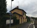
At St-Romain-de-Popey railway station
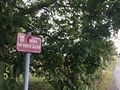
On the path
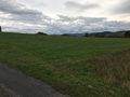
The geohash

Coordinates reached
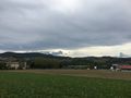
The surroundings

Stupid grin
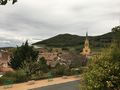
Up in the village


Achievements
Baarde earned the Land geohash achievement
|

Baarde earned the Subdivision geohash achievement
by reaching hash points in all 2 arrondissements of the Rhône department.