Difference between revisions of "2021-05-21 47 8"
(→Expedition) |
m (Location) |
||
| (4 intermediate revisions by one other user not shown) | |||
| Line 36: | Line 36: | ||
Image:2021-05-21 47 8 View to the hash.jpeg | View towards the hash | Image:2021-05-21 47 8 View to the hash.jpeg | View towards the hash | ||
Image:2021-05-21 47 8 The way over the river.jpeg | Let's cross this! | Image:2021-05-21 47 8 The way over the river.jpeg | Let's cross this! | ||
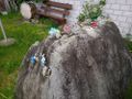
| + | Image:2021-05-21 47 8 Hashshot.jpeg | Jumpy location | ||
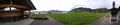
Image:2021-05-21 47 8 View from the hash.jpeg | View from the hash | Image:2021-05-21 47 8 View from the hash.jpeg | View from the hash | ||
Image:2021-05-21 47 8 View up from the hash.jpeg | View from the hash uphill | Image:2021-05-21 47 8 View up from the hash.jpeg | View from the hash uphill | ||
| Line 57: | Line 58: | ||
== Achievements == | == Achievements == | ||
{{#vardefine:ribbonwidth|800px}} | {{#vardefine:ribbonwidth|800px}} | ||
| − | + | {{Geohashing Day|latitude=47|longitude=8|year=2021|coorddate=2021-05-21|name=[[User:Tungmar|Tungmar]]}} | |
| + | {{Two to the N achievement|count=4|latitude=47|longitude=8|year=2021|date=2021-05-21|name=[[User:Tungmar|Tungmar]]}} | ||
| − | |||
| − | |||
| − | |||
| − | |||
| − | |||
| − | |||
| − | |||
| − | |||
| − | |||
| − | |||
| − | |||
| − | |||
| − | |||
| − | |||
[[Category:Expeditions]] | [[Category:Expeditions]] | ||
| − | |||
[[Category:Expeditions with photos]] | [[Category:Expeditions with photos]] | ||
| − | |||
| − | |||
| − | |||
| − | |||
| − | |||
[[Category:Coordinates reached]] | [[Category:Coordinates reached]] | ||
| − | + | {{location|CH|SZ}} | |
| − | |||
| − | |||
| − | |||
| − | |||
| − | |||
| − | |||
| − | |||
| − | |||
| − | |||
| − | |||
| − | |||
| − | |||
| − | |||
| − | |||
| − | |||
| − | |||
| − | |||
Latest revision as of 10:42, 22 May 2021
| Fri 21 May 2021 in 47,8: 47.0962137, 8.7886586 geohashing.info google osm bing/os kml crox |
Location
On a filed in Steinbach near Einsideln.
Participants
Plans
Take a bus to Stinbach, walk up to the hash and and then, if the weather is not to bad, hike up the Hummel.
Expedition
It all went as planed. Relaxing train ride with a engine break down and clear instructions on how to proceed. Finding a easy way over the river. Climbing fences to reach the hash. Walking in mud around the hash until I got green lights from the satellites. Hiking up the hill in mud on a not any more maintained hiking route. Having a nice chat with the farmer who confirms that there was a hiking route but not any more. Hating that that I wear the rain trousers and sweat now. Finding a good path after it got totally invisible. Loving that I wear the rain trousers and now are protected from the ongoing rain. Dealing unharmed with a bunch of young and aggressive bulls who protected their field (but I just found the path again...). Finding some nice waterfalls. Searching for a non existent path down. Finding some GeoCaches along the path.
So yes, despite the bad weather, it was a excellent trip.
Tracklog

Photos
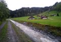
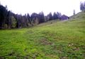
View towards the hash
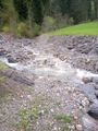
Let's cross this!
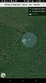
Jumpy location
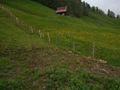
View from the hash
View from the hash uphill
Luckily, the hash was not in this mud
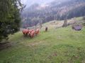
They look bad ass
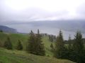
View from the "top"
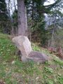
Nice natural chair
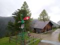
How to get power up here

It was about 7 degree Celsius
Call for a pick nick
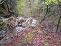
As far as I dared to reach the top of the Waterfall...
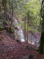
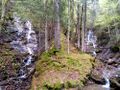
Wassersprung from the side
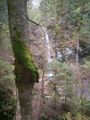
Wassersprung
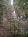
And once again the Wassersprung
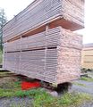
They did some nice stacking tricks here!
This model is totally to scale!
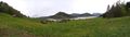
View including the route
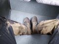
In the bus I realized: It was muddy!


Achievements
Tungmar earned the 2021 Geohashing Day achievement
|
