Difference between revisions of "2021-07-31 39 -3"
m (Location) |
(→Photos) |
||
| Line 64: | Line 64: | ||
Image:2021-07-31_39_-3_L1040483.JPG | Convenient parking in new development area. The geohash is 350 meters in viewing direction. | Image:2021-07-31_39_-3_L1040483.JPG | Convenient parking in new development area. The geohash is 350 meters in viewing direction. | ||
Image:2021-07-31_39_-3_L1040485.JPG | This path leads close to the geohash. | Image:2021-07-31_39_-3_L1040485.JPG | This path leads close to the geohash. | ||
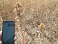
| − | Image:2021-07-31_39_-3_L1040487.JPG | A particularly big thistle. | + | Image:2021-07-31_39_-3_L1040487.JPG | A particularly big thistle. They seem to be ubiquitous. Expedition [[2021-06-18 40 -3]] had also ended in a thistle field and later I took another photo of one in [[2021-08-28_40_-4]]. |
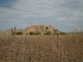
Image:2021-07-31_39_-3_L1040489.JPG | I follow this track to get to the back of the thistle field, which seems to be much closer to the geohash than the front. | Image:2021-07-31_39_-3_L1040489.JPG | I follow this track to get to the back of the thistle field, which seems to be much closer to the geohash than the front. | ||
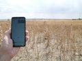
Image:2021-07-31_39_-3_L1040492.JPG | From this side, only 14 meters into the field. | Image:2021-07-31_39_-3_L1040492.JPG | From this side, only 14 meters into the field. | ||
Latest revision as of 07:33, 11 January 2022
| Sat 31 Jul 2021 in 39,-3: 39.9971778, -3.9532730 geohashing.info google osm bing/os kml crox |
Location
In a thistle field (yet agein), close to a not completed new development area (yet again), on the outskirts of Cabañas de la Sagra.
Participants
Plans
Expedition
At first, I felt not very tempted to do this one. The location did not look very interesting, the route comprised all kinds of roads, small ones, big ones, four lane motorways, roads I knew, roads I didn't, most of them not particularly attractive for motorcycling.
Nevertheless, I decided to go. It was a relatively long trip, a well over an hour motorcycle ride, a complicated route, and I wanted to bring the complete photo equipment with tele lens, so the bike of choice was the old Goldwing, offering comfort, mounting for the navigation system, and ample luggage capacity.
In the end, it was a nice ride, and the previously unknown part was more interesting than expected, with diverse views ranging from idyllic setlements nested in the hills to derelicted industrial areas. Walking through the deserted thistle field in search for the geohash with the motorway rushing in the distance was kind of elevating. I was happy that I did this one.
Tracklog
Photos
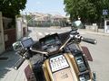
Ready for takeoff (search selfie).
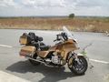
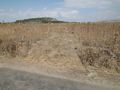
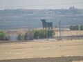
Convenient parking in new development area. The geohash is 350 meters in viewing direction.
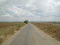
This path leads close to the geohash.
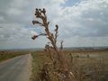
A particularly big thistle. They seem to be ubiquitous. Expedition 2021-06-18 40 -3 had also ended in a thistle field and later I took another photo of one in 2021-08-28_40_-4.
I follow this track to get to the back of the thistle field, which seems to be much closer to the geohash than the front.
From this side, only 14 meters into the field.
Here it is.
View from the geohash: there is a hill close by; I will climb up and have a look from the top.
Another view from the geohash (changed to telelens).
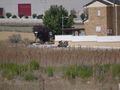
From the hill I could see the bike.
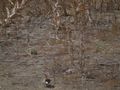
Search image: managed to (barely) capture one of the numerous rabbits.
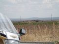
View from the parking place to the hill.


