Difference between revisions of "2021-10-12 40 -4"
m (looks finished, removing Category:New report) |
m (Location) |
||
| Line 90: | Line 90: | ||
<!-- if you reached your coords: --> | <!-- if you reached your coords: --> | ||
[[Category:Coordinates reached]] | [[Category:Coordinates reached]] | ||
| + | {{location|ES|CL|AV}} | ||
Latest revision as of 17:42, 19 October 2021
| Tue 12 Oct 2021 in 40,-4: 40.5029646, -4.5156728 geohashing.info google osm bing/os kml crox |
Location
On a pasture area at the very scenic road between Cebreros and San Bartolomé de Pinares.
Participants
Plans
Expedition
This was a public holiday in Spain, so I had time and wanted to give it a try, although, as far as I could see on the Maps, the geohash resided on a fenced property. At least there seemed to be a reasonable parking place for the Goldwing, right where the road came closest to the geohash.
So I took again the Goldwing this time, with recharged battery after she did not fire up when I wanted to go on the last expedition 2021-10-08_40_-4. The route passed by the geohash from expedition 2021-08-28_40_-4 and thus also by the two satellite tracking stations I had visited there. The current geohash was located in a beautiful part of the Sierra Oeste which I had seen for the first time in expedition 2021-06-06_40_-4.
The geohash was indeed behind a fence, but it was acessible through kind of a gate, not far from the road, and in benign terrain, so one could in principle call it an easy one. However, I had some mixed feelings at times…
Tracklog
Photos
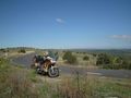
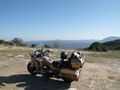
The planned parking place as seen on the Maps works out well.
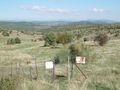
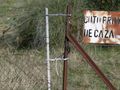
The geohash is 500 meters behind this improvised gate.
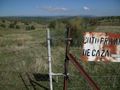
It looks like I could open this.
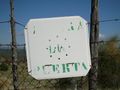
This once read CIERRA LA PUERTA — close the gate. Hm…, asking me to close it implies allowing me to open it, no?
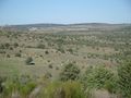
So I pass the gate. Wind power plants are spanning the horizon.
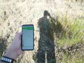
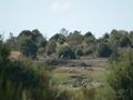
Terrain is easy, so here I am.
It's at the bush in the front.
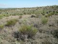
There are some cows (I think).
From a few meters from the geohash, I can see the parked bike. I switch to the telelens and take a photo.
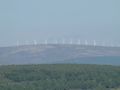
While I'm at it, I also take a closer photo of the wind power plants…
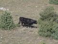
… and of a cow. Cow? Wait a minute, this one looks male! I hurry back, looking over my shoulder to check for a raging bull, …
… pass the gate and close it carefully.
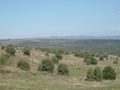
On the ride back, I stop at a very scenic part of the road…
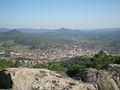
… for a breathtaking view of Cebreros embeded in the mountainous landscape.


