Difference between revisions of "2022-02-09 -37 145"
| (20 intermediate revisions by 6 users not shown) | |||
| Line 1: | Line 1: | ||
| − | + | [[Image:{{{image|Geohash 2022-02-09 -37 145 06 Steve.jpg}}}|thumb|left]] | |
| − | + | {{meetup graticule | |
| − | |||
| − | |||
| − | |||
| − | |||
| − | |||
| − | |||
| lat=-37 | | lat=-37 | ||
| lon=145 | | lon=145 | ||
| date=2022-02-09 | | date=2022-02-09 | ||
| − | }} | + | }} |
| + | |||
__NOTOC__ | __NOTOC__ | ||
== Location == | == Location == | ||
| − | + | On the grass just off Darebin Creek, Heidelberg West. | |
== Participants == | == Participants == | ||
| − | + | *[[User:Talex|Talex]] | |
| − | + | *[[User:Felix Dance|Felix Dance]] | |
| − | + | *[[User:johnwrw|John]] | |
| − | + | *[[User:Stevage|Stevage]] | |
| − | + | *[[User:EdBordin|Ed]] | |
| − | |||
| − | |||
| − | |||
| − | |||
| + | == Expeditions == | ||
| + | === Expedition 1 - [[User:Talex|Talex]] === | ||
*Geohash Success! -- [[User:Talex|Talex]] ([[User talk:Talex|talk]]) [https://openstreetmap.org/?mlat=-37.72716010&mlon=145.04602170&zoom=16 @-37.7272,145.0460] 08:19, 9 February 2022 (GMT+11:00) | *Geohash Success! -- [[User:Talex|Talex]] ([[User talk:Talex|talk]]) [https://openstreetmap.org/?mlat=-37.72716010&mlon=145.04602170&zoom=16 @-37.7272,145.0460] 08:19, 9 February 2022 (GMT+11:00) | ||
| − | + | Super easy one for me. Checked the coordinates during the night, close to home and only requiring a modest detour on my usual commute. Left home while others in our geohashing chat group were planning their trip. I rode up, hoping that I could reach the hash from memory. I couldn't and was 40 meters off. Zipped up to the correct location, took appropriate photos and evidence. Decided to leave some XKCD sticks behind, but I was rushing and used small hard to see sticks. Jumped back on my bike and headed on to work. Enjoyed taking the detour, there's some nice wetlands up this way and was good to ride a slightly different route to normal. | |
| + | <gallery mode="packed" heights="300px"> | ||
| + | Image:2022-02-09_-37_145_XL 20220208 211950092.jpg|Talex's hash transport | ||
| − | + | Image:2022-02-09_-37_145_PXL_20220208_212011302.jpg|Scenic embankment views | |
| + | </gallery> | ||
| − | + | === Expedition 2 - [[User:Johnwrw|John]] === | |
| + | I had not done a geohash since 2015, but a few weeks ago I happened to go nearby the site of a geohash of mine from long ago, which reawakened my interest, and I have been checking the daily geohash site fairly consistently since. I saw today's location and immediately I was very keen. It was right by Latrobe Uni, where I had done some work a few years ago, and so I knew the ride there well, a pleasant ride of around an hour from home, with minimal on road sections, and with a very nice section along the Darebin Creek Trail to finish. I messaged [[User:Lachie|Lachie]] and [[User:Felix_Dance|Felix]], knowing they were still regular keen geohashers, and Felix was very happy to invite me along for the expedition he was planning with [[User:Stevage|Stevage]]. Lachie, meanwhile, was interstate and couldn't join us. | ||
| − | + | I set off from home at about 2:40pm, and after the frustration of a car cutting me off going along Racecourse Rd, I met Felix, just where the Capital City Trail diverges from the Upfield Bike Path. We continued along the former, before heading up St. Georges Rd. We then cut across to pick up Steve just off High St in Northcote. We then continued east through some backstreets of Northcote, navigating across the All Nations Park, before joining the Darebin Creek Trail at Darebin Rd. Heading north up the trail, we arrived at and located the hash point in good time and without much difficulty, just about 30m from the bike path across some longish grass and up a slope. It took a bit more looking to find the XKCD sticks but these we also found before too long. We had a decent sit down rest and bit of a chat over a couple of beers, and we also discovered that there were some ominous looking blobs on the radar, however we weren't too concerned and only felt a drop or two on us (for the time being). After a while we decided to make a move back, and before too long it was absolutely pouring down! One of those ominous blobs had really decided to let rip upon us. Thankfully, it was still quite warm and so once you got over the wetness, it wasn't too unpleasant. And as heavy as the rain was, it was fairly short lived meaning that we were pretty much fully dry again before getting home. Rain aside it was a fairly uneventful ride home, taking a slightly different route as we didn't need to go via Northcote, so instead we continued further down the Darebin Creek Trail before shimmying along the Hurstbridge line back to St Georges Rd. In Brunswick I was rudely cut off AGAIN by a car turning left across me without looking, but overall it was a very successful expedition, with my strava reading 44km by the time I was home again. | |
| − | + | This is geohash #2 of 6 of a consecutive geohashing achievement by [[User:Felix Dance|Felix Dance]]: | |
| − | |||
| − | + | # [[2022-02-08 -37 144]] | |
| − | + | # [[2022-02-09 -37 145]] | |
| − | + | # [[2022-02-10 -38 145]] | |
| − | -- | + | # [[2022-02-11 -37 145]] |
| − | + | # [[2022-02-12 -37 144]] | |
| + | # [[2022-02-13 -37 145]] | ||
| + | <gallery mode="packed" heights="300px"> | ||
Image:2022-02-09_-37_145_Felix Dance_1644382530002.jpg|Geohash success! [https://openstreetmap.org/?mlat=-37.72723580&mlon=145.04604390&zoom=16 @-37.7272,145.0460] | Image:2022-02-09_-37_145_Felix Dance_1644382530002.jpg|Geohash success! [https://openstreetmap.org/?mlat=-37.72723580&mlon=145.04604390&zoom=16 @-37.7272,145.0460] | ||
| Line 52: | Line 50: | ||
Image:2022-02-09_-37_145_Felix Dance_1644383401947.jpg|XKCD | Image:2022-02-09_-37_145_Felix Dance_1644383401947.jpg|XKCD | ||
| − | + | File:Geohash 2022-02-09 -37 145 01 Slope.jpg|Hash slope | |
| + | File:Geohash 2022-02-09 -37 145 02 Beer.jpg|Drinking the beer! | ||
| + | File:Geohash 2022-02-09 -37 145 03 Bush.jpg|Bush bashing out | ||
| + | File:Geohash 2022-02-09 -37 145 04 Path.jpg|Path along the creek | ||
| + | File:Geohash 2022-02-09 -37 145 05 Rain.jpg|Riding in the rain | ||
| + | |||
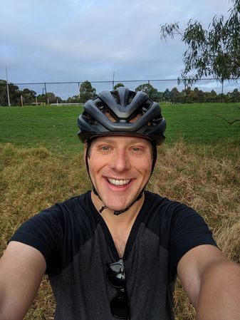
| + | Geohash 2022-02-09 -37 145 06 Steve.jpg|Steve at the hash | ||
| + | </gallery> | ||
| − | + | === Expedition 3 - [[User:EdBordin|EdBordin]] === | |
| + | I was the third expedition for the day (that we know of). I went to work without checking the hash so I went on an impromptu solo adventure after work. After a quick detour via Don Tojo for dinner, I rode up the very bike-friendly Canning St and St George's Rd before cutting through slightly less friendly roads in Preston to join onto the Darebin creek trail. From there it was just a short ride through the greenery to reach the hash. Nearly left without locating Talex's xkcd sticks but after some prompting I found they'd survived until the end of the day! On the way home I took a more scenic route along a little more of the Darebin Creek rather than backtracking through Preston. Strava summary: 31.75km, 1:38:27 moving time (probably including wandering to the hash). A nice little ride! | ||
| − | Image:PXL_20220209_084442652.jpg| | + | <gallery mode="packed" heights="300px"> |
| + | Image:2022-02-09_-37_145_EdBordin_073625714.jpg|Pre-hash fuel - chicken teriyaki don | ||
| + | Image:2022-02-09_-37_145_EdBordin_083833312.jpg|Almost tried to cross this water before realising the hash was on my other left | ||
| + | Image:2022-02-09_-37_145_EdBordin_084450578.MP.jpg|Scenic embankment again, but with my face in the way | ||
| + | Image:PXL_20220209_084442652.jpg|Scenic soccer pitch view | ||
</gallery> | </gallery> | ||
| + | |||
| + | == Tracklog == | ||
| + | {{tracklog | 20220209_144709 Heidelberg West Geohash.gpx}} | ||
== Achievements == | == Achievements == | ||
| + | This isn't an official record yet, but I believe this sets the record for most cumulative years of cumulative geohashing experience at a given hash on a given day (at least as far as participants with wiki accounts that didn't change names during the | ||
| + | Dark Years). [[User:Stevage|Stevage]] ([[User talk:Stevage|talk]]) 00:10, 22 February 2022 (UTC) | ||
| + | |||
{{#vardefine:ribbonwidth|800px}} | {{#vardefine:ribbonwidth|800px}} | ||
| − | + | {{bicycle geohash | |
| − | + | | latitude = -37 | |
| − | + | | longitude = 145 | |
| − | [[ | + | | date = 2022-02-09 |
| + | | name = [[User:Talex|Talex]], [[User:Felix Dance|Felix Dance]], [[User:johnwrw|John]], [[User:Stevage|Stevage]] and [[User:EdBordin|EdBordin]] | ||
| + | | distance = 44 kms | ||
| + | | bothways = true | ||
| + | | image = 2022-02-09_-37_145_Felix Dance_1644382530002.jpg | ||
| − | + | }} | |
| − | + | {{consecutive geohash | |
| − | |||
| − | |||
| − | |||
| − | + | | count = 6 | |
| + | | latitude = -37 | ||
| + | | longitude = 144 | ||
| + | | date = 2022-02-08 | ||
| + | | name = [[User:Felix Dance|Felix Dance]] | ||
| + | |||
| + | }} | ||
| + | |||
| + | <br/>This is hash #2 of the [[2022 Victorian Geohash Streak]].<br/> | ||
| − | |||
[[Category:Expeditions]] | [[Category:Expeditions]] | ||
| − | |||
[[Category:Expeditions with photos]] | [[Category:Expeditions with photos]] | ||
| − | |||
| − | |||
| − | |||
| − | |||
| − | |||
[[Category:Coordinates reached]] | [[Category:Coordinates reached]] | ||
| − | + | {{location|AU|VIC|DA}} | |
| − | |||
| − | |||
| − | |||
| − | |||
| − | |||
| − | |||
| − | |||
| − | |||
| − | |||
| − | |||
| − | |||
| − | |||
| − | |||
| − | |||
| − | |||
| − | |||
| − | |||
Latest revision as of 07:30, 2 August 2023

| Wed 9 Feb 2022 in -37,145: -37.7271908, 145.0460405 geohashing.info google osm bing/os kml crox |
Location
On the grass just off Darebin Creek, Heidelberg West.
Participants
Expeditions
Expedition 1 - Talex
- Geohash Success! -- Talex (talk) @-37.7272,145.0460 08:19, 9 February 2022 (GMT+11:00)
Super easy one for me. Checked the coordinates during the night, close to home and only requiring a modest detour on my usual commute. Left home while others in our geohashing chat group were planning their trip. I rode up, hoping that I could reach the hash from memory. I couldn't and was 40 meters off. Zipped up to the correct location, took appropriate photos and evidence. Decided to leave some XKCD sticks behind, but I was rushing and used small hard to see sticks. Jumped back on my bike and headed on to work. Enjoyed taking the detour, there's some nice wetlands up this way and was good to ride a slightly different route to normal.
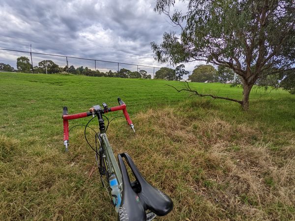
Talex's hash transport
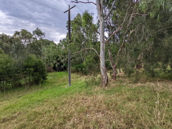
Scenic embankment views


Expedition 2 - John
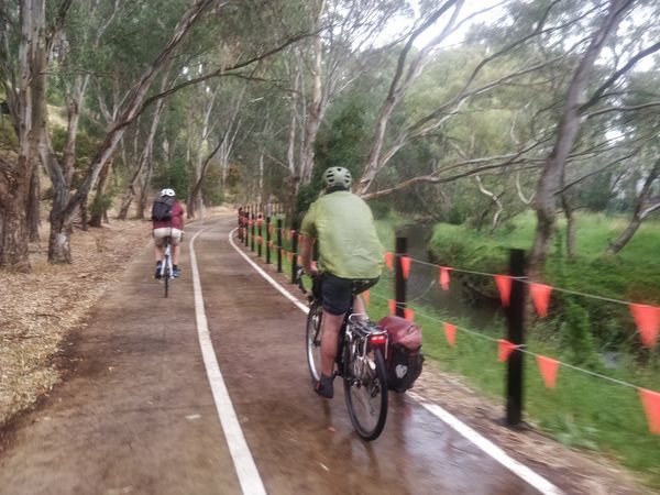
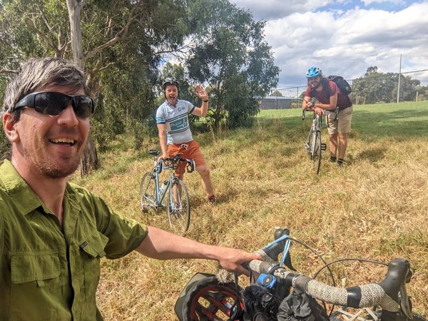
I had not done a geohash since 2015, but a few weeks ago I happened to go nearby the site of a geohash of mine from long ago, which reawakened my interest, and I have been checking the daily geohash site fairly consistently since. I saw today's location and immediately I was very keen. It was right by Latrobe Uni, where I had done some work a few years ago, and so I knew the ride there well, a pleasant ride of around an hour from home, with minimal on road sections, and with a very nice section along the Darebin Creek Trail to finish. I messaged Lachie and Felix, knowing they were still regular keen geohashers, and Felix was very happy to invite me along for the expedition he was planning with Stevage. Lachie, meanwhile, was interstate and couldn't join us.
I set off from home at about 2:40pm, and after the frustration of a car cutting me off going along Racecourse Rd, I met Felix, just where the Capital City Trail diverges from the Upfield Bike Path. We continued along the former, before heading up St. Georges Rd. We then cut across to pick up Steve just off High St in Northcote. We then continued east through some backstreets of Northcote, navigating across the All Nations Park, before joining the Darebin Creek Trail at Darebin Rd. Heading north up the trail, we arrived at and located the hash point in good time and without much difficulty, just about 30m from the bike path across some longish grass and up a slope. It took a bit more looking to find the XKCD sticks but these we also found before too long. We had a decent sit down rest and bit of a chat over a couple of beers, and we also discovered that there were some ominous looking blobs on the radar, however we weren't too concerned and only felt a drop or two on us (for the time being). After a while we decided to make a move back, and before too long it was absolutely pouring down! One of those ominous blobs had really decided to let rip upon us. Thankfully, it was still quite warm and so once you got over the wetness, it wasn't too unpleasant. And as heavy as the rain was, it was fairly short lived meaning that we were pretty much fully dry again before getting home. Rain aside it was a fairly uneventful ride home, taking a slightly different route as we didn't need to go via Northcote, so instead we continued further down the Darebin Creek Trail before shimmying along the Hurstbridge line back to St Georges Rd. In Brunswick I was rudely cut off AGAIN by a car turning left across me without looking, but overall it was a very successful expedition, with my strava reading 44km by the time I was home again.
This is geohash #2 of 6 of a consecutive geohashing achievement by Felix Dance:
- 2022-02-08 -37 144
- 2022-02-09 -37 145
- 2022-02-10 -38 145
- 2022-02-11 -37 145
- 2022-02-12 -37 144
- 2022-02-13 -37 145
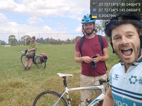
Geohash success! @-37.7272,145.0460
GPS proof

XKCD
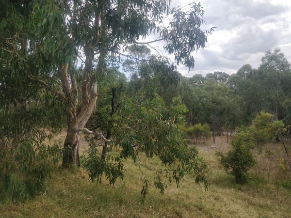
Hash slope
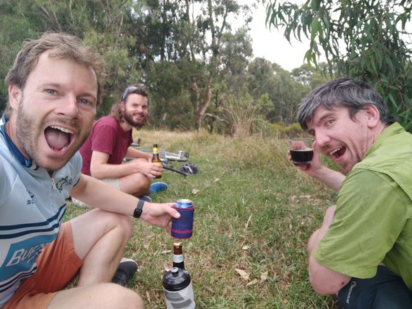
Drinking the beer!
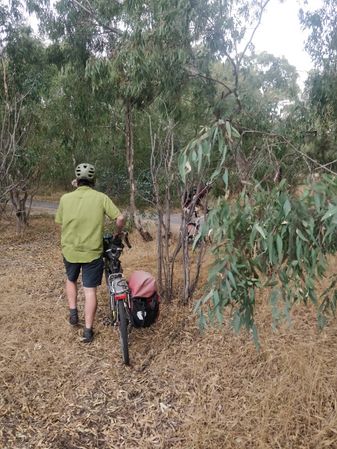
Bush bashing out
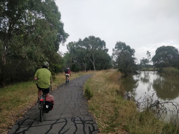
Path along the creek
Riding in the rain
Steve at the hash


Expedition 3 - EdBordin
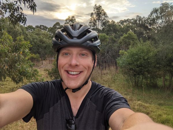
I was the third expedition for the day (that we know of). I went to work without checking the hash so I went on an impromptu solo adventure after work. After a quick detour via Don Tojo for dinner, I rode up the very bike-friendly Canning St and St George's Rd before cutting through slightly less friendly roads in Preston to join onto the Darebin creek trail. From there it was just a short ride through the greenery to reach the hash. Nearly left without locating Talex's xkcd sticks but after some prompting I found they'd survived until the end of the day! On the way home I took a more scenic route along a little more of the Darebin Creek rather than backtracking through Preston. Strava summary: 31.75km, 1:38:27 moving time (probably including wandering to the hash). A nice little ride!
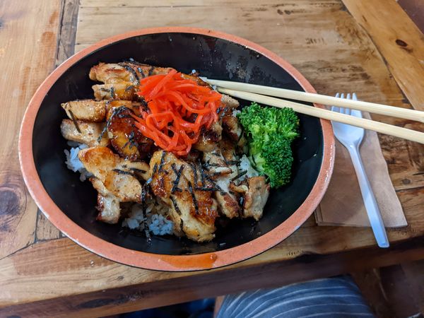
Pre-hash fuel - chicken teriyaki don

Almost tried to cross this water before realising the hash was on my other left
Scenic embankment again, but with my face in the way
Scenic soccer pitch view


Tracklog
Achievements
This isn't an official record yet, but I believe this sets the record for most cumulative years of cumulative geohashing experience at a given hash on a given day (at least as far as participants with wiki accounts that didn't change names during the Dark Years). Stevage (talk) 00:10, 22 February 2022 (UTC)
Talex, Felix Dance, John, Stevage and EdBordin earned the Bicycle geohash achievement
|
Felix Dance earned the Consecutive geohash achievement
|
This is hash #2 of the 2022 Victorian Geohash Streak.