Difference between revisions of "2022-10-20 -37 144"
([retro picture]Gps proof) |
m (Location) |
||
| (7 intermediate revisions by one other user not shown) | |||
| Line 1: | Line 1: | ||
| − | |||
| − | [[Image:{{{image| | + | [[Image:{{{image|2022-10-20_-37_144_Success.jpg}}}|thumb|left]] |
| − | + | {{meetup graticule | |
| − | |||
| − | |||
| − | |||
| − | |||
| − | |||
| lat=-37 | | lat=-37 | ||
| lon=144 | | lon=144 | ||
| Line 13: | Line 7: | ||
}}<!-- edit as necessary --> | }}<!-- edit as necessary --> | ||
== Location == | == Location == | ||
| − | + | In the Mt Cottrell Nature Conservation Reserve | |
== Participants == | == Participants == | ||
| − | + | [[User:Johnwrw|John]] | |
| − | |||
| − | |||
| − | |||
== Expedition == | == Expedition == | ||
| − | + | ''Written up in 2024, fortunately with a good amount of photos to prompt my memory''. | |
| + | |||
| + | I rode off from home in Ascot Vale. Crossing the Maribyrnong river I saw ongoing clean up from the flood that had happened very recently. I rode along the trainline to Sunshine, then continued west along Kororoit Creek, eventually getting out of Melbourne via Caroline Springs. I went past where, a few months previously, I had [[2022-04-26 -37 144|an expedition]] to Melton rudely interrupted by a broken spoke. Thankfully, no mechanical issues this time, but I did make a wrong turn around the same spot. Thankfully, this was soon corrected. I continued on my way, turned down south down a dirt road, and soon the reserve within which the hash lay was to my right. | ||
| − | + | The hash, however was still several hundred metres inland up a slope. Thankfully a vehicle track of some description went along the edge of the reserve, I just had to get onto it. There was muddy ditch and then a fence in my way, with a locked gate. But I surmounted these obstacles, and lifted my bike over the fence at a point that made it not too difficult. I got onto the vehicle track, and while it was surely better than trying to ride over knee-high grass, it wasn't especially kind. The track was only very lightly imprinted into the landscape, and the grassy surface concealed quite a rocky substrate. But it was just about still ride-able with my road bike, at least in sections. | |
| − | + | ||
| + | I slowly got to the point at which I would have to leave the track, and start clomping over the longer grass. I left my bike by the track, and clomped the requisite 30m or so to the hash. As I took a selfie, above me flitted birds of some description, loudly chirping away with noises that I wouldn't have described as particularly pleasant. My later research revealed that they were introduced Eurasian skylarks, [https://www.youtube.com/watch?v=rBp1Q_bHe0Y whose song] Europeans apparently adore. I think that speaks to the paucity of good bird song that they must have over there. Native Australian birds on the whole sound much nicer, although we do also have the cacophonous sulphur-crested cockatoo to account for too. | ||
| + | |||
| + | I returned back to my bike, and went back my bumpy way down the track. I hopped back over the fence, and returned home in much the same way as I had come. On my way I saw a duck family, and a swan atop a beautiful floating nest of reeds. I reached home just before four hours after departing, having done exactly 70km. Strava tells me I wasn't finished riding for the day, with activities later that evening riding in to the city and back. My camera roll tells me it was to see the bass player Mononeon play a gig as part of the jazz festival. | ||
== Photos == | == Photos == | ||
| − | |||
| − | |||
| − | |||
| − | |||
| − | Image:2022-10-20_-37_144_Johnwrw_1710668344601.jpg | + | <gallery heights="300px" mode="packed"> |
| + | Image:2022-10-20_-37_144_Flood_Clean_up.jpg|Flood clearn up | ||
| + | Image:2022-10-20_-37_144_Burnewang_St.jpg|Sounds painful | ||
| + | Image:2022-10-20 -37 144 Horses and Birds.jpg | ||
| + | Image:2022-10-20_-37_144_Tree_and_Fence.jpg| The hash lies in past this fence somewhere | ||
| + | Image:2022-10-20_-37_144_Vehicle_track.jpg|Not a very well used track | ||
| + | Image:2022-10-20_-37_144_Bike_by_fence.jpg|Bike left by the track | ||
| + | Image:2022-10-20_-37_144_Swan_Nest.jpg | ||
| + | Image:2022-10-20_-37_144_Ducklings.jpg | ||
| + | Image:2022-10-20_-37_144_Johnwrw_1710668344601.jpg | ||
</gallery> | </gallery> | ||
== Achievements == | == Achievements == | ||
{{#vardefine:ribbonwidth|100%}} | {{#vardefine:ribbonwidth|100%}} | ||
| − | + | {{bicycle geohash | |
| + | | latitude={{#explode:{{SUBPAGENAME}}| |1}} | ||
| + | | longitude={{#explode:{{SUBPAGENAME}}| |2}} | ||
| + | | date={{#explode:{{SUBPAGENAME}}| |0}} | ||
| + | | name=John | ||
| + | | distance=70km | ||
| + | | bothways=true | ||
| + | }} | ||
__NOTOC__ | __NOTOC__ | ||
| − | |||
| − | |||
| − | |||
| − | |||
| − | + | [[Category:Expeditions]] | |
| − | |||
| − | [[Category: | ||
| − | |||
| − | + | [[Category:Expeditions with photos]] | |
| − | |||
| − | |||
| − | |||
| − | |||
| − | |||
| − | |||
| − | |||
| − | + | ||
[[Category:Coordinates reached]] | [[Category:Coordinates reached]] | ||
| − | + | {{location|AU|VIC|MT}} | |
| − | |||
| − | |||
| − | |||
| − | |||
| − | |||
| − | |||
| − | |||
| − | |||
| − | |||
| − | |||
| − | |||
| − | |||
| − | |||
| − | |||
| − | |||
| − | |||
| − | |||
Latest revision as of 12:42, 17 March 2024

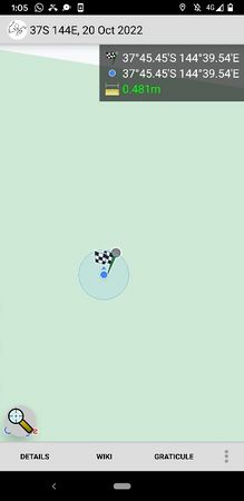
| Thu 20 Oct 2022 in -37,144: -37.7574640, 144.6589845 geohashing.info google osm bing/os kml crox |
Location
In the Mt Cottrell Nature Conservation Reserve
Participants
Expedition
Written up in 2024, fortunately with a good amount of photos to prompt my memory.
I rode off from home in Ascot Vale. Crossing the Maribyrnong river I saw ongoing clean up from the flood that had happened very recently. I rode along the trainline to Sunshine, then continued west along Kororoit Creek, eventually getting out of Melbourne via Caroline Springs. I went past where, a few months previously, I had an expedition to Melton rudely interrupted by a broken spoke. Thankfully, no mechanical issues this time, but I did make a wrong turn around the same spot. Thankfully, this was soon corrected. I continued on my way, turned down south down a dirt road, and soon the reserve within which the hash lay was to my right.
The hash, however was still several hundred metres inland up a slope. Thankfully a vehicle track of some description went along the edge of the reserve, I just had to get onto it. There was muddy ditch and then a fence in my way, with a locked gate. But I surmounted these obstacles, and lifted my bike over the fence at a point that made it not too difficult. I got onto the vehicle track, and while it was surely better than trying to ride over knee-high grass, it wasn't especially kind. The track was only very lightly imprinted into the landscape, and the grassy surface concealed quite a rocky substrate. But it was just about still ride-able with my road bike, at least in sections.
I slowly got to the point at which I would have to leave the track, and start clomping over the longer grass. I left my bike by the track, and clomped the requisite 30m or so to the hash. As I took a selfie, above me flitted birds of some description, loudly chirping away with noises that I wouldn't have described as particularly pleasant. My later research revealed that they were introduced Eurasian skylarks, whose song Europeans apparently adore. I think that speaks to the paucity of good bird song that they must have over there. Native Australian birds on the whole sound much nicer, although we do also have the cacophonous sulphur-crested cockatoo to account for too.
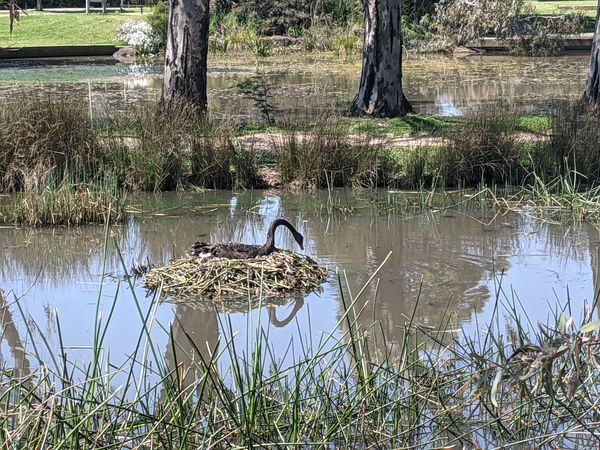
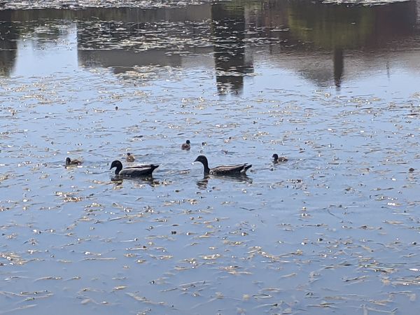
I returned back to my bike, and went back my bumpy way down the track. I hopped back over the fence, and returned home in much the same way as I had come. On my way I saw a duck family, and a swan atop a beautiful floating nest of reeds. I reached home just before four hours after departing, having done exactly 70km. Strava tells me I wasn't finished riding for the day, with activities later that evening riding in to the city and back. My camera roll tells me it was to see the bass player Mononeon play a gig as part of the jazz festival.
Photos
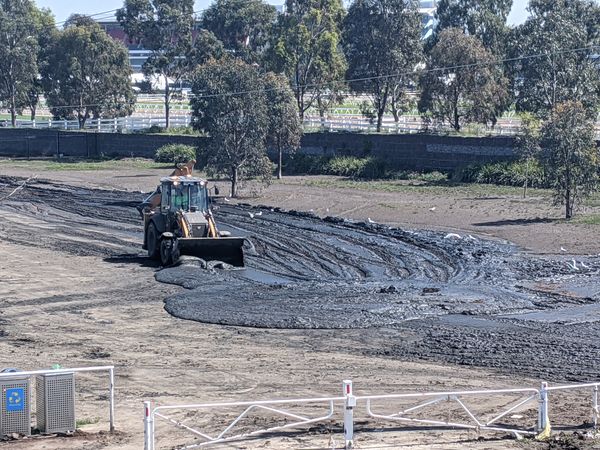
Flood clearn up
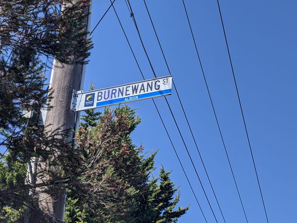
Sounds painful
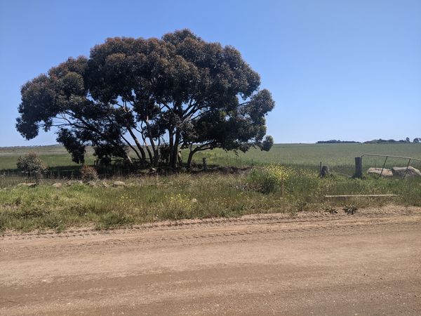
The hash lies in past this fence somewhere
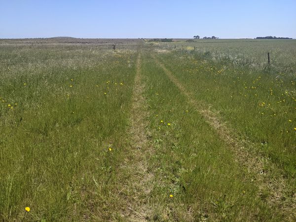
Not a very well used track
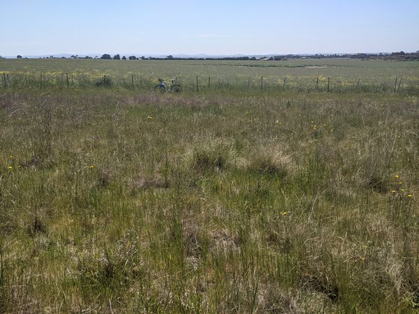
Bike left by the track


Achievements
John earned the Bicycle geohash achievement
|