Difference between revisions of "2023-07-28 41 2"
(Expedition report.) |
m (User categories) |
||
| Line 52: | Line 52: | ||
{{Location|ES|CT|B}} | {{Location|ES|CT|B}} | ||
| − | {{user categories|user=SastRe.O|bus=12.6|train=28.8| | + | {{user categories|user=SastRe.O|bus=12.6|train=28.8|foot=6.3}} |
[[Category:Expeditions]] | [[Category:Expeditions]] | ||
[[Category:Expeditions with photos]] | [[Category:Expeditions with photos]] | ||
[[Category:Coordinates reached]] | [[Category:Coordinates reached]] | ||
Latest revision as of 16:23, 31 July 2023
| Fri 28 Jul 2023 in Barcelona, Catalonia: 41.6277364, 2.0275298 geohashing.info google osm bing/os kml crox |
Location
Camí de Castellar a la Mola, north of the masia Can Torres in the Natural Park of Sant Llorenç del Munt i l'Obac.
Participants
Plans
Take the train to Terrassa, bus to Matadepera and walk/hike/jog to the hash.
Expedition
After a few months of less activity on geohashing, due to having less free time, today I had a day off and granting enough, the dice of geohashing placed a geohash in a quite accessible place.
It's on the Natural Park of Sant Llorenç, which I always like to visit since there are still many many places unknown for me which I like to discover. And, yes, we're having a rather warm summer, but I expect to be done before 13h and let's hope it doesn't surpass 32-33ºC.
Train on time and the bus a few minutes late, but with no setbacks I arrived in Matadepera. Then I started walking. Where the track starts a quick pause to gather water and put sunscreen on and took of.
First I visited the "Avenc de Can Torres" (avenc means something like shaft cave or vertical cave) which was quite impressive. I had another thing in mind when I read its description, but it's stunning. You don't want to fall in there. Then I visited the Masia with the same name, Can Torres.
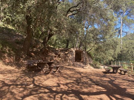
Then it was turn to approach the hash. Came from west, and not that much of a dance was necessary to get a good read on my GPSr. Crown on, a few pictures taken, drank water and continued my way.
After that the path was downhill. I took the opportunity to jog a little to make sure I would not miss the bus for the way back, otherwise I would have had to wait for an hour and I didn't want to.
Tracklog
Photos
Tartana spring where I started.
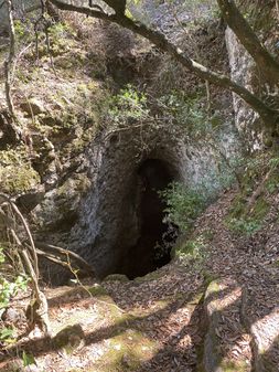
Avenc de Can Torres
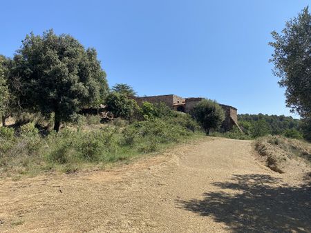
Can Torres
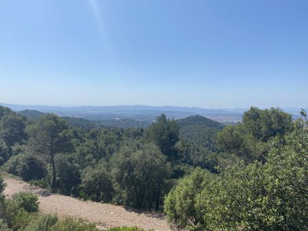
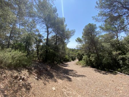
View looking south.
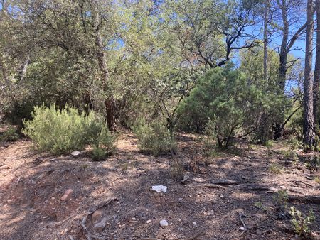
Hash location
Path on the hash location looking east.
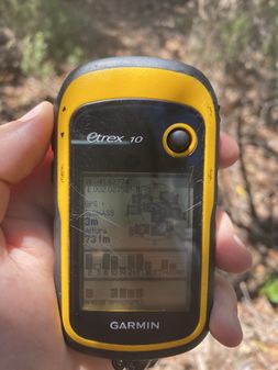
Proof with GPSr.


Achievements
SastRe.O earned the Public transport geohash achievement
|
SastRe.O earned the Birthday Geohash Achievement
|
Other Geohashing Expeditions and Plans on This Day
Expeditions and Plans
| 2023-07-28 | ||
|---|---|---|
| Melbourne East, Australia | Stevage | In a Woolworths supermarket in Lindarum, just north of Epping in Melbourne'... |
| Los Angeles, California | LB-FT | Right near the trailhead of Sycamore Canyon Trail in Whittier, just about b... |
| Barcelona, Spain | SastRe.O | Camí de Castellar a la Mola, north of the masia Can Torres in the Natural P... |
| Hamburg (East), Germany | π π π | in a park right next to the Alster in Hamburg-Fuhlsbüttel |
- Meetup on 2023-07-28
- Meetup in 41 2
- Expeditions with tracklogs
- Public transport geohash achievement
- Birthday geohash achievement
- Meetup in Província de Barcelona
- Expeditions by SastRe.O
- SastRe.O's expeditions by bus
- SastRe.O's expeditions on foot
- SastRe.O's expeditions by train
- Expeditions
- Expeditions with photos
- Coordinates reached