Difference between revisions of "2024-02-14 41 -86"
From Geohashing
(→Participants) |
m (Location) |
||
| (4 intermediate revisions by one other user not shown) | |||
| Line 1: | Line 1: | ||
| − | + | {{meetup graticule | |
| − | |||
| − | |||
| − | |||
| − | |||
| − | |||
| − | |||
| − | |||
| − | |||
| lat=41 | | lat=41 | ||
| lon=-86 | | lon=-86 | ||
| Line 19: | Line 11: | ||
--> | --> | ||
[[User:Ironeagl|Ironeagl]] ([[User talk:Ironeagl|talk]]) | [[User:Ironeagl|Ironeagl]] ([[User talk:Ironeagl|talk]]) | ||
| − | |||
| − | |||
| − | |||
== Expedition == | == Expedition == | ||
| − | + | If it weren't for the highway, I could have walked here from work. As it is, it was a short drive. There was even a parking lot a few steps away. | |
| − | |||
| − | |||
| − | |||
== Photos == | == Photos == | ||
| Line 35: | Line 21: | ||
<gallery perrow="5"> | <gallery perrow="5"> | ||
| − | Image:2024-02-14_41_-86_ironeagl_1707949734812.jpg| | + | Image:2024-02-14_41_-86_ironeagl_1707949734812.jpg|Point is on the side of a public-access road next to a toll booth. |
</gallery> | </gallery> | ||
== Achievements == | == Achievements == | ||
{{#vardefine:ribbonwidth|100%}} | {{#vardefine:ribbonwidth|100%}} | ||
| − | + | {{Two to the N achievement | count = 1 | date = 2024-02-14 | latitude = 41 | longitude = -86 | reached = true | name = Ironeagl}} | |
| + | {{gratuitous ribbon | color = #fd91b7 | icon = valentinesicon.png | latitude = 41 | longitude = -86 | date = 2024-02-14 | achievement = Valentine's Achievement | description = geohashing on Valentine's Day at the | name = Ironeagl}} | ||
| + | |||
__NOTOC__ | __NOTOC__ | ||
| − | |||
| − | |||
| − | |||
| − | |||
| − | |||
| − | |||
| − | |||
| − | |||
| − | |||
| − | |||
| − | |||
| − | |||
| − | |||
| − | |||
[[Category:Expeditions]] | [[Category:Expeditions]] | ||
| − | |||
[[Category:Expeditions with photos]] | [[Category:Expeditions with photos]] | ||
| − | |||
[[Category:Expedition without GPS]] | [[Category:Expedition without GPS]] | ||
| − | |||
| − | |||
| − | |||
[[Category:Coordinates reached]] | [[Category:Coordinates reached]] | ||
| − | + | {{location|US|IN|EL}} | |
| − | |||
| − | |||
| − | |||
| − | |||
| − | |||
| − | |||
| − | |||
| − | |||
| − | |||
| − | |||
| − | |||
| − | |||
| − | |||
| − | |||
| − | |||
| − | |||
| − | |||
Latest revision as of 23:42, 16 February 2024
| Wed 14 Feb 2024 in 41,-86: 41.7340934, -86.0056836 geohashing.info google osm bing/os kml crox |
Location
On the side of a road in Elkhart
Participants
Expedition
If it weren't for the highway, I could have walked here from work. As it is, it was a short drive. There was even a parking lot a few steps away.
Photos
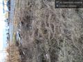
Point is on the side of a public-access road next to a toll booth.

Achievements

Ironeagl earned the Two to the N achievement
by reaching 21 hashpoints on 2024-02-14 41 -86 and is promoted to Level 1 (Coordinates reached).
Ironeagl earned the Valentine's Achievement
|