2008-07-23 52 13

| Wed 23 Jul 2008 in 52,13: 52.2130408, 13.1882042 geohashing.info google osm bing/os kml crox |
Todays spot is near Löwenberge near Trebbin in the south of Berlin. Lyx and I had planned to take the train to Thyrow (closest station within the city fare) and from there go by bike. Lyx missed the train, so I had to sadly go alone.
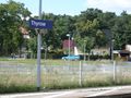
Thyrow station

With a short detour (I don't navigate by GPS), I came close to the spot at about 4:30pm. The closest road is the Waldstraße, leading into the forest.
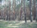
Forest :)
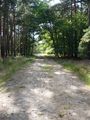
Waldstraße
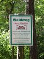
Not to be confused with "Waldweg"


From there, the unlabeled Steiler Weg leads steeply up to a tower that was already visible on the satellite view. It turned out to be a cellular network station. (Or maybe it's related to the nearby airport Schönhagen?) The spot is in the forest below.
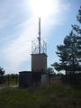
cell station
The only street sign around


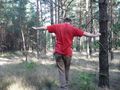
I turned on the GPS on the top of the hill and 7 satellites led the way through the forest.
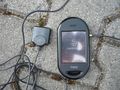
My trusty (ahem) Openmoko. :)

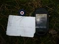
- I found the geohash location in the forest, rather close to a service path
- I hid a geocache near the spot; the cache is marked by a bull's eye. It contains the first of a series of puzzle pieces, which will be placed at consequent geohashing locations I visit.
- I set up a flashline near the spot and walked it.
That makes it a Geohashcacheflashline expedition.
Geohash
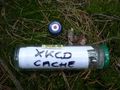
Geocache GC1EFMC - the cache was first discovered but one day later! :)
Geoflashline
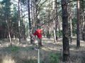
Walking the line.


