2012-08-12 37 -121
| Sun 12 Aug 2012 in 37,-121: 37.1868606, -121.9329124 geohashing.info google osm bing/os kml crox |
Location
Just off of the Limekiln Trail in Los Gatos, between Alma Bridge Road and Woods Road.
Participants
Plans
I will bike here sometime in the afternoon.
Expedition
Last night, I realized that the Sunday geohash was only 13 miles away from me by bike! Of course, I had to go.
I left at around 4 PM, and for the most part, took the exact same route as last month's hash. I took the LG Creek Trail all the way up to Alma Bridge Road, but this time, I took a left on Alma Bridge, not a right. So far, everything went swimmingly.
After originally missing the turnoff (I went all the way to Priest Rock trail), I reached the point where I'd turn off of Alma Bridge. It was a small trail called Limekiln Trail, close to the quarry (I had no idea there was a quarry until I hashed).
The Limekiln Trail, according to Google, connects Alma Bridge with Woods Road. Fun fact: Exactly 11 months ago, I went too far on the Woods Trail (as you can guess, it is close to Woods Road), and it got dark. I had gone over 5 miles past the closest road, and therefore had to call the parks service to rescue me. I was fine, but decided to hash today with caution, as I had to go to the same Open Space Preserve as the one I got "lost" in. When I left, I didn't worry too much though. At the time, I didn't have a smartphone. Now, I did, and it was loaded with Google Maps, Navigation, and Geohash Droid. What could go wrong?
When I was about 1,000 feet away from Alma Bridge Road on Limekiln Trail, I checked my phone to see how it was doing. I had no signal. Absolutely none. Geohash Droid couldn't determine my current location, as a result.
My old phone had Verizon, which has pretty good service essentially everywhere. My new one had Virgin Mobile (Sprint), which has no service in anywhere approaching rural. I have had no service in Lake Berryessa, and when we went to the Grand Canyon last week, my family (Verizon and AT&T) could call with surprisingly good signal while my phone was essentially a really small camera.
Even though it was only around 5:30-6, and I still had plenty of daylight left, I called off the hash. I was not walking 4 miles on the trail, and then 0.3 mile off of it without any GPS. Plus, I now had no idea where to turn off the trail. I was blinded by science!
I did get to explore the really cool roads of Los Gatos though, so all in all, it was an awesome trip, as always.
Gallery
- Photo Gallery
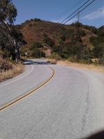
Alma Bridge Road looking west
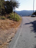
Jones Trail
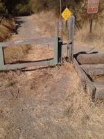
Trail entrance. I can't remember whether this was Priest Rock Trail or Limekiln. I think the latter.
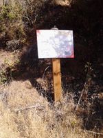
Another sign (about canine heatstroke, probably on Priest Rock Trail
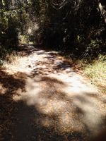
With no signal and 4 miles to go, I turned back here.

I took this pic about half a mile down Alma Bridge. My phone told me I was in Holy City[[1]], a place which I am glad is no longer there. I would not do well in a white supremacist society.
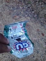
Geotrashing.


Achievements
Chandru earned the Blinded by Science Consolation Prize
|
Chandru earned the GeoTrash Geohash Achievement
|