2015-02-06 52 1
| Fri 6 Feb 2015 in Norwich, UK: 52.5833871, 1.6088116 geohashing.info google osm bing/os kml crox |
Location
On a farm track next to a drainage ditch between Halvergate and the river Yare, Norfolk, UK.
Participants
Expedition
- Arrived. -- Sourcerer (talk) @52.5835,1.6089 00:19, 6 February 2015 (GMT)
The hashpoint was 2km from the nearest parking place. Farm tracks led right to the location. The walk was in moonlight and there was a cold east wind. In the shelter of trees, the ground was starting to freeze. At the destination, I was safely inside the "circle of uncertainty" but perhaps the hashpoint was in the drainage ditch. I didn't go paddling!
The midnight timing allowed two hashpoints to be reached with only one car journey.
My journey home was uneventful after getting slightly lost.
- We did it! -- ChromeCrusaders (talk) @52.5834,1.6090 12:21, 6 February 2015 (EST)
Unlike the Sourcerer, we decided against walking the 2km and instead decided (after walking 20 feet and turning back) that our bikes were definitely authorised vehicles which is what the sign asked for. The ride was in sunlight and there was no wind at all and I noticed how un-frozen the ground was - because I almost suffered the same fate as last time... (2015-01-30_52_1)
Photos
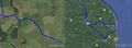
Track Log
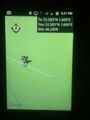
ChromeCrusaders Proof
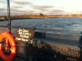
Enjoying a ferry ride
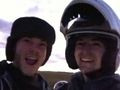
Happy Faces XD


Achievements
Sourcerer earned the Midnight Geohash achievement
|
ChromeCrusaders earned the Land geohash achievement
|
ChromeCrusaders earned the Ferry Achievement
|
Expeditions and Plans
| 2015-02-06 | ||
|---|---|---|
| Christchurch, New Zealand | Quaternary | Cracroft, Christchurch, New Zealand |
| Norwich, United Kingdom | Sourcerer, ChromeCrusaders | On a farm track next to a drainage ditch between Halvergate and the river Y... |
Sourcerer's Expedition Links
2015-02-05 52 1 - 2015-02-06 52 1 - 2015-02-07 52 1 - KML file download of Sourcerer's expeditions for use with Google Earth.