2015-09-28 52 1
| Mon 28 Sep 2015 in Norwich, UK: 52.5874809, 1.6473152 geohashing.info google osm bing/os kml crox |
Location
In Breydon water where the rivers Waveney and Yare meet, Burgh Castle, Norfolk, UK. w3w
Participants
Plans
I'll see if I can hire a day boat at Burgh Castle Marina. High tide is at 10:25 local time. The hashpoint is about 40 metres outside the navigable channel but a small craft might be able to reach the point at high tide.
Expedition
- No boats available at Burgh Castle Marina. -- Sourcerer (talk) @52.5779,1.6502 09:15, 28 September 2015 (GMT+01:00)
- Closest approach by land (370 metres). -- Sourcerer (talk) @52.5866,1.6526 09:26, 28 September 2015 (GMT+01:00)
The track log image shows where I went.
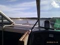
- Got a hire boat at Saint Olaves. -- Sourcerer (talk) @52.5403,1.6157 10:31, 28 September 2015 (GMT+01:00)
Once I had the boat, the rest was "plain sailing" from Saint Olaves to Burgh Castle. I arrived at high tide, as planned, although this was an hour later than I thought (to my advantage). With the full super-moon it was a spring tide with deeper water than usual. I risked leaving the channel and crept 45 metres to the hashpoint, ready to reverse out at the smallest sign of going aground. I didn't attempt to get proof photos at the zero mark. There was wind and current and it would not have been a good idea to lose attention and drift aground, to be stuck for 10 to 12 hours before the next high tide. The track-log will have to suffice. In the relative safety of the navigable channel, I took the evidence photos, about 50 metres from the zero mark.
The boat cruise took two hours. The craft looked like a speed boat but it had a clunky diesel engine and barely managed to achieve the 5 or 6 mph river speed limits.
Photos
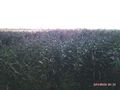
Land fail
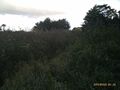
Land fail
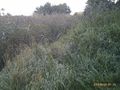
Land fail
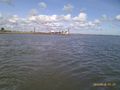
Still about 4km to go
Getting close
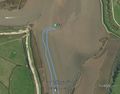
Track in Google Earth
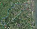
Zoomed out track
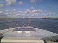
Arrived - the view
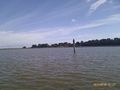
Arrived - the view
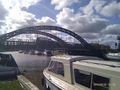
Back at the boatyard
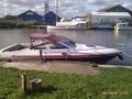
The boat
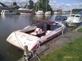
The boat


Achievements
Sourcerer earned the Water geohash achievement
|
Expeditions and Plans
| 2015-09-28 | ||
|---|---|---|
| Paderborn, Germany | GeorgDerReisende | The hash lay on the fieldway passing the motorway rest area Wewelsburg ... |
| Norwich, United Kingdom | Sourcerer | In Breydon water where the rivers Waveney and Yare meet, Burgh Castle, Norf... |
| Nilsiä, Finland | Pastori, The Wife | Valtimo, Pajukoski. The point lies in a spruce forest, on the bank of a dit... |
Sourcerer's Expedition Links
2015-09-27 52 1 - 2015-09-28 52 1 - 2015-09-29 52 1 - KML file download of Sourcerer's expeditions for use with Google Earth.