2016-06-23 52 1
| Thu 23 Jun 2016 in Norwich, UK: 52.7120614, 1.1643006 geohashing.info google osm bing/os kml crox |
Location
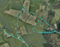
30 metres from a public footpath close to the Marriot's Way and Attlebridge, Norfolk, UK.
Participants
Plans
One of two spanning midnight - 2016-06-23 52 1 - 2016-06-24 52 1 - ETA 22:10.
Expedition
There were small flash floods after thunder storms. Some roads were blocked and trees and branches had fallen. There were patches of mud, silt or gravel washed onto the roads making them slippery and unpredictable. So it was an exciting drive with extra care needed. The walk to the hashpoint was wet but easy enough. The point was about 25 metres off the footpath into a field of sweet corn seedlings. There were zones where the soil and plants had washed away in the storms. One of these mini-stream beds (barranquitos?) led to the hashpoint. The route to the second hashpoint was slow due to a flooded and closed road.
Photos
- Photo Gallery
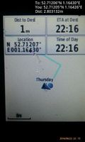
Arrived. @52.7121,1.1643
Achievements
Expeditions and Plans
| 2016-06-23 | ||
|---|---|---|
| Placerville, California | Someone went | Globalhash alert 2016-06-23 global at Valley Springs, California, United States. |
| Norwich, United Kingdom | Sourcerer | 30 metres from a public footpath close to the Marriot's Way and Attlebridge... |
| Kemijärvi, Finland | Pastori, The Wife | Kemijärvi, the point lies right next to the fence of the Kemijärvi airport.... |
| Globalhash | Someone went | Valley Springs, California, United States. |
Sourcerer's Expedition Links
2016-06-22 52 1 - 2016-06-23 52 1 - 2016-06-24 52 1 - KML file download of Sourcerer's expeditions for use with Google Earth.

