2022-02-06 40 -4
| Sun 6 Feb 2022 in 40,-4: 40.3886040, -4.3483988 geohashing.info google osm bing/os kml crox |
Location
In the waters of the reservoir Embalse de San Juan near Pelayos de la Presa.
Participants
Plans
Expedition
This was my first expedition towards a geohash in the water, but I did not know this in the beginning, because I started as a mystery tour, like expeditions 2022-01-10_40_-4 and 2022-01-16_40_-4. I did not check out the location in advance, but just entered the coordinates in the navigation device, which indicated a riding distance of 25 km, and followed the directions.
This took me to Pelayos de la Presa and then off the main through road, which I already had travelled frequently before. In the outskirts of the village, I had to leave the paved road, and the navigation device wanted to send me onto a path which was impassable for the heavy Goldwing. Thus, I parked the bike there and checked out the location of the geohash on the Droid.
At that moment I realized that it was in the waters of the nearby reservoir. This was not the season for swimming or for boat rental, so it was clear that I cannot reach the geohash. However, it was not far, so I decided to try to get to the shore as close as possible. Unfortunately, I had to find out that this coastal area was a closed settlement, only accessible for registered residents.
Finally, I wanted at least to reach somewhere the waters that host the geohash, even if far from the actual location. And this I did.
Tracklog
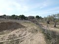
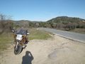
Start of the track (green) is where I parked the Goldwing, first photo. I first tried to get North on foot cross country and then with the bike on the road, all unsuccessful. Finally, I rode to a kind of beach resort which I knew and walked down to the water, where the track ends (red), last photo. The water level in the reservoir was lower than assumed in the map, so I got to the end point with dry feet.
Photos
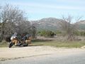
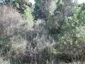
Parking by the side of the road, looking in the direction of the geohash.
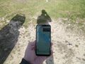
The Droid shows it's in the waters, 1.76 km from the parking place as the crow flies.
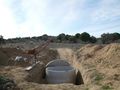
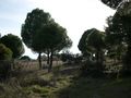
After passing by a fountain construction site, I continue North with a fence to my left…
… but I'm stopped soon by an East-West fence.
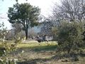
I return to the fountain site and follow a fence westward…
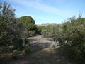
… until the North direction becomes open again.
A fence comes up to my left, but I can still continue North.
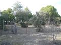
There is a settlement of weekend houses behind the fence.
The terrain gets a bit tough.
The fence turns to the right, eastward, and then again, forcing me back southward.
I loose somewhat direction on the way back, but then I see the fountain construction site…
… and finally the Goldwing.
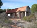
I try to continue with the bike on the paved road, but it leads to a closed settlement I can't enter.
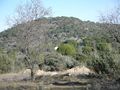
I turn around and ride to an access to the reservoir I know, albeit further away from the geohash.
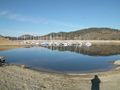
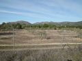
At the waters in which the geohash resides, behind the boat docks about three kilometers to the left.


