Difference between revisions of "Auckland, New Zealand"
From Geohashing
imported>JimmyNZ (→Geohashes Reached) |
imported>JimmyNZ (→Photos) |
||
| Line 71: | Line 71: | ||
File:2010-06-24 -36 174 That direction.jpg |[[2010-06-24 -36 174| Shakespear Regional Park, Whangaparoa]] | File:2010-06-24 -36 174 That direction.jpg |[[2010-06-24 -36 174| Shakespear Regional Park, Whangaparoa]] | ||
File:File_2010-06-19_-36_174_Sign_says_no.JPG | [[2010-06-19 -36 174|Parau, West Auckland]] | File:File_2010-06-19_-36_174_Sign_says_no.JPG | [[2010-06-19 -36 174|Parau, West Auckland]] | ||
| − | File:2010 01 24 -36 174 view from the hashs.jpg | [[2010-01-24 -36 174| | + | File:2010 01 24 -36 174 view from the hashs.jpg | [[2010-01-24 -36 174|Farm Paddock, Taupaki]] |
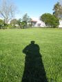
Image:IMG 1983 -1024x768-.JPG | In one of our many parks | Image:IMG 1983 -1024x768-.JPG | In one of our many parks | ||
Revision as of 03:16, 25 June 2010
| Northland | Whangarei | Mokohinau Islands |
| Glinks Gully | Auckland | Coromandel |
| -37,173 | Manukau City | Hamilton |
|
Today's location: geohashing.info google osm bing/os kml crox | ||
Today's Location: Auckland, NZ
The Auckland graticule is at latitude -36, longitude 174
Description
Auckland is the biggest city in New Zealand.
Links
The Maxx for up to date and pretty accurate information on your public transport options in the Greater Auckland Area. [1]
Local Geohashers
- AMADANON Inc.
- Aspirin
- bobilljim
- Cascade
- Eb
- gnail
- Greenslime
- Halkyardo
- jinerviet
- JimmyNZ
- Khadgar
- TunezNZ
- wipash
- Zaf
- You_Fool
Geohashes Reached
- 2008-06-25 - gnail - In the parking lot of Mt Roskill Grammar School
- 2008-07-28 - zaf, lan - Western Park
- 2008-08-10 - zaf - Meters off East Coast Rd, near Albany
- 2008-09-08 - Khadgar - Helensville
- 2008-10-02 - TunezNZ - East Tamaki Industrial zone
- 2008-11-26 - Aspirin - No.56 Parkinson Avenue
- 2009-03-17 - TunezNZ - Corn field, Flatbush
- 2009-09-05 - TunezNZ - East Tamaki War Memorial park sports field
- 2010-01-24 - Greenslime - Farm Paddock, Taupaki
- 2010-06-24 - Greenslime - Shakespear Regional Park, Whangaparoa Peninsula, Auckland
Failed Geohashes
- 2010-06-19 - JimmyNZ - Native Bush, Parau
Photos
In one of our many parks


