Difference between revisions of "2010-04-10 48 11"
imported>Reinhard (tale of two hashes - well done!) |
imported>FippeBot m (Location) |
||
| (2 intermediate revisions by 2 users not shown) | |||
| Line 25: | Line 25: | ||
== Expedition == | == Expedition == | ||
| − | + | ||
| − | As already done on previous expeditions, [[User:DerFlob|DerFlob]] and [[User:The_T-Man|The_T-Man]] met up at The_T-Man's place, which was only 2.1 km away from the hashpoint this time. They followed Ostpreussenstrasse until they noticed they had cycled too far. Then they took a turn into a side street, which turned out not to lead towards the hashpoint. The third attempt finally brought them into the immediate vicinity of the point, which was - as previously observed from satellite imagery - located in the garden of a detached house. This is where the actual challenge began. Soon after their arrival, an old lady - apparently the owner/resident of said house - spotted the two geohashers and asked whether she could help them. The_T-Man gave his best shot at explaining the | + | As already done on previous expeditions, [[User:DerFlob|DerFlob]] and [[User:The_T-Man|The_T-Man]] met up at The_T-Man's place, which was only 2.1 km away from the hashpoint this time. They followed Ostpreussenstrasse until they noticed they had cycled too far. Then they took a turn into a side street, which turned out not to lead towards the hashpoint. The third attempt finally brought them into the immediate vicinity of the point, which was - as previously observed from satellite imagery - located in the garden of a detached house. |
| + | |||
| + | This is where the actual challenge began. Soon after their arrival, an old lady - apparently the owner/resident of said house - spotted the two geohashers and asked whether she could help them. The_T-Man gave his best shot at explaining the purpose of their mission, starting off a series of approaches, all of which resulted in the old lady answering "But I don't get the sense of it.". Which - taking the general idea of geohashing into consideration - probably meant she understood the previous explanations. However, since the two hashers didn't want to bother her and/or make her feel uncomfortable, they offered to stay out of the garden, said goodbye to her and prepared to leave. Then, however, the lady opened a window and told the two expedition members that she just had informed a neighboring relative of hers who would walk them through the garden. After visiting the exact coordinates and taking a photo with the relative of the old lady (who felt she was not properly dressed for a picture), DerFlob and The_T-Man thanked them for their generous cooperation efforts and left. On their way back home, they stopped by to take some pictures of the [http://en.wikipedia.org/wiki/SV-Hochhaus Süddeutscher-Verlag-Hochhaus], which is located about 300 metres away from The_T-Man's apartment. | ||
== Photos == | == Photos == | ||
| Line 49: | Line 51: | ||
| image = 2010-04-10_48_11_Flob_04.jpg | | image = 2010-04-10_48_11_Flob_04.jpg | ||
}} | }} | ||
| − | |||
| − | + | {{A Tale of Two Hashes | latitude = 48| longitude = 11| date = 2010-04-10| user2 = [[user:paintedhell|Juja]], [[user:Manu|Manu]] and [[user:Reinhard|Reinhard]]| name = [[User:DerFlob|DerFlob]] and [[User:The_T-Man|The T-Man]]| place = München| image = 2010-04-10_48_11_Flob_04.jpg}} | |
| − | |||
| − | [[ | ||
| Line 59: | Line 58: | ||
[[Category:Expeditions with photos]] | [[Category:Expeditions with photos]] | ||
[[Category:Coordinates reached]] | [[Category:Coordinates reached]] | ||
| + | {{location|DE|BY|M|city=true}} | ||
Latest revision as of 01:34, 9 August 2019
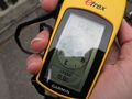
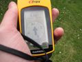
| Sat 10 Apr 2010 in 48,11: 48.1513277, 11.6384178 geohashing.info google osm bing/os kml crox |
Location
In the garden of a detached house in München.
Participants
Plans
- 2010-04-10: Even though it's on private ground The T-Man and me will visit it around 4 p.m. -DerFlob 00:36, 10 April 2010 (UTC) -- This would be a really easy one, but I'm not in town this afternoon, so I won't come. You might like to take this challenge, though. --Zb 09:34, 10 April 2010 (UTC)
Expedition
As already done on previous expeditions, DerFlob and The_T-Man met up at The_T-Man's place, which was only 2.1 km away from the hashpoint this time. They followed Ostpreussenstrasse until they noticed they had cycled too far. Then they took a turn into a side street, which turned out not to lead towards the hashpoint. The third attempt finally brought them into the immediate vicinity of the point, which was - as previously observed from satellite imagery - located in the garden of a detached house.
This is where the actual challenge began. Soon after their arrival, an old lady - apparently the owner/resident of said house - spotted the two geohashers and asked whether she could help them. The_T-Man gave his best shot at explaining the purpose of their mission, starting off a series of approaches, all of which resulted in the old lady answering "But I don't get the sense of it.". Which - taking the general idea of geohashing into consideration - probably meant she understood the previous explanations. However, since the two hashers didn't want to bother her and/or make her feel uncomfortable, they offered to stay out of the garden, said goodbye to her and prepared to leave. Then, however, the lady opened a window and told the two expedition members that she just had informed a neighboring relative of hers who would walk them through the garden. After visiting the exact coordinates and taking a photo with the relative of the old lady (who felt she was not properly dressed for a picture), DerFlob and The_T-Man thanked them for their generous cooperation efforts and left. On their way back home, they stopped by to take some pictures of the Süddeutscher-Verlag-Hochhaus, which is located about 300 metres away from The_T-Man's apartment.
Photos

This is the garden where the geohash was located
About 15m away, outside the garden
After we gained permission, we were able to reach the coordinates

Backside of the Hochhaus Süddeutscher Verlag

Frontview of the SV-Hochhaus


Achievement ribbons
The T-Man and DerFlob earned the Ambassador achievement
|
