Difference between revisions of "2011-04-01"
From Geohashing
imported>AperfectBot m (Ook.) |
imported>Jiml m (Switch to new style) |
||
| Line 1: | Line 1: | ||
<noinclude>{{date navigation}}</noinclude> | <noinclude>{{date navigation}}</noinclude> | ||
{{auto coordinates|2011-04-01}} | {{auto coordinates|2011-04-01}} | ||
| − | {{auto | + | {{auto gallery2|2011-04-01}} |
<noinclude>{{expedition summaries|2011-04-01}}</noinclude> | <noinclude>{{expedition summaries|2011-04-01}}</noinclude> | ||
Latest revision as of 03:09, 2 April 2011
Expedition Archives from April 2011
Thursday 31 March 2011 | Friday 1 April 2011 | Saturday 2 April 2011
See also: Category:Meetup on 2011-04-01
Coordinates
West of -30°: .5523773, .3726063
East of -30°: .0760312, .3007916
Globalhash:
-76.314389658881,-71.715037498301
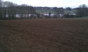
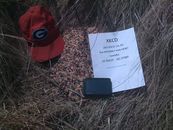
Photo Gallery
Expeditions and Plans
| 2011-04-01 | ||
|---|---|---|
| Toccoa, Georgia | tomkf61 | On north side of Highway 17 (Toccoa Bypass), 4.75 kilometers from Toccoa, G... |
| Plovdiv, Bulgaria | Kisolre | Near Radilovo village. |
| Portland, Oregon | kydlt, The lovely Kate | At the park at the Sandy River delta, at exit 18 of I-84 |
| Frankfurt am Main, Germany | LadyBB | A field between Wiesbaden-Bierstadt and-Wiesbaden-Igstadt |
| Norwich, United Kingdom | Sourcerer | Beside Martlesham Creek north east of the church. It's near Woodbridge, Suf... |


