Difference between revisions of "2008-06-04"
From Geohashing
imported>Tjtrumpet2323 m |
imported>Aperfectring |
||
| (One intermediate revision by one other user not shown) | |||
| Line 14: | Line 14: | ||
=== Photo Gallery === | === Photo Gallery === | ||
| − | {{Expedition Images | + | {{Expedition Images|2008-06-04}} |
| + | <noinclude>{{expedition summaries|2008-06-04}}</noinclude> | ||
Latest revision as of 12:49, 10 July 2009
Expedition Archives from June 2008
Tuesday 3 June 2008 | Wednesday 4 June 2008 | Thursday 5 June 2008
See also: Category:Meetup on 2008-06-04
Coordinates
West of -30°: 0.18029229786871545, 0.8450323290648286
East of -30°: 0.7008177097112361, 0.704888801316744
Expeditions
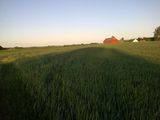
- 2008-06-04 Malmö, Sweden - In a beautiful field just north east of Lake Vomb outside Sjöbo. Aerial photo
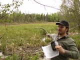
- 2008-06-04 Anchorage, AK - In undeveloped land just off Tudor West of Lake Otis. The second most accessible location since the algorithm was published. (Accessible with proper footwear, In the middle of a marsh)
- 2008-06-04 San Jose, CA - Reached by Tapin on the side of a poison-oak-covered hill in Almaden Quicksilver County Park fairly close to sunset; didn't see any evidence of other geohashers.
- 2008-06-04 Los Angeles, CA - In the valley just off the 101, Hampshire exit. There's a good Mexican place and a Claim Jumpers nearby. Might go there for dinner. Daniel 16:46, 4 June 2008 (UTC)
- 2008-06-04 Surrey, BC - In the parking lot of a Korean church slated for demolition. Robyn 02:19, 5 June 2008 (UTC)
Photo Gallery
Add your own photo for Wednesday 4 June
Expeditions and Plans
| 2008-06-04 | ||
|---|---|---|
| Los Angeles, California | Someone went | Somewhere |
| Charlotte, North Carolina | Karl, Chase, JD | Somewhere |
| San Jose, California | Tapin, Ted | Somewhere |
| Surrey, British Columbia | me | It's the parking lot of a Korean church slated for demolition, but said dem... |
| Malmö, Sweden | HannesL | We made it! The first ever graticule meetup in Malmö. HannesL and David tog... |
| Anchorage, Alaska | Max, Yos, Doug, orbatos | Somewhere |


