Difference between revisions of "2008-06-16 40 -74"
From Geohashing
imported>ReletBot m (mv template as per Naming conventions) |
imported>Benjw m (gallery section now with local versions of photos) |
||
| Line 11: | Line 11: | ||
Hash was a couple of feet east of the GSP northbound side and a couple of feet north of the Holmdel Rd. overpass. Great spot for a speedracer achievement either way. | Hash was a couple of feet east of the GSP northbound side and a couple of feet north of the Holmdel Rd. overpass. Great spot for a speedracer achievement either way. | ||
| − | == | + | == Gallery == |
| − | + | <gallery> | |
| − | + | Image:P6160271.jpg | Image of the GPS | |
| − | + | Image:P6160272.jpg | Picture of LangleyLGLF | |
| + | Image:P6160274.jpg | Estimated speed, 61mph | ||
| + | </gallery> | ||
== Achivements == | == Achivements == | ||
Revision as of 11:10, 10 October 2010
| Mon 16 Jun 2008 in Newark: 40.4015923, -74.1894812 geohashing.info google osm bing/os kml crox |
Planning
Hash was a couple of feet east of the GSP northbound side and a couple of feet north of the Holmdel Rd. overpass. Great spot for a speedracer achievement either way.
Gallery
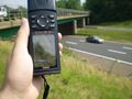
Image of the GPS

Picture of LangleyLGLF
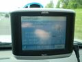
Estimated speed, 61mph


Achivements
LangleyLGLF earned the Land geohash achievement
|

LangleyLGLF earned the Speed racer achievement
by passing through the (40, -74) geohash on 2008-06-16 at ~61 MPH.