Difference between revisions of "2008-10-19 53 12"
imported>Hessophanes |
m (Location correction) |
||
| (4 intermediate revisions by 3 users not shown) | |||
| Line 1: | Line 1: | ||
| − | __NOTOC__[[Image:200810195312. | + | __NOTOC__[[Image:200810195312.jpg|thumb|left]] |
{{meetup graticule | {{meetup graticule | ||
| map=<map lat=53 lon=12 date=2008-10-19/> | | map=<map lat=53 lon=12 date=2008-10-19/> | ||
| Line 50: | Line 50: | ||
[[Category:Expeditions with photos]] | [[Category:Expeditions with photos]] | ||
[[Category:Coordinates reached]] | [[Category:Coordinates reached]] | ||
| + | |||
| + | == Gallery == | ||
| + | <gallery widths="160px" align=center> | ||
| + | Image:200810195312-P1020324.JPG|Phoenix driving to hash #2... | ||
| + | Image:200810195312-P1020325.JPG|... guided by his infallible (but a bit too sensitive) nav system. | ||
| + | Image:200810195312-P1020326.JPG|Relet's brought extra GPS equipment. | ||
| + | Image:200810195312-P1020327.JPG|Bicycle route Berlin-Kopenhagen? Now that's a task... | ||
| + | Image:200810195312-P1020328.JPG|Hessophanes and Phoenix (and the autobahn bridge). | ||
| + | Image:200810195312-P1020329.JPG|More forest... | ||
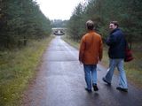
| + | Image:200810195312-P1020330.JPG|The final approach (note the birches in the background). | ||
| + | Image:200810195312-P1020331.JPG|Same view, now with Phoenix and relet. | ||
| + | Image:200810195312-P1020334.JPG|Concentrated GPS power! | ||
| + | Image:200810195312-P1020335.JPG|Oh yeah, of course we're still in the car. | ||
| + | Image:200810195312-P1020337.JPG|Hash reached. | ||
| + | Image:200810195312-P1020339.JPG|The supposed pond - mh, only reed. Lots of reed. | ||
| + | Image:200810195312-P1020340.JPG|Hey, it's a milestone! (Obvious puns omitted.) | ||
| + | Image:200810195312-P1020341.JPG|Hessophanes scouting again (although he was told not to!). | ||
| + | Image:200810195312-P1020342.JPG|Phoenix following. | ||
| + | Image:200810195312-P1020343.JPG|Hey, a geodetic fixpoint! We should move it by a few metres... | ||
| + | Image:200810195312-P1020344.JPG|Awww, forbidden. | ||
| + | </gallery> | ||
| + | {{location|DE|MV|LRO}} | ||
Latest revision as of 19:50, 16 May 2020

| Sun 19 Oct 2008 in 53,12: 53.5790317, 12.3253218 geohashing.info google osm bing/os kml crox |
Participants
Multihash
Second stop of a triple multihash - cf. 2008-10-19_52_13 and 2008-10-19_52_12.
Expedition
As precursory map studying had revealed, Phoenix, relet and Hessophanes had to drive north on A24 several kilometres past the hash (as there were no autobahn exits in the nature reserve), then leave the autobahn in Linstow and make their way back on bumpy forest paths.
Indeed the hash was only 550m away when they passed it on the autobahn, and the streets in the nature reserve weren't as bumpy as expected - actually they could always drive on tarmac. The last three kilometres of the road were restricted to residents and local deliveries though, so they had to park the car and continue on foot.
The road seemed to be never-ending. After more than two kilometres they finally found the autobahn bridge they had used before - the tunnel opening was big enough that a tank would have fit through. They walked through it, turned left and continued along the autobahn for some time. For the last few metres they had to turn away from it again, met a small herd of deer (which quickly fled at their sight) and finally found the geohash in a birch forest.
They didn't stay very long, for the hash itself was quite boring. They wandered a bit further to have a look at what seemed to be a small pond (judging from the sat images they had seen), but they found only reed. Afterwards they took a different route back, had a short break on the way to placate their hungry stomachs and ended up in Phoenix' car with pretty much time left. It wasn't dark yet, they had just eaten something - why not add a third hash to the plan? So off they went...
Tracklog
Photos
- Phoenix driving to hash #2...
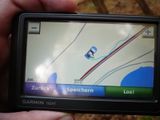
- ... guided by his infallible (but a bit too sensitive) nav system.
- Relet's brought extra GPS equipment.
- Bicycle route Berlin-Kopenhagen? Now that's a task...
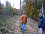
- Hessophanes and Phoenix (and the autobahn bridge).
- More forest...
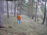
- The final approach (note the birches in the background).
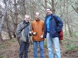
- Same view, now with Phoenix and relet.
- Concentrated GPS power!
- Oh yeah, of course we're still in the car.
- Hash reached.
- The supposed pond - mh, only reed. Lots of reed.
- Hey, it's a milestone! (Obvious puns omitted.)
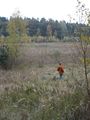
- Hessophanes scouting again (although he was told not to!).
- Phoenix following.
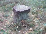
- Hey, a geodetic fixpoint! We should move it by a few metres...
- Awww, forbidden.
Gallery
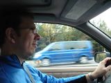
Phoenix driving to hash #2...
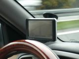
... guided by his infallible (but a bit too sensitive) nav system.
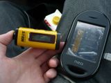
Relet's brought extra GPS equipment.

Bicycle route Berlin-Kopenhagen? Now that's a task...
Hessophanes and Phoenix (and the autobahn bridge).
More forest...
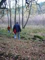
The final approach (note the birches in the background).
Same view, now with Phoenix and relet.
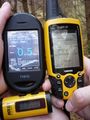
Concentrated GPS power!
Oh yeah, of course we're still in the car.
Hash reached.
The supposed pond - mh, only reed. Lots of reed.
Hey, it's a milestone! (Obvious puns omitted.)
Hessophanes scouting again (although he was told not to!).
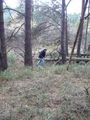
Phoenix following.
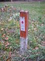
Hey, a geodetic fixpoint! We should move it by a few metres...
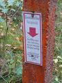
Awww, forbidden.


