Difference between revisions of "2008-05-27 49 -123"
imported>Srs0 |
m (More specific location) |
||
| (11 intermediate revisions by 5 users not shown) | |||
| Line 1: | Line 1: | ||
| + | {{meetup graticule | ||
| + | | map=<map lat="49" lon="-123" date="2008-05-27" /> | ||
| + | | lat=49 | ||
| + | | lon=-123 | ||
| + | | date=2008-05-27 | ||
| + | }} | ||
| + | |||
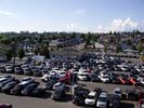
The location today was on a rooftop parking lot at a Superstore at SE Marine Drive and Main Street. | The location today was on a rooftop parking lot at a Superstore at SE Marine Drive and Main Street. | ||
== Successfully Reached == | == Successfully Reached == | ||
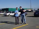
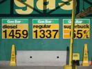
[[user:srs0|srs0]] and [[user:thepiguy|thepiguy]] reached the site at ~18:00 by public transit. The geohash featured 1337 gas, a tape-measuring contest, and a ridiculously bright sun. | [[user:srs0|srs0]] and [[user:thepiguy|thepiguy]] reached the site at ~18:00 by public transit. The geohash featured 1337 gas, a tape-measuring contest, and a ridiculously bright sun. | ||
| + | |||
| + | Not quite a lush green paradise, but an amazing first geohash! | ||
| + | |||
| + | (We also aplogise for our lack of Xkcd t-shirts. This was a spur of the moment desision and we wern't quite as prepared as we would have liked) | ||
<br> | <br> | ||
<br> | <br> | ||
<br> | <br> | ||
| − | <gallery widths="150px" heights="100px" perrow=" | + | <gallery widths="150px" heights="100px" perrow="3"> |
Image:2008-05-27_49_-123_geohash.JPG|The geohash location (and stupidly grinning geohashers)! Unfortunately the sign can't be seen too well in this picture. | Image:2008-05-27_49_-123_geohash.JPG|The geohash location (and stupidly grinning geohashers)! Unfortunately the sign can't be seen too well in this picture. | ||
Image:2008-05-27_49_-123_1337gas.JPG|The 1337est gas I've ever seen! Conveniently located right by the geohash. Coincidence? I think not! | Image:2008-05-27_49_-123_1337gas.JPG|The 1337est gas I've ever seen! Conveniently located right by the geohash. Coincidence? I think not! | ||
| Line 13: | Line 24: | ||
Image:2008-05-27_49_-123_geohashClose.JPG|A close up of the geohash location sign. Now you can actually see what it says! | Image:2008-05-27_49_-123_geohashClose.JPG|A close up of the geohash location sign. Now you can actually see what it says! | ||
Image:2008-05-27_49_-123_measuring.JPG|Tape measurer achievement? | Image:2008-05-27_49_-123_measuring.JPG|Tape measurer achievement? | ||
| − | Image:2008-05-27 49 -123 noInternet.JPG|No Internets... :( | + | Image:2008-05-27 49 -123 noInternet.JPG|No Internets... :( |
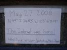
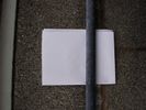
Image:2008-05-27_49_-123_signBehind.JPG|Left a sign to inform other geohashers and/or confuse the public. | Image:2008-05-27_49_-123_signBehind.JPG|Left a sign to inform other geohashers and/or confuse the public. | ||
</gallery> | </gallery> | ||
| + | |||
| + | |||
| + | ==Retro Expedition== | ||
| + | |||
| + | ===[[user:thepiguy|thepiguy's]] Expedition=== | ||
| + | He went, but I'll leave it to him to discuss his trip. -[[User:Srs0|Srs0]] 22:34, 30 May 2010 (UTC) | ||
| + | |||
| + | ===[[user:srs0|srs0's]] Expedition=== | ||
| + | [[user:srs0|srs0]] was unable to go most of the way to Mission for his second hashiversary, due to having work until 17:00, so he instead visited his original expedition (see above). He left work, as mentioned, at 17:00. He quickly stopped by home to change his shirt and drop off his backpack, and got on the bus at 17:31. He then switched buses to get to the Broadway/City Hall Skytrain station, and then took the Canada Line to Marine Drive Station. He could have taken the bus again, but opted to walk the remaining distance (~1.3km). | ||
| + | |||
| + | At the geohash, he noticed a sign that [[user:thepiguy|thepiguy]] had left behind from his visit earlier in the day. He stopped to take some pictures, and then headed home by the same route. | ||
| + | |||
| + | As an interesting note, he got off the last bus at 19:31. Yes, it took two hours to the minute for the expedition, minus the time walking to and from the first bus stop. [[user:srs0|srs0]] wished that he had checked the seconds when he left to see how close to two hours it really was. | ||
| + | |||
| + | <gallery widths="150px" heights="100px" perrow="4"> | ||
| + | Image:2008-05-27 49 -123 retro close.JPG|Approaching the geohash location. | ||
| + | Image:2008-05-27 49 -123 retro gas.JPG|1337 gas no more... | ||
| + | Image:2008-05-27 49 -123 retro superstore.JPG|Getting closer to Superstore. | ||
| + | Image:2008-05-27 49 -123 retro approach.JPG|There's the hashpoint! Almost there. | ||
| + | Image:2008-05-27 49 -123 retro sign.JPG|A note at the hashpoint? | ||
| + | Image:2008-05-27 49 -123 retro sign2.JPG|Yup, a note! | ||
| + | Image:2008-05-27 49 -123 retro srs.JPG|[[user:srs0|srs0]], two years later. | ||
| + | Image:2008-05-27 49 -123 retro skytrain.JPG|This station didn't exist two years ago! | ||
| + | </gallery> | ||
| + | |||
| + | [[Category:Expeditions]] | ||
| + | [[Category:Expeditions with photos]] | ||
| + | [[Category:Coordinates reached]] | ||
| + | {{location|CA|BC|MV}} | ||
Latest revision as of 22:33, 9 August 2020
| Tue 27 May 2008 in 49,-123: 49.2096776, -123.1014417 geohashing.info google osm bing/os kml crox |
The location today was on a rooftop parking lot at a Superstore at SE Marine Drive and Main Street.
Successfully Reached
srs0 and thepiguy reached the site at ~18:00 by public transit. The geohash featured 1337 gas, a tape-measuring contest, and a ridiculously bright sun.
Not quite a lush green paradise, but an amazing first geohash!
(We also aplogise for our lack of Xkcd t-shirts. This was a spur of the moment desision and we wern't quite as prepared as we would have liked)
Retro Expedition
thepiguy's Expedition
He went, but I'll leave it to him to discuss his trip. -Srs0 22:34, 30 May 2010 (UTC)
srs0's Expedition
srs0 was unable to go most of the way to Mission for his second hashiversary, due to having work until 17:00, so he instead visited his original expedition (see above). He left work, as mentioned, at 17:00. He quickly stopped by home to change his shirt and drop off his backpack, and got on the bus at 17:31. He then switched buses to get to the Broadway/City Hall Skytrain station, and then took the Canada Line to Marine Drive Station. He could have taken the bus again, but opted to walk the remaining distance (~1.3km).
At the geohash, he noticed a sign that thepiguy had left behind from his visit earlier in the day. He stopped to take some pictures, and then headed home by the same route.
As an interesting note, he got off the last bus at 19:31. Yes, it took two hours to the minute for the expedition, minus the time walking to and from the first bus stop. srs0 wished that he had checked the seconds when he left to see how close to two hours it really was.
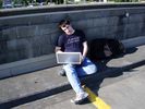
srs0, two years later.
