Difference between revisions of "2008-09-01 49 -124"
(Tada!) |
(per Renaming Proposal) |
||
| (20 intermediate revisions by 15 users not shown) | |||
| Line 32: | Line 32: | ||
==Location== | ==Location== | ||
| − | The hash point was located 250 meters | + | The hash point was located 250 meters off the shore in Lee Bay at Pender Harbor. |
==Planning== | ==Planning== | ||
| Line 40: | Line 40: | ||
Since I wanted to catch the first ferry out of Horseshoe Bay, I decided to leave my house at 3:00 in the morning. I hadn't gotten to bed until 10:00 the night before (and I only got around 3 hours sleep), but I some how mannaged to drag myself out of bed, onto my bike and set off into the dark. | Since I wanted to catch the first ferry out of Horseshoe Bay, I decided to leave my house at 3:00 in the morning. I hadn't gotten to bed until 10:00 the night before (and I only got around 3 hours sleep), but I some how mannaged to drag myself out of bed, onto my bike and set off into the dark. | ||
| − | Things started out well. I had to pace myself on the | + | Things started out well. I had to pace myself on the bike at the beginning (I had a long day ahead!) but I made it out of Richmond and through Vancouver without incident. My first worry is that I was, once again, going to get myself lost in Stanley Park. But, good planning prevailed and I managed to get to the causeway and over the Lions Gate bridge without having to take any trails or bike the wrong way on a one way street. |
Marine drive turned out to be more of an effort this time around, but I was still wide awake and made it to the ferry by 5:30. The first ferry to Langdale wasn't until 7:25, so I had a little bit of a wait ahead of me. It was at this point that I realized I had only brought a cycling and a reflective vest, but no coat. I tried to huddle behind my bike, but the crappy chairs made my legs fall asleep. I had my usual ferry breakfast with a side of bacon for extra energy. I was going to take a nap too, but the ferry ride is only 40 minutes long and I barely put my head down before we arrived. | Marine drive turned out to be more of an effort this time around, but I was still wide awake and made it to the ferry by 5:30. The first ferry to Langdale wasn't until 7:25, so I had a little bit of a wait ahead of me. It was at this point that I realized I had only brought a cycling and a reflective vest, but no coat. I tried to huddle behind my bike, but the crappy chairs made my legs fall asleep. I had my usual ferry breakfast with a side of bacon for extra energy. I was going to take a nap too, but the ferry ride is only 40 minutes long and I barely put my head down before we arrived. | ||
| Line 50: | Line 50: | ||
I stowed all of my valuables in their respective water tight containers and boarded my small neon orange vessel. I had rented a recreational kayak, meaning it was a lot wider and stable than your average kayak. Which was good, because it meant I didn't earn the drowned rat achievement. Paddling turned out to be a heck of a lot more work than biking. Fortunately it was rather easy on my legs, so at least the lower half of my body got a break. My GPS has great maps on it, but every time I stopped to take my bearing I ended up drifting towards undesirable obstacles such as large pointy rocks or power boats. I managed to stay pretty close to land and navigate myself to Lee bay and to the general location. | I stowed all of my valuables in their respective water tight containers and boarded my small neon orange vessel. I had rented a recreational kayak, meaning it was a lot wider and stable than your average kayak. Which was good, because it meant I didn't earn the drowned rat achievement. Paddling turned out to be a heck of a lot more work than biking. Fortunately it was rather easy on my legs, so at least the lower half of my body got a break. My GPS has great maps on it, but every time I stopped to take my bearing I ended up drifting towards undesirable obstacles such as large pointy rocks or power boats. I managed to stay pretty close to land and navigate myself to Lee bay and to the general location. | ||
| − | Which brought me to my next obstacle; how to actually reach the coordinates. It had never occurred to me that the first 141km would be easier than those last 50 meters. Fist of all, there is a distinct lack of landmarks in the middle of the water (and only now, as I type that sentence, does the sheer irony hit me. I guess there's a reason | + | Which brought me to my next obstacle; how to actually reach the coordinates. It had never occurred to me that the first 141km would be easier than those last 50 meters. Fist of all, there is a distinct lack of landmarks in the middle of the water (and only now, as I type that sentence, does the sheer irony hit me. I guess there's a reason they're called <i>land</i>marks.) which means I had to navigate using only the GPS bearing and a compass. Which, normally, wouldn't be that hard; if not for the fact that it is impossible to stay stationary in moving water. Every time I stopped to see where I was and which direction I had to go, I would start drifting in a random direction. If that wasn't bad enough, the kayak also usually turned as it drifted, meaning it was nearly impossible to accurately use the compass. Every time I paddled in any direction I had no more than 15 seconds to check the GPS, figure out how much I had over shot, align the compass and start paddling again before I had moved too far off course. I ended up just taking random shots at where I guessed it was. If you look at the track log you can see where it goes sort of crazy while I was paddling in circles. |
I ended up getting exact coordinates (I assume purely by luck) and even get a decent shot of the GPS too. Once the rush of actually having reached a seemingly impossible set of coordinates wore off, I decided to call a few friends. How often does one get the chance to call people from a kayak? When I finally decided to start heading back I realized that I was now about 25m from the shore. D'oh! | I ended up getting exact coordinates (I assume purely by luck) and even get a decent shot of the GPS too. Once the rush of actually having reached a seemingly impossible set of coordinates wore off, I decided to call a few friends. How often does one get the chance to call people from a kayak? When I finally decided to start heading back I realized that I was now about 25m from the shore. D'oh! | ||
| Line 58: | Line 58: | ||
It was half way up a particularly large hill that I stopped/collapsed on the side of the road to have a snack. I was rummaging through my bag when I came across a Clif Shot energy gel that I had bought as a joke. "What the hell" I thought, I might as well give it a try. First of all, these thing may be the worst tasting product yet developed by man kind. I nearly gagged on the three mouth fulls of what was supposedly "strawberry" flavored gel. Secondly, energy gel should be a controlled substance. Not only did I make it in time to catch the ferry, I made it back with an hour and a half to spare. I was simultaneously relieved that I wouldn't have to spend the night in Gibsons and terrified that 32 grams of semi liquid caffeine could affect my body in such a way. On the plus side, I was wide awake when I finally reached the 3km hill down to the ferry terminal. My crappy bike speedometer maxed out at 50km/h, which isn't all that fast, but fact that it <i>stayed</i> maxed out for a full <i>5 minutes</i> was rather fun. | It was half way up a particularly large hill that I stopped/collapsed on the side of the road to have a snack. I was rummaging through my bag when I came across a Clif Shot energy gel that I had bought as a joke. "What the hell" I thought, I might as well give it a try. First of all, these thing may be the worst tasting product yet developed by man kind. I nearly gagged on the three mouth fulls of what was supposedly "strawberry" flavored gel. Secondly, energy gel should be a controlled substance. Not only did I make it in time to catch the ferry, I made it back with an hour and a half to spare. I was simultaneously relieved that I wouldn't have to spend the night in Gibsons and terrified that 32 grams of semi liquid caffeine could affect my body in such a way. On the plus side, I was wide awake when I finally reached the 3km hill down to the ferry terminal. My crappy bike speedometer maxed out at 50km/h, which isn't all that fast, but fact that it <i>stayed</i> maxed out for a full <i>5 minutes</i> was rather fun. | ||
| − | My victory, however, was rather short lived when I realized that I now had to spend 1.5 coatless hours | + | My victory, however, was rather short lived when I realized that I now had to spend 1.5 coatless hours at the ferry terminal and then still had another 45km left once I got to Vancouver. I hung out in the waiting room, which was a little warmer than outside, and had another delicious ferry meal on the way back. |
Needless to say, I made it the rest of the way back. I can't remember much after I got off of the ferry, but I got home around 1:30 in the morning, a little over 22 hours after I had left. | Needless to say, I made it the rest of the way back. I can't remember much after I got off of the ferry, but I got home around 1:30 in the morning, a little over 22 hours after I had left. | ||
| Line 72: | Line 72: | ||
Image:2008-09-01 49 -124 breakfast.jpg|<nowiki>*drool*</nowiki> | Image:2008-09-01 49 -124 breakfast.jpg|<nowiki>*drool*</nowiki> | ||
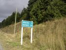
Image:2008-09-01 49 -124 sign2.jpg|If only it had been that easy. | Image:2008-09-01 49 -124 sign2.jpg|If only it had been that easy. | ||
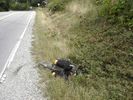
| − | Image:2008-09-01 49 -124 oops.jpg|I took a small detour into a local ditch. This first time I've | + | Image:2008-09-01 49 -124 oops.jpg|I took a small detour into a local ditch. This first time I've ever fallen off that bike too! |
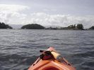
| − | Image:2008-09-01 49 -124 water.jpg|Welcome to the | + | Image:2008-09-01 49 -124 water.jpg|Welcome to the world's orangest kayak! Taken on the way to the hash point. |
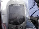
Image:2008-09-01 49 -124 dist.jpg|Water geohash achieved? I think so! | Image:2008-09-01 49 -124 dist.jpg|Water geohash achieved? I think so! | ||
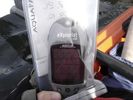
Image:2008-09-01 49 -124 gps.jpg|You can even see the water! | Image:2008-09-01 49 -124 gps.jpg|You can even see the water! | ||
| Line 79: | Line 79: | ||
Image:2008-09-01 49 -124 water3.jpg|And this is looking out into the straight. | Image:2008-09-01 49 -124 water3.jpg|And this is looking out into the straight. | ||
Image:2008-09-01 49 -124 me.jpg|The beard decided to come along too this time. | Image:2008-09-01 49 -124 me.jpg|The beard decided to come along too this time. | ||
| − | Image:2008-09-01 49 -124 pelican.jpg|Let no one say I | + | Image:2008-09-01 49 -124 pelican.jpg|Let no one say I waste money on things I never use! |
Image:2008-09-01 49 -124 tired.jpg|This picture says it all. | Image:2008-09-01 49 -124 tired.jpg|This picture says it all. | ||
</gallery> | </gallery> | ||
| Line 85: | Line 85: | ||
==Achievements== | ==Achievements== | ||
{{ | {{ | ||
| − | + | Graticule unlocked | latitude = 49 | longitude = -124 | date = 2008-09-01 | name = thepiguy | |
}}{{ | }}{{ | ||
water geohash | latitude = 49 | longitude = -124 | date = 2008-09-01 | name = thepiguy| image = 2008-09-01 49 -124 me.jpg | vehicle = kayak | water geohash | latitude = 49 | longitude = -124 | date = 2008-09-01 | name = thepiguy| image = 2008-09-01 49 -124 me.jpg | vehicle = kayak | ||
| Line 110: | Line 110: | ||
[[Category:Expeditions with photos]] | [[Category:Expeditions with photos]] | ||
[[Category:Coordinates reached]] | [[Category:Coordinates reached]] | ||
| + | {{location|CA|BC|SC}} | ||
Latest revision as of 11:36, 20 March 2024
| Mon 1 Sep 2008 in 49,-124: 49.6360098, -124.0640611 geohashing.info google osm bing/os kml crox |
Not wanting to waste his final day off before school thepiguy made an epic bike trip that culminated in the perfect water geohash!
Summary
| Mode of Transportation | Distance (km) | Time |
|---|---|---|
| Total | 282 | 22:07 |
| Bike | 237 | 11:41 |
| Ferry | 36.5 | 1:20 |
| Kayak | 8.5 | 2:36 |
I even have a tracklog!
And a quick panorama too.
Location
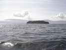
The hash point was located 250 meters off the shore in Lee Bay at Pender Harbor.
Planning
I didn't start class until noon the next day, so I decided to resurrect my original plans from my last big geohash. I was going to bike to the ferry terminal, then bike up through Sechelt to Pender harbor and rent a kayak for the rest of the trip. Luckily for me, Pender harbor is a fairly busy piece of water, and there were multiple places to rent a boat from.
Expedition
Since I wanted to catch the first ferry out of Horseshoe Bay, I decided to leave my house at 3:00 in the morning. I hadn't gotten to bed until 10:00 the night before (and I only got around 3 hours sleep), but I some how mannaged to drag myself out of bed, onto my bike and set off into the dark.
Things started out well. I had to pace myself on the bike at the beginning (I had a long day ahead!) but I made it out of Richmond and through Vancouver without incident. My first worry is that I was, once again, going to get myself lost in Stanley Park. But, good planning prevailed and I managed to get to the causeway and over the Lions Gate bridge without having to take any trails or bike the wrong way on a one way street.
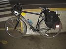
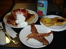
Marine drive turned out to be more of an effort this time around, but I was still wide awake and made it to the ferry by 5:30. The first ferry to Langdale wasn't until 7:25, so I had a little bit of a wait ahead of me. It was at this point that I realized I had only brought a cycling and a reflective vest, but no coat. I tried to huddle behind my bike, but the crappy chairs made my legs fall asleep. I had my usual ferry breakfast with a side of bacon for extra energy. I was going to take a nap too, but the ferry ride is only 40 minutes long and I barely put my head down before we arrived.
Once in Langdale I had to immediately tackle the giant spirit breaking hill that protected the rest of the sunshine coast from unworthy cyclists. By the time I reached Sechelt, the 3 hours sleep was starting to run out and I decided to take a nap on a nice block of concrete I found by the side of the road. My sleep now totaling 3 hours and 20 minutes, I set off again. Although I had planned my journey carefully, I hadn't counted on the "hilly" nature of highway 101. It took me almost 5 hours to bike the 70km into Garden Bay,
The marina was located behind the local pub, so I locked up my bike (read: hid it behind a bush) and headed down to the dock. The women at the rental shop was very happy and didn't question why I only needed a kayak for 2 hours or the exact nature of my previous kayaking experience (read: almost none).
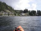
I stowed all of my valuables in their respective water tight containers and boarded my small neon orange vessel. I had rented a recreational kayak, meaning it was a lot wider and stable than your average kayak. Which was good, because it meant I didn't earn the drowned rat achievement. Paddling turned out to be a heck of a lot more work than biking. Fortunately it was rather easy on my legs, so at least the lower half of my body got a break. My GPS has great maps on it, but every time I stopped to take my bearing I ended up drifting towards undesirable obstacles such as large pointy rocks or power boats. I managed to stay pretty close to land and navigate myself to Lee bay and to the general location.
Which brought me to my next obstacle; how to actually reach the coordinates. It had never occurred to me that the first 141km would be easier than those last 50 meters. Fist of all, there is a distinct lack of landmarks in the middle of the water (and only now, as I type that sentence, does the sheer irony hit me. I guess there's a reason they're called landmarks.) which means I had to navigate using only the GPS bearing and a compass. Which, normally, wouldn't be that hard; if not for the fact that it is impossible to stay stationary in moving water. Every time I stopped to see where I was and which direction I had to go, I would start drifting in a random direction. If that wasn't bad enough, the kayak also usually turned as it drifted, meaning it was nearly impossible to accurately use the compass. Every time I paddled in any direction I had no more than 15 seconds to check the GPS, figure out how much I had over shot, align the compass and start paddling again before I had moved too far off course. I ended up just taking random shots at where I guessed it was. If you look at the track log you can see where it goes sort of crazy while I was paddling in circles.
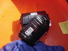
I ended up getting exact coordinates (I assume purely by luck) and even get a decent shot of the GPS too. Once the rush of actually having reached a seemingly impossible set of coordinates wore off, I decided to call a few friends. How often does one get the chance to call people from a kayak? When I finally decided to start heading back I realized that I was now about 25m from the shore. D'oh!
I made it back to land without too much trouble. I need to pay more attention to other boats though, they kept sneaking up on me. It took me about a half hour to sort all of my stuff back into my panniers, but I started the long trip back around 16:30. It was about 15 minutes (and the first hill) later when I realized I was in serious trouble. That lack of sleep combined with the 7ish hours I had already spent cycling had finally hit me. I had to stop after every hill and sometimes take breaks in the middle of them. I estimated that I was going to reach the ferry terminal at around 22:30, which was almost an hour after the last ferry back to Vancouver. So sure was I, that I was going to be spending the night at the ferry terminal; I was already starting to think of ways to build a sleeping bag out of garbage bags and duct tape.
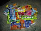
It was half way up a particularly large hill that I stopped/collapsed on the side of the road to have a snack. I was rummaging through my bag when I came across a Clif Shot energy gel that I had bought as a joke. "What the hell" I thought, I might as well give it a try. First of all, these thing may be the worst tasting product yet developed by man kind. I nearly gagged on the three mouth fulls of what was supposedly "strawberry" flavored gel. Secondly, energy gel should be a controlled substance. Not only did I make it in time to catch the ferry, I made it back with an hour and a half to spare. I was simultaneously relieved that I wouldn't have to spend the night in Gibsons and terrified that 32 grams of semi liquid caffeine could affect my body in such a way. On the plus side, I was wide awake when I finally reached the 3km hill down to the ferry terminal. My crappy bike speedometer maxed out at 50km/h, which isn't all that fast, but fact that it stayed maxed out for a full 5 minutes was rather fun.
My victory, however, was rather short lived when I realized that I now had to spend 1.5 coatless hours at the ferry terminal and then still had another 45km left once I got to Vancouver. I hung out in the waiting room, which was a little warmer than outside, and had another delicious ferry meal on the way back.
Needless to say, I made it the rest of the way back. I can't remember much after I got off of the ferry, but I got home around 1:30 in the morning, a little over 22 hours after I had left.
Images
I'm going to see if I can create a panorama too.
Achievements
thepiguy earned the Graticule Unlocked Achievement
|
thepiguy earned the Water geohash achievement
|
thepiguy achieved level 3 of the Minesweeper Geohash achievement
|
Thanks
Special thanks goes to srs0. Although he couldn't come, he let me text message him over 20 times throughout the day so that he could tell search and rescue where to start looking in case I never came home!
He also made the panorama. If it looks a little choppy, that's because it was how I wanted it, believe me; he'd still be working on it otherwise.
Discussion
This was posted on my user page before, during and after the hash. I took it off my page, but I'm sentimental and I didn't want to delete it (that or just a digital pack rat):
- I'm getting up in 6 hours; I've got 7 litres of gator aid in the fridge, three changes of clothes and a kayak rental at a marina over 100km away. If I'm never seen alive again, I want my ashes spread over each Vancouver geohash location for the next month. Let's hope it wont come to that... Thepiguy 04:10, 1 September 2008 (UTC)
- I'm rooting for you! I don't want to have to make all those geohashes to spread the ashes! -Robyn 10:00, 1 September 2008 (UTC)
- I have returned! 22 hours and 7 minutes after I left. Imma' go sleep now. Thepiguy 08:31, 2 September 2008 (UTC)
- Noooo, first tell me if you beat me or not! -- Arvid@work


