Difference between revisions of "2022-10-17 51 0"
PeterRoder (talk | contribs) m (Planning) |
m (subst-ing) |
||
| (7 intermediate revisions by 3 users not shown) | |||
| Line 1: | Line 1: | ||
{{meetup graticule | {{meetup graticule | ||
| − | | lat= | + | | lat=51 |
| − | | lon= | + | | lon=0 |
| − | | date= | + | | date=2022-10-17 |
}} | }} | ||
== Location == | == Location == | ||
| − | + | In a wooded area near Newport. | |
This is pretty much the optimal location for me to reach a hash in this graticule, so I'm going for it. | This is pretty much the optimal location for me to reach a hash in this graticule, so I'm going for it. | ||
| Line 11: | Line 11: | ||
[[User:PeterRoder|PeterRoder]] | [[User:PeterRoder|PeterRoder]] | ||
| − | == | + | == Expedition == |
| − | + | I walked to the station, and having allowed slack time at several points while planning, I reached my platform 20 minutes early. This was my first train journey in several years, but it all went fine and I arrived at Newport station at 12:43 as planned. | |
| + | |||
| + | As I was walking up the main road through Newport, I had a mild panic as my GPS said I should be in Letchworth, 30km away. After a short period of confusion, I realised that it was taking me to the mirror image of the hash across the prime meridian. I fixed it, and continued on my way. | ||
| + | |||
| + | My route took me along 150m of the [https://www.ldwa.org.uk/ldp/members/show_path.php?path_name=Harcamlow+Way Harcamlow Way], compared to 200m on [[2022-01-21 52 0]], which I didn't notice at the time. At this rate, I'll have walked the whole thing by the time I've done my 2600th hash! | ||
| + | |||
| + | {| class="wikitable" style="float:left; margin-right:10px; margin-bottom:0px;" | ||
| + | |[[Image:2022-10-17 51 0 sewage ducks.jpg|frameless|upright]]<br>Sewage ducks | ||
| + | |[[Image:2022-10-17 51 0 sewage hashcat.jpg|frameless|upright]]<br>Sewage hashcat | ||
| + | |} | ||
| + | |||
| + | I was a little worried about reaching the hash, because the footpath I was relying on didn't exist on google maps. Thankfully, the real world beat google maps on this occasion. I paused behind the sewage works to observe the local wildlife (unfortunately the hashcat wasn't friendly enough to get me an achievement), then carried on towards the hash. | ||
| + | |||
| + | [[Image:2022-10-17 51 0 I crawled under there.jpg|thumb|upright|right|Formidable Hedgerow]] | ||
| + | I easily reached the point on the footpath closest to the hash, but getting through the hedgerow to the hash itself was another challenge. Admittedly, I could have headed back to one of the gaps in the bush that I'd passed earlier, but at ground level right in front of me there was an opening slightly larger than my cross-sectional area, and I was well within the [[stupidity distance]] by that point. I lay down on my front and slid forwards, which miraculously got me into the woods without even a scratch. Getting the gps to settle under the cover of trees was difficult; the best I got a photo of was 2m away. | ||
| + | |||
| + | The tree nearest to the hash looked quite climbable, so I did. | ||
| + | |||
| + | {|class="wikitable" style="float:left;margin-right:10px;" | ||
| + | |[[Image:2022-10-17 51 0 at the hash.jpg|frameless|upright]]<br>Made it! | ||
| + | |[[Image:2022-10-17 51 0 me.jpg|frameless|upright]]<br>Silly grin | ||
| + | |[[Image:2022-10-17 51 0 tree.jpg|frameless|upright]] | ||
| + | |[[Image:2022-10-17 51 0 me in tree.jpg|frameless|upright]]<br>Me, partway up the tree | ||
| + | |[[Image:2022-10-17 51 0 view south.jpg|frameless|upright]]<br>The view to the South from near the hash | ||
| + | |} | ||
| + | |||
| + | [[Image:2022-10-17 51 0 stats.jpg|thumb|upright|right|Some stats from the journey]] | ||
| + | |||
| + | I decided to look for a better way out of the plantation. As you can see by the tracklog, I was successful, but it took me on quite a detour. On the walk back I stopped at Dorringtons to buy a brie and crispy bacon baguette for lunch. Then it was just a 45 minute wait for my train home, and I was done. | ||
| − | + | Total (train+food) spent on this expedition: £9.65 | |
| − | |||
== Tracklog == | == Tracklog == | ||
| − | + | {{tracklog|2022-10-17 51 0.gpx}} | |
| − | |||
| − | |||
| − | |||
| − | |||
| − | |||
| − | |||
| − | |||
== Achievements == | == Achievements == | ||
{{#vardefine:ribbonwidth|100%}} | {{#vardefine:ribbonwidth|100%}} | ||
<!-- Add any achievement ribbons you earned below, or remove this section --> | <!-- Add any achievement ribbons you earned below, or remove this section --> | ||
| + | {{Public transport geohash | ||
| + | |latitude=51 | ||
| + | |longitude=0 | ||
| + | |date=2022-10-17 | ||
| + | |name=Peter | ||
| + | }} | ||
| − | + | {{Minesweeper geohash | |
| − | + | |graticule=52,0 | |
| − | + | |ranknumber=2 | |
| − | + | |w=true | |
| + | |s=true | ||
| + | |name=Peter | ||
| + | }} | ||
| + | (also minesweeper for the 2 neighbouring grats) | ||
| + | {{Two to the N achievement | ||
| + | |count=2 | ||
| + | |date=2022-10-17 | ||
| + | |latitude=51 | ||
| + | |longitude=0 | ||
| + | |name=Peter | ||
| + | |reached=true | ||
| + | }} | ||
| − | + | After the expedition, I realised that this technically counts for the [[Juggernaut achievement]]. The distance from home to the hash is 24km, and by choosing a point <1km closer to the station as my start point, I could have the maximum deviation be less than 1.2km. Since it's still not a very good straight line and I wasn't going for the achievement, I'll take a radio yerevan instead. | |
| − | + | {{Radio Yerevan | |
| + | |achievement=[[Juggernaut achievement]] | ||
| + | |detail=he doesn't think it should count, because he wasn't trying for it. Also it was only just within the required deviation even when moving the start point for convenience. | ||
| + | |date=2022-10-17 | ||
| + | |latitude=51 | ||
| + | |longitude=0 | ||
| + | |user=Peter | ||
| + | }} | ||
| + | Turns out railways are quite straight! | ||
| − | + | __NOTOC__ | |
| − | + | [[Category:Expeditions]] | |
| − | |||
| − | |||
| − | |||
[[Category:Expeditions with photos]] | [[Category:Expeditions with photos]] | ||
| − | |||
| − | |||
| − | |||
| − | |||
| − | |||
| − | |||
| − | + | [[Category:Coordinates reached]] | |
| − | [[Category:Coordinates | + | {{location|GB|ENG|ESS}} |
| − | |||
| − | |||
| − | |||
| − | |||
| − | |||
| − | |||
| − | |||
| − | |||
| − | |||
| − | |||
| − | |||
| − | |||
| − | |||
| − | |||
Latest revision as of 20:52, 24 May 2024
| Mon 17 Oct 2022 in 51,0: 51.9890242, 0.2237915 geohashing.info google osm bing/os kml crox |
Location
In a wooded area near Newport. This is pretty much the optimal location for me to reach a hash in this graticule, so I'm going for it.
Participants
Expedition
I walked to the station, and having allowed slack time at several points while planning, I reached my platform 20 minutes early. This was my first train journey in several years, but it all went fine and I arrived at Newport station at 12:43 as planned.
As I was walking up the main road through Newport, I had a mild panic as my GPS said I should be in Letchworth, 30km away. After a short period of confusion, I realised that it was taking me to the mirror image of the hash across the prime meridian. I fixed it, and continued on my way.
My route took me along 150m of the Harcamlow Way, compared to 200m on 2022-01-21 52 0, which I didn't notice at the time. At this rate, I'll have walked the whole thing by the time I've done my 2600th hash!
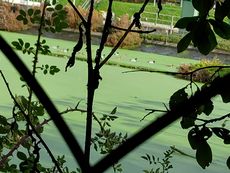 Sewage ducks |
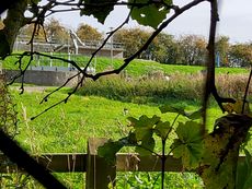 Sewage hashcat |
I was a little worried about reaching the hash, because the footpath I was relying on didn't exist on google maps. Thankfully, the real world beat google maps on this occasion. I paused behind the sewage works to observe the local wildlife (unfortunately the hashcat wasn't friendly enough to get me an achievement), then carried on towards the hash.
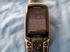
I easily reached the point on the footpath closest to the hash, but getting through the hedgerow to the hash itself was another challenge. Admittedly, I could have headed back to one of the gaps in the bush that I'd passed earlier, but at ground level right in front of me there was an opening slightly larger than my cross-sectional area, and I was well within the stupidity distance by that point. I lay down on my front and slid forwards, which miraculously got me into the woods without even a scratch. Getting the gps to settle under the cover of trees was difficult; the best I got a photo of was 2m away.
The tree nearest to the hash looked quite climbable, so I did.
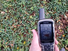 Made it! |
 Silly grin |
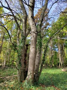
|
 Me, partway up the tree |
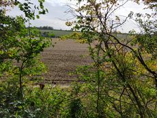 The view to the South from near the hash |
I decided to look for a better way out of the plantation. As you can see by the tracklog, I was successful, but it took me on quite a detour. On the walk back I stopped at Dorringtons to buy a brie and crispy bacon baguette for lunch. Then it was just a 45 minute wait for my train home, and I was done.
Total (train+food) spent on this expedition: £9.65
Tracklog
Achievements
Peter earned the Public transport geohash achievement
|
Peter achieved level 2 of the Minesweeper Geohash achievement
|
(also minesweeper for the 2 neighbouring grats)
After the expedition, I realised that this technically counts for the Juggernaut achievement. The distance from home to the hash is 24km, and by choosing a point <1km closer to the station as my start point, I could have the maximum deviation be less than 1.2km. Since it's still not a very good straight line and I wasn't going for the achievement, I'll take a radio yerevan instead.
Is it true that Peter earned the Juggernaut achievement?
|
Turns out railways are quite straight!
