Difference between revisions of "2009-03-08 33 -85"
imported>Woodveil (→Expedition) |
m (fix, sorry) |
||
| (12 intermediate revisions by 5 users not shown) | |||
| Line 10: | Line 10: | ||
== Planning == | == Planning == | ||
| − | As [[2009-03-08 33 -84|previously stated]], [[user:Woodveil| | + | As [[2009-03-08 33 -84|previously stated]], we ([[user:Woodveil|Woodveil]]) had our eye on the [[Time-Traveller Geohash|Time-Traveller]] geohash. After waiting for the right set of coordinates, today was finally the day. The coordinates in the [[Anniston, Alabama|Anniston, Alabama]] graticule were directly on I20, in the Westbound lanes. We were pushing the hour that we had, and we knew that whatever the result, it was going to be tight. But with the opportunity too good to pass up, we had to go for it. |
== Expedition == | == Expedition == | ||
| − | We started a timer when we left the [[2009-03-08 33 -84|Atlanta coordinates]] at approximately 12:40 Eastern Standard Time. The roads leading away from the hash started off with 40 mph speed limits, which was good. But we also had to drive straight through the little town of Carrollton on our way to I20. We knew that this part of the drive, before we hit I20, would be crucial. It was a Sunday afternoon, and so traffic shouldn't have been too bad. We did hit some unfortunate traffic lights though, | + | [[Image:2009-03-08B carrollton.jpg| thumb| left| So this is Carrollton...]]We started a timer when we left the [[2009-03-08 33 -84|Atlanta coordinates]] at approximately 12:40 Eastern Standard Time. The roads leading away from the hash started off with 40 mph speed limits, which was good. But we also had to drive straight through the little town of Carrollton on our way to I20. We knew that this part of the drive, before we hit I20, would be crucial. It was a Sunday afternoon, and so traffic shouldn't have been too bad. We did hit some unfortunate traffic lights though, though the town center was pretty nice. But the fact of the matter is we didn't get to I20 until just after 1:00 EST. According to the maps, we had 49.0 miles to go. A little math, and we needed to average between 75 and 80 mph. The speed limit was 70. Our goal was still within reach. |
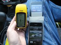
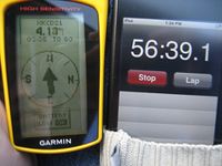
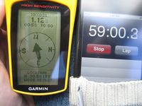
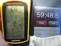
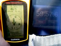
The next forty minutes were some of the most dramatic of our geohashing careers, and perhaps in all of geohashing ever. The entire time as Chris drove, Nick sat in the passenger seat with the timer, GPS and camera. The GPS would periodically give an estimated time of arrival at the hash, which he frantically compared with the time we had left. The first reading he got wasn't good. We had 35 minutes left, and the GPS told us we wouldn't reach the hash for another 40 minutes. That set the stage. Chris asked the Sentra for some more power, and somehow, it delivered. The miles and minutes ticked past until we had closed the time gap. But just as soon as that would happen, we'd get stuck behind slower cars. We were on a mission; these cars were obviously not. So for the duration of the trip we would make time when we could, only to lose it when we caught slow cars in the left lane. The time gap hovered around zero. The most we could manage to accumulate was about 45 seconds, but it never lasted. We were also constantly looking out for police cars. It was tense. | The next forty minutes were some of the most dramatic of our geohashing careers, and perhaps in all of geohashing ever. The entire time as Chris drove, Nick sat in the passenger seat with the timer, GPS and camera. The GPS would periodically give an estimated time of arrival at the hash, which he frantically compared with the time we had left. The first reading he got wasn't good. We had 35 minutes left, and the GPS told us we wouldn't reach the hash for another 40 minutes. That set the stage. Chris asked the Sentra for some more power, and somehow, it delivered. The miles and minutes ticked past until we had closed the time gap. But just as soon as that would happen, we'd get stuck behind slower cars. We were on a mission; these cars were obviously not. So for the duration of the trip we would make time when we could, only to lose it when we caught slow cars in the left lane. The time gap hovered around zero. The most we could manage to accumulate was about 45 seconds, but it never lasted. We were also constantly looking out for police cars. It was tense. | ||
| − | Then it came down to it. We were less than a mile away, with less than a minute left. We were in the left lane, going 80 behind another car, as we watched a semi-truck getting pulled over for a ticket. That could have been us! But we didn't have time to watch, because Nick had to be ready to take a picture at the hashpoint. Mere seconds and mere feet remained. The moment was here, we were at the hash, and our entire universe was shrinking to a single point in space and time that was our goal. Then Nick snapped | + | Then it came down to it. We were less than a mile away, with less than a minute left. We were in the left lane, going 80 behind another car, as we watched a semi-truck getting pulled over for a ticket. That could have been us! But we didn't have time to watch, because Nick had to be ready to take a picture at the hashpoint. Mere seconds and mere feet remained. The moment was here, we were at the hash, and our entire universe was shrinking to a single point in space and time that was our goal. Then Nick snapped another picture. Had we made it? |
| − | + | <gallery widths="400" heights="300px" perrow="2"> | |
| + | Image:2009-03-08B timer 7.jpg| Before. | ||
| + | Image:2009-03-08B DONE.jpg| After. | ||
| + | </gallery> | ||
| − | We had done it. The first recorded Time-Travelling geohashers. Our pulses were racing, and the intensity of the moment was still with us. Following photo confirmation, we slowed down to 65 and took the next exit we saw. There was a gas station and a Dairy Queen, so we stopped for some spoils of victory. Chris got an Arctic Rush and Nick had a Blizzard. We enjoyed our treats as we allowed our parasympathetic nervous systems to restore calm. Then we refueled the Sentra and headed back to a hero's welcome in Atlanta. Well, not really, but in our minds it was pretty good. | + | We had done it. With fewer than 3 seconds remaining, we crossed over the hash. The first recorded Time-Travelling geohashers. Our pulses were racing, and the intensity of the moment was still with us. Following photo confirmation, we slowed down to 65 and took the next exit we saw. There was a gas station and a Dairy Queen, so we stopped for some spoils of victory. Chris got an Arctic Rush and Nick had a Blizzard. We enjoyed our treats as we allowed our parasympathetic nervous systems to restore calm. Then we refueled the Sentra and headed back to a hero's welcome in Atlanta. Well, not really, but in our minds it was pretty good. |
== Gallery == | == Gallery == | ||
| − | |||
<gallery caption="Photo Gallery" widths="200px" heights="200px" perrow="3"> | <gallery caption="Photo Gallery" widths="200px" heights="200px" perrow="3"> | ||
| − | Image:2009-03- | + | Image:2009-03-08B timer 1.jpg| The timer, driving into Carrollton. |
| − | Image:2009-03- | + | Image:2009-03-08B timer 2.jpg| On I20. |
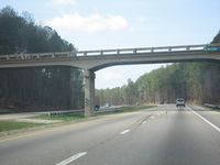
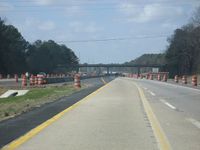
| + | Image:2009-03-08B I20.jpg| There was a nice-looking overpass. | ||
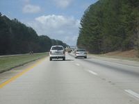
| + | Image:2009-03-08B slow cars.jpg| This was the kind of thing that lost us time. | ||
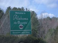
| + | Image:2009-03-08B alabama.jpg| Entering Alabama. | ||
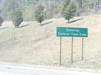
| + | Image:2009-03-08B CST.jpg| But more importantly, entering CST. | ||
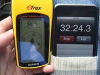
| + | Image:2009-03-08B timer 3.jpg| A couple minutes into the Central Time Zone. | ||
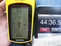
| + | Image:2009-03-08B timer 4.jpg| Closing the gap. | ||
| + | Image:2009-03-08B downhill.jpg| What kind of road is the Sentra best suited for? Downhill roads. | ||
| + | Image:2009-03-08B timer 5.jpg| Slipping into madness. | ||
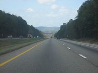
| + | Image:2009-03-08B interstate.jpg| Lane shifts. | ||
| + | Image:2009-03-08B timer 6.jpg| Inside of one minute. It was going to be a matter of seconds. | ||
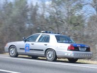
| + | Image:2009-03-08B police.jpg| The last thing we wanted was a [[Police Geohash]]. | ||
| + | Image:2009-03-08B timer 7.jpg| 12 seconds. | ||
| + | Image:2009-03-08B DONE.jpg| DONE! We did it! This picture says it all. | ||
| + | Image:2009-03-08B both.jpg| And we both exhaled. | ||
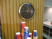
| + | Image:2009-03-08B DQ time.jpg| The clock inside the Dairy Queen. | ||
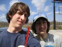
| + | Image:2009-03-08B DQ both.jpg| And us outside. | ||
</gallery> | </gallery> | ||
| Line 43: | Line 61: | ||
| date = 2009-03-08 | | date = 2009-03-08 | ||
}} | }} | ||
| − | {{Speed | + | {{Speed racer | latitude = 33 | longitude = -85 | date = 2009-03-08}} |
| − | {{Reverse | + | {{Reverse regional |
| latitude = 33 | | latitude = 33 | ||
| longitude = -85 | | longitude = -85 | ||
| Line 55: | Line 73: | ||
| user = {{{name|}}} | | user = {{{name|}}} | ||
| achievement = [[Time-Traveller Geohash]] Achievement | | achievement = [[Time-Traveller Geohash]] Achievement | ||
| − | | action = reaching both the | + | | action = reaching both the {{egl|2009-03-08|33|-84|text=(33, -84)}} and {{egl|2009-03-08|33|-85|text=(33, -85) geohashes}} exactly on 2009-03-08, at 12:39 P.M |
| − | | image = 2009-03- | + | | image = 2009-03-08B DONE.jpg |
| category = Time-traveller achievement | | category = Time-traveller achievement | ||
}} | }} | ||
| Line 63: | Line 81: | ||
[[Category:Expeditions with photos]] | [[Category:Expeditions with photos]] | ||
[[Category:Coordinates reached]] | [[Category:Coordinates reached]] | ||
| + | {{location|US|AL|TD}} | ||
Latest revision as of 18:56, 18 January 2022
| Sun 8 Mar 2009 in Anniston: 33.5792666, -85.9768719 geohashing.info google osm bing/os kml crox |
Contents
Planning
As previously stated, we (Woodveil) had our eye on the Time-Traveller geohash. After waiting for the right set of coordinates, today was finally the day. The coordinates in the Anniston, Alabama graticule were directly on I20, in the Westbound lanes. We were pushing the hour that we had, and we knew that whatever the result, it was going to be tight. But with the opportunity too good to pass up, we had to go for it.
Expedition
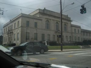
We started a timer when we left the Atlanta coordinates at approximately 12:40 Eastern Standard Time. The roads leading away from the hash started off with 40 mph speed limits, which was good. But we also had to drive straight through the little town of Carrollton on our way to I20. We knew that this part of the drive, before we hit I20, would be crucial. It was a Sunday afternoon, and so traffic shouldn't have been too bad. We did hit some unfortunate traffic lights though, though the town center was pretty nice. But the fact of the matter is we didn't get to I20 until just after 1:00 EST. According to the maps, we had 49.0 miles to go. A little math, and we needed to average between 75 and 80 mph. The speed limit was 70. Our goal was still within reach.
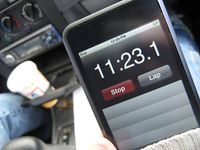
The next forty minutes were some of the most dramatic of our geohashing careers, and perhaps in all of geohashing ever. The entire time as Chris drove, Nick sat in the passenger seat with the timer, GPS and camera. The GPS would periodically give an estimated time of arrival at the hash, which he frantically compared with the time we had left. The first reading he got wasn't good. We had 35 minutes left, and the GPS told us we wouldn't reach the hash for another 40 minutes. That set the stage. Chris asked the Sentra for some more power, and somehow, it delivered. The miles and minutes ticked past until we had closed the time gap. But just as soon as that would happen, we'd get stuck behind slower cars. We were on a mission; these cars were obviously not. So for the duration of the trip we would make time when we could, only to lose it when we caught slow cars in the left lane. The time gap hovered around zero. The most we could manage to accumulate was about 45 seconds, but it never lasted. We were also constantly looking out for police cars. It was tense.
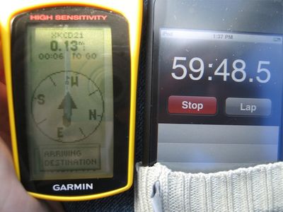
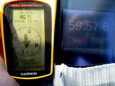
Then it came down to it. We were less than a mile away, with less than a minute left. We were in the left lane, going 80 behind another car, as we watched a semi-truck getting pulled over for a ticket. That could have been us! But we didn't have time to watch, because Nick had to be ready to take a picture at the hashpoint. Mere seconds and mere feet remained. The moment was here, we were at the hash, and our entire universe was shrinking to a single point in space and time that was our goal. Then Nick snapped another picture. Had we made it?
We had done it. With fewer than 3 seconds remaining, we crossed over the hash. The first recorded Time-Travelling geohashers. Our pulses were racing, and the intensity of the moment was still with us. Following photo confirmation, we slowed down to 65 and took the next exit we saw. There was a gas station and a Dairy Queen, so we stopped for some spoils of victory. Chris got an Arctic Rush and Nick had a Blizzard. We enjoyed our treats as we allowed our parasympathetic nervous systems to restore calm. Then we refueled the Sentra and headed back to a hero's welcome in Atlanta. Well, not really, but in our minds it was pretty good.
Gallery
- Photo Gallery
The last thing we wanted was a Police Geohash.
Achievements
This user earned the Land geohash achievement
|
This user earned the Multihash Achievement
|
This user earned the Speed racer achievement
|
This user earned the Reverse regional achievement
|
This user earned the Time-Traveller Geohash Achievement
|
