Difference between revisions of "2009-04-17"
From Geohashing
imported>Aperfectring |
imported>ReletBot m (moving from Template:auto gallery to Template:auto gallery2) |
||
| Line 1: | Line 1: | ||
<noinclude>{{date navigation}}</noinclude> | <noinclude>{{date navigation}}</noinclude> | ||
{{auto coordinates|2009-04-17}} | {{auto coordinates|2009-04-17}} | ||
| − | {{auto | + | {{auto gallery2|2009-04-17}} |
<noinclude>{{expedition summaries|2009-04-17}}</noinclude> | <noinclude>{{expedition summaries|2009-04-17}}</noinclude> | ||
Latest revision as of 22:27, 23 August 2010
Expedition Archives from April 2009
Thursday 16 April 2009 | Friday 17 April 2009 | Saturday 18 April 2009
See also: Category:Meetup on 2009-04-17
Coordinates
West of -30°: .3262266, .5006527
East of -30°: .5152987, .6611671
Globalhash:
2.753765422418,58.020144501521
Photo Gallery
Expeditions and Plans
| 2009-04-17 | ||
|---|---|---|
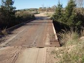
| Bathurst, Australia | Ephphatha | The hash falls on a ridge between O'Connell and Lagoon. 800 metres from the... |
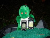
| Atlanta, Georgia | NWoodruff | Hey Yall! I made this one too. |
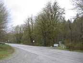
| North Cascades National Park, Washington | Robyn | This day's geohash for North Cascades National Park, Washington fell about 13 km northeast of the town of Darringto... |
| Schweinfurt, Germany | Manu, Reinhard | On our way home we accepted a small detour to Neuhof on a wet Friday evenin... |


