Difference between revisions of "2010-09-12 52 1"
imported>Sourcerer m (→Planning) |
imported>FippeBot m (Location) |
||
| (3 intermediate revisions by one other user not shown) | |||
| Line 13: | Line 13: | ||
== Participants == | == Participants == | ||
| − | [[User:Sourcerer|Sourcerer]] | + | *[[User:Sourcerer|Sourcerer]] |
| + | *[[User:Sourcerer|Sourcerer]] again as a retro on 2015-12-16. | ||
== Expedition == | == Expedition == | ||
| Line 25: | Line 26: | ||
=== Retro === | === Retro === | ||
| − | Expedition | + | Expedition three of four spanning midnight, |
| + | |||
| + | [[2015-12-16 52 1]] - [[2015-08-25 52 1|2015-08-25 52 1 Retro]] - [[2010-09-12 52 1|2010-09-12 52 1 Retro]] - [[2015-12-17 52 1]] - ETA 23:45. | ||
| + | |||
| + | This was really close to the route between the two real hashpoints so the extra effort was minimal. Dry 13 C - hot for December! | ||
== Image Gallery == | == Image Gallery == | ||
| Line 32: | Line 37: | ||
Image:2010-09-12_52_1_Sourcerer_GE.jpg|Google Earth with Expedition Path. | Image:2010-09-12_52_1_Sourcerer_GE.jpg|Google Earth with Expedition Path. | ||
Image:2010-09-12_52_1_Sourcerer_GE_Zoom.jpg|Google Earth Expedition Path at the Hashpoint. | Image:2010-09-12_52_1_Sourcerer_GE_Zoom.jpg|Google Earth Expedition Path at the Hashpoint. | ||
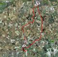
| + | Image:2010-09-12 52 1 Retro Track.jpg|Retro track in Google Earth. | ||
| + | Image:2010-09-12 52 1 Retro Proof.jpg|Retro proof. | ||
</gallery> | </gallery> | ||
| + | |||
| + | == Achievements == | ||
{{Sourcerer_links | {{Sourcerer_links | ||
| Line 44: | Line 53: | ||
[[Category:Coordinates reached]] | [[Category:Coordinates reached]] | ||
[[Category:Expeditions with photos]] | [[Category:Expeditions with photos]] | ||
| + | [[Category:Retro coordinates reached]] | ||
| + | [[Category:Retro meetup]] | ||
| + | [[Category:Golf course]] | ||
| + | {{location|GB|ENG|SFK}} | ||
Latest revision as of 03:42, 9 August 2019
| Sun 12 Sep 2010 in Norwich: 52.3299831, 1.5132765 geohashing.info google osm bing/os kml crox |
Contents
Location
In light rough on the Halesworth Golf Course.
Participants
Expedition
Original
Sourcerer, Neil chased the setting sickle moon into the west as the daylight slowly faded. There was a small layby about 300 metres from the hashpoint and a disused road led in the right direction. Bats were flying and owls could be heard in the distance. A short walk into the golf course led past a green and across the fairway into light rough. The club house was a few hundred metres away and looked welcoming. The course was deserted because it was nearly dark. The GPS receiver distance-to-destination measurement dropped to 1 metre. Neil walked in a small circle but the distance never went below 1 metre. The evening calm was shattered by sirens. It was the railway level crossing. A three car diesel multiple unit train was labouring up hill heading towards Halesworth and Beccles.
This expedition had a bit more spice than usual because, unusually, the Google Earth view was covered in cloud. There was a greater element of surprise. Tomorrow's hash is interesting too. It's in the grounds of Banham Zoo and perhaps the hashpoint is in a tiger enclosure. Sadly, Neil has to work and will not find out.
Retro
Expedition three of four spanning midnight,
2015-12-16 52 1 - 2015-08-25 52 1 Retro - 2010-09-12 52 1 Retro - 2015-12-17 52 1 - ETA 23:45.
This was really close to the route between the two real hashpoints so the extra effort was minimal. Dry 13 C - hot for December!
Image Gallery
Achievements
Expeditions and Plans
| 2010-09-12 | ||
|---|---|---|
| Baltimore, Maryland | Mike | Rosedale, just off of 95, just East of the Rosedale Shopping Center. It app... |
| Andorra la Vella, Andorra | relet | The bridge of Ortedó, or very close to it. |
| Perpignan, France | relet | Just south of the southernmost tip of France. |
| München, Germany | Zb | On a hill near Amperpettenbach. |
| Norwich, United Kingdom | Sourcerer | In light rough on the Halesworth Golf Course. |
Sourcerer's Expedition Links
2010-09-04_52_0 - 2010-09-12_52_1 - 2010-09-18_52_1 - KML file download of Sourcerer's expeditions for use with Google Earth.


