Difference between revisions of "2019-01-19 52 9"
imported>Fippe (New Report) |
(Great Climb) |
||
| (4 intermediate revisions by 3 users not shown) | |||
| Line 23: | Line 23: | ||
As I expected, the thermometer showed a subzero temperature. After recording proof, I went back to the train station. I experienced the sunset, but this time it was not the sun disappearing behind the horizon, it was me going over a hill. | As I expected, the thermometer showed a subzero temperature. After recording proof, I went back to the train station. I experienced the sunset, but this time it was not the sun disappearing behind the horizon, it was me going over a hill. | ||
| + | |||
| + | Addendum: The [[climb achievement]] has recently been established, and as far as I can tell I gained the most elevation during this expedition, 503m. The maximum elevation wasn't particularly high at just over 300m, but a hike going through hilly terrain for over 20km will rake up lots of elevation gain throughout its distance. --[[User:Fippe|Fippe]] ([[User talk:Fippe|talk]]) 11:05, 13 May 2024 (UTC) | ||
==Photos== | ==Photos== | ||
| Line 49: | Line 51: | ||
{{#vardefine:ribbonwidth|100%}} | {{#vardefine:ribbonwidth|100%}} | ||
{{land geohash|latitude=52|longitude=9|date=2019-01-19|name=[[User:Fippe|Fippe]]|image=2019-01-19 52 09 10 Geohash.jpg}} | {{land geohash|latitude=52|longitude=9|date=2019-01-19|name=[[User:Fippe|Fippe]]|image=2019-01-19 52 09 10 Geohash.jpg}} | ||
| − | {{reverse regional|latitude=52|longitude=9|graticule=Hannover|count=2|level=state|name=[[User:Fippe|Fippe]]}} | + | {{reverse regional|latitude=52|longitude=9|graticule=Hannover|count=2|level=state|name=[[User:Fippe|Fippe]]|image=States of 52,9.svg}} |
{{frozen geohash|latitude=52|longitude=9|date=2019-01-19|temperature=-2 °C|name=[[User:Fippe|Fippe]]|image=2019-01-19 52 09 14 Thermometer.jpg}} | {{frozen geohash|latitude=52|longitude=9|date=2019-01-19|temperature=-2 °C|name=[[User:Fippe|Fippe]]|image=2019-01-19 52 09 14 Thermometer.jpg}} | ||
| + | {{climb|latitude=52|longitude=9|date=2019-01-19|elevation=503|mode=foot|name=[[User:Fippe|Fippe]]|image=2019-01-19 52 9 19 Climb.png}} | ||
| + | {{xkcd centurion|count=10|name=[[User:Fippe|Fippe]]}} | ||
__NOTOC__ | __NOTOC__ | ||
| Line 57: | Line 61: | ||
[[Category:Expeditions with photos]] | [[Category:Expeditions with photos]] | ||
{{location|DE|NW|LIP}} | {{location|DE|NW|LIP}} | ||
| − | + | {{user categories|user=Fippe|tram=21|train=149|foot=26|hours=16}} | |
Latest revision as of 11:06, 13 May 2024
| Sat 19 Jan 2019 in Hannover: 52.0080221, 9.1268286 geohashing.info google osm bing/os kml crox |
Location
This Geohash is located on a meadow near Barntrup.
Participants
Expedition
I took the train to Bad Pyrmont, and walked the rest of the distance to the coordinates, which was 13 kilometers. Since it was cold, I brought a thermometer to prove a freezing temperature.
First, I walked through the city of Bad Pyrmont. I've been here previously to visit 2018-09-11 51 9. After that, I walked towards Sonneborn, which belongs to Barntrup. Sonneborn of course also is the name of the best politician.
The border between the counties of Hameln-Pyrmont and Lippe, which also is the border between the states of Lower Saxony and North Rhine-Westphalia, was somewhere between Bad Pyrmont and Sonneborn, but I did not see any marks.
After leaving the Sonneborn behind me, I alwas already getting close, and eventually reached the site. The coordinates were on a meadow next to a forest. The meadow had a fence around it to keep the animals inside from escaping. However, there were no animals inside, just horse feces. I figured it was okay for me to enter since I was not going to break anything, so I did.
As I expected, the thermometer showed a subzero temperature. After recording proof, I went back to the train station. I experienced the sunset, but this time it was not the sun disappearing behind the horizon, it was me going over a hill.
Addendum: The climb achievement has recently been established, and as far as I can tell I gained the most elevation during this expedition, 503m. The maximum elevation wasn't particularly high at just over 300m, but a hike going through hilly terrain for over 20km will rake up lots of elevation gain throughout its distance. --Fippe (talk) 11:05, 13 May 2024 (UTC)
Photos
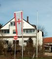
BARF is back.
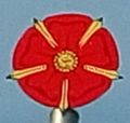
The Rose of Lippe
Achievements
Fippe earned the Land geohash achievement
|
Fippe earned the Reverse regional achievement
|
Fippe earned the Frozen Geohash Achievement
|
Fippe earned the Great Climb achievement
|
Fippe earned the xkcd Decurion achievement
|
- Meetup on 2019-01-19
- Meetup in 52 9
- Land geohash achievement
- Reverse regional achievement
- Frozen geohash achievement
- Climbed by foot
- Climb achievement
- Xkcd centurion achievement
- Expeditions
- Coordinates reached
- Expeditions with photos
- Meetup in Kreis Lippe
- Expeditions by Fippe
- Fippe's expeditions on foot
- Fippe's expeditions by train
- Fippe's expeditions by tram


