Difference between revisions of "2023-06-29 45 -122"
From Geohashing
Michael5000 (talk | contribs) (Created page with "{{subst:Expedition}}") |
m (subst-ing) |
||
| (5 intermediate revisions by 2 users not shown) | |||
| Line 1: | Line 1: | ||
| − | + | {{meetup graticule | |
| − | + | | lat=45 | |
| − | + | | lon=-122 | |
| − | + | | date=2023-06-29 | |
| − | |||
| − | |||
| − | |||
| − | |||
| − | |||
| − | | lat= | ||
| − | | lon= | ||
| − | | date= | ||
}}<!-- edit as necessary --> | }}<!-- edit as necessary --> | ||
== Location == | == Location == | ||
| − | + | On 152nd Avenue, near the Hockinson area north of Vancouver. | |
== Participants == | == Participants == | ||
| − | + | *[[user:Michael5000|Michael5000]] | |
| − | |||
| − | |||
| − | |||
| − | |||
== Expedition == | == Expedition == | ||
| − | + | Last October, I went to the little neighborhood of Hockinson, north of Vancouver, and ran to a [[2022-10-23 45 -122|a hashpoint]] on a country road. And today, I did the same thing. This hashpoint was west of the village and on flatter ground, so I didn't have any trouble with the run; in fact I did a few laps on the high school track in order to add a little distance. 4.43 miles, for those keeping track. | |
| − | == | + | == Photos == |
| − | |||
| − | |||
| − | |||
| − | |||
| − | |||
<gallery perrow="5"> | <gallery perrow="5"> | ||
| + | File:2023-06-29 45 -122 1.jpg|GEV ''Bright Blue Gravitas'' in preparation for the expedition. | ||
| + | File:2023-06-29 45 -122 2.jpg|Success. | ||
| + | File:2023-06-29 45 -122 3.jpg|Looking north up 152rd Avenue. | ||
| + | File:2023-06-29 45 -122 4.jpg|Looking south up 152rd Avenue. | ||
| + | File:2023-06-29 45 -122 5.jpg|Running. | ||
</gallery> | </gallery> | ||
| Line 40: | Line 28: | ||
__NOTOC__ | __NOTOC__ | ||
| − | |||
| − | |||
| − | |||
| − | |||
| − | |||
| − | |||
| − | |||
| − | |||
| − | |||
| − | |||
| − | |||
| − | |||
| − | |||
| − | |||
[[Category:Expeditions]] | [[Category:Expeditions]] | ||
| − | |||
[[Category:Expeditions with photos]] | [[Category:Expeditions with photos]] | ||
| − | |||
| − | |||
| − | |||
| − | |||
| − | |||
[[Category:Coordinates reached]] | [[Category:Coordinates reached]] | ||
| − | + | {{location|US|WA|CR}} | |
| − | |||
| − | |||
| − | |||
| − | |||
| − | |||
| − | |||
| − | |||
| − | |||
| − | |||
| − | |||
| − | |||
| − | |||
| − | |||
| − | |||
| − | |||
| − | |||
| − | |||
Latest revision as of 21:01, 24 May 2024
| Thu 29 Jun 2023 in 45,-122: 45.7427489, -122.5164896 geohashing.info google osm bing/os kml crox |
Location
On 152nd Avenue, near the Hockinson area north of Vancouver.
Participants
Expedition
Last October, I went to the little neighborhood of Hockinson, north of Vancouver, and ran to a a hashpoint on a country road. And today, I did the same thing. This hashpoint was west of the village and on flatter ground, so I didn't have any trouble with the run; in fact I did a few laps on the high school track in order to add a little distance. 4.43 miles, for those keeping track.
Photos
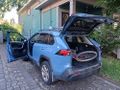
GEV Bright Blue Gravitas in preparation for the expedition.
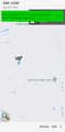
Success.
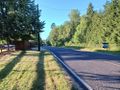
Looking north up 152rd Avenue.
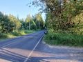
Looking south up 152rd Avenue.
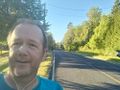
Running.


