Difference between revisions of "2009-08-28"
From Geohashing
imported>AperfectBot m (Ook.) |
imported>ReletBot m (moving from Template:auto gallery to Template:auto gallery2) |
||
| Line 1: | Line 1: | ||
<noinclude>{{date navigation}}</noinclude> | <noinclude>{{date navigation}}</noinclude> | ||
{{auto coordinates|2009-08-28}} | {{auto coordinates|2009-08-28}} | ||
| − | {{auto | + | {{auto gallery2|2009-08-28}} |
<noinclude>{{expedition summaries|2009-08-28}}</noinclude> | <noinclude>{{expedition summaries|2009-08-28}}</noinclude> | ||
Latest revision as of 22:32, 23 August 2010
Expedition Archives from August 2009
Thursday 27 August 2009 | Friday 28 August 2009 | Saturday 29 August 2009
See also: Category:Meetup on 2009-08-28
Coordinates
West of -30°: .4996837, .8026864
East of -30°: .5643503, .9348701
Globalhash:
11.583048240536,156.553222894230
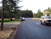
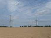
Photo Gallery
|
|
Expeditions and Plans
| 2009-08-28 | ||
|---|---|---|
| Fort Collins, Colorado | Cedar Myers | On a hill overlooking Long Draw Reservoir, inside of the Neota Wilderness b... |
| Lansing, Michigan | excellentdude | The day's hash was a small distance into a forest south of Charlotte. |
| Portland, Oregon | Jim | Beaverton, Oregon, on a side street: near Walker Road, on SW 122nd road. C... |
| Bamberg, Germany | thepiguy, srs0, Danatar | next to a field between Erlangen's boroughs Neuses and Frauenaurach, not fa... |
| Erfurt, Germany | srs0, Danatar, thepiguy | in a piece of forest between Thierbach and Mühltroff, not far from Pausa. ... |
| Halle (Saale), Germany | Danatar, thepiguy, srs0 | in a field near Möderau, a borough of Morl, not far from Halle (Saale). Co... |
| Northampton, United Kingdom | Joe Hardman | Just off the Gartree Road (a section that's footpath/bridleway rather than ... |
| Brandenburg, Germany | ekorren, srs0, thepiguy, Danatar | in a field near Zeestow, not far from Wustermark. Country: Germany; state:... |
| Tampere, Finland | jil | for Tampere graticule. Located in Sorila, Tampere. Meetup location: * 61... |


