Difference between revisions of "Providence, Rhode Island"
imported>Patrick m (→Statistics) |
imported>Patrick m (→Statistics) |
||
| Line 75: | Line 75: | ||
Water Locations - (1/1/7) | Water Locations - (1/1/7) | ||
| − | Total | + | Total Locations Reached - 2<br> |
Total Persons to Have Arrived - 3 | Total Persons to Have Arrived - 3 | ||
Revision as of 19:52, 2 June 2008
| Springfield, MA | Boston, MA | Gloucester, MA |
| Hartford, CT | Providence, Rhode Island | Cape Cod, MA |
| Riverhead, NY | – | – |
[[Category:Meetup in {{{lat}}} {{{lon}}}| ]]
Contents
Graticule Mottto
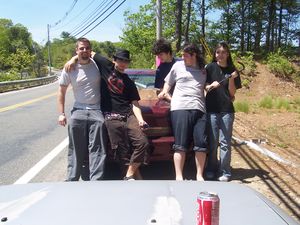
"To the Coke!"
Preferred Raptor Defense System
Velociraptor Species: Crowbar
Aquaraptor Species: None identified
Officialish Welcome
Welcome! The Providence, Rhode Island graticule is at latitude 41, longitude -71. Note that this graticule contains nearly all of the state of Rhode Island, as well as bits of Massachusetts, Connecticut, and the tip of Long Island, NY. And also, possibly, aquaraptors.
Today's Location: [Providence, RI]
Notable Dates
2008-05-26: First successful geohash in this graticule!
2008-05-30: First unsuccessful geohash in this graticule!
2008-06-01: First successful land geohash in this graticule!
Daily Locations
2008-05-21: 41.179467°, -71.861537° Coordinates located in Long Island Sound. (No visits.)
2008-05-22: 41.972874°, -71.238697° Coordinates located near Norton, MA. (No visits.)
2008-05-23: 41.400246°, -71.722772° Coordinates located near Bradford, RI. (No visits.)
2008-05-24: 41.126648°, -71.547533° Coordinates located in Long Island Sound near Block Island, RI. (No visits.)
2008-05-25: 41.941774°, -71.182874° Coordinates located on the Wading River, near Norton Center, MA. (No visits.)
2008-05-26: 41.673128°, -71.607309° Coordinates located near bridge on Hill Farm Rd., Coventry, RI.
Meeting SUCCESSFUL!!! Click above for details and pics.
2008-05-27: 41.209677°, -71.101442° Coordinates located between Rhode Island Sound and Nantucket Sound. (No visits.)
2008-05-28: 41.68745°, -71.212208° Coordinates located in Mt. Hope Bay, between Bristol, RI and southern Fall River, MA. (No visits.)
2008-05-29: 41.464701°, -71.034125° Coordinates located at the mouth of Buzzards Bay, Westport, MA. (No visits.)
2008-05-30: 41.853102°, -71.244603° Coordinates located off of Winthrop St. (Route 44) in Rehoboth, MA.
Geohash UNREACHABLE!!! Click above for details; pics may be forthcoming.
2008-05-31: 41.037487°, -71.281266° Coordinates located 10 miles southeast of Block Island, RI. (No visits.)
2008-06-01: 41.349107°, -71.916239° Coordinates located behind houses near Stony Brook on Stonington Rd. (Route 1) in Stonington, CT.
GEOHASH SUCCESSFUL!
2008-06-02: 41.952873°, -71.02433° Coordinates located on the median of Route 24, North of 495, in Taunton, MA
Statistics
Starting May 21st, (attempted/reached/generated)
Land Locations - (2/1/7)
Water Locations - (1/1/7)
Total Locations Reached - 2
Total Persons to Have Arrived - 3
Records
Consecutive Arrivals - 1
Consecutive Saturdays - 0
Most People - 5 (only 2 of this group successfully completed Water Geohash)
Geohasher with most arrivals - 3 tied with 1 each
Participants
- Patrick - the inaugural geohash in this graticule will be most...satisfying
- Yusuke - Slightly disturbed by the above word choice.
- Tim (aka Yusuke's Ride) - Less disturbed by the aforementioned word choice.
- Shannon
- The Nihilist
