Difference between revisions of "2009-02-21 35 -75"
imported>FippeBot m (Location) |
m (Replacing http://wiki.xkcd.com/geohashing/Image:02_21_09_Muddy_and_Cut_035.jpg with :Image:02 21 09 Muddy and Cut 035.jpg) |
||
| Line 11: | Line 11: | ||
The hash was located in one of the few accessible portions of the refuge (which is mostly “impenetrable vegetation” – per the Refuge brochure), and just over 500 ft/152m from the edge of the road. For most of the year this wetlands is crawling with three types of poisonous snakes, alligators, biting flies, mosquitoes, and a multitude of other inhospitable things looking to make a meal out of you. So, this rare opportunity was simply too good to pass up. | The hash was located in one of the few accessible portions of the refuge (which is mostly “impenetrable vegetation” – per the Refuge brochure), and just over 500 ft/152m from the edge of the road. For most of the year this wetlands is crawling with three types of poisonous snakes, alligators, biting flies, mosquitoes, and a multitude of other inhospitable things looking to make a meal out of you. So, this rare opportunity was simply too good to pass up. | ||
| − | We were fortunate enough to find a fallen log across the canal…and from the looks of it many large Ursa Americanus had used this bridge before! It was a hard 500 feet through the bog and we tripped in many hidden holes, falling face first to the ground. And although we both suffered [ | + | We were fortunate enough to find a fallen log across the canal…and from the looks of it many large Ursa Americanus had used this bridge before! It was a hard 500 feet through the bog and we tripped in many hidden holes, falling face first to the ground. And although we both suffered [[:Image:02 21 09 Muddy and Cut 035.jpg|multiple raptor clawings]], we pressed on, joyous that we could claim the coveted “Look at me, I got injured in the middle of nowhere all because the omniscient Internet told me to go there.” It took us 15 minutes to fight our way to the hash, but when we looked down at the GPS and saw we had finally made it, we squealed with the delight of a school child on Christmas morning. |
Unlike last Saturday’s expedition, we saw no recent bear sign (and we’ve seen many bears in this portion of the refuge in times past), indicating the semi-hibernating fuzzy critters have moved to a quieter and safer portion of the refuge. | Unlike last Saturday’s expedition, we saw no recent bear sign (and we’ve seen many bears in this portion of the refuge in times past), indicating the semi-hibernating fuzzy critters have moved to a quieter and safer portion of the refuge. | ||
Revision as of 11:04, 19 February 2020
| Sat 21 Feb 2009 in 35,-75: 35.8655206, -75.8235131 geohashing.info google osm bing/os kml crox |
Report
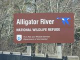
This Geohash was located inside the Alligator River National Wildlife Refuge and a perfect opportunity to grab a Geohash at one of our most favorite places in North Carolina. We visit this refuge several times a year to watch the Black Bears and clean the trails. (In fact, we stopped here during our New Year’s Geohash Expedition.) So this was a Déjà vu Geohash for us.
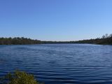
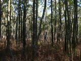
The hash was located in one of the few accessible portions of the refuge (which is mostly “impenetrable vegetation” – per the Refuge brochure), and just over 500 ft/152m from the edge of the road. For most of the year this wetlands is crawling with three types of poisonous snakes, alligators, biting flies, mosquitoes, and a multitude of other inhospitable things looking to make a meal out of you. So, this rare opportunity was simply too good to pass up.
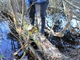
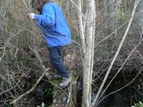
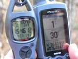
We were fortunate enough to find a fallen log across the canal…and from the looks of it many large Ursa Americanus had used this bridge before! It was a hard 500 feet through the bog and we tripped in many hidden holes, falling face first to the ground. And although we both suffered multiple raptor clawings, we pressed on, joyous that we could claim the coveted “Look at me, I got injured in the middle of nowhere all because the omniscient Internet told me to go there.” It took us 15 minutes to fight our way to the hash, but when we looked down at the GPS and saw we had finally made it, we squealed with the delight of a school child on Christmas morning.
Unlike last Saturday’s expedition, we saw no recent bear sign (and we’ve seen many bears in this portion of the refuge in times past), indicating the semi-hibernating fuzzy critters have moved to a quieter and safer portion of the refuge.
Participants
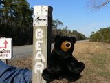
Eisen & Bear - NCBears
Geological Features
Flat coastal wetlands and dense vegetation/forests. Geohash was located ~0.1mile/160m from edge of road.
Wildlife Encounters
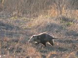
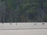
Two Bald Eagles, Swans, Canada Geese, two Great Blue Herons, a Red-Tailed Hawk, numerous Robins and smaller song birds. White-tailed deer, Opossum, Red Fox
Weather
54.1°F/12.3°C, clear skies, winds 5+mph/8+kph
