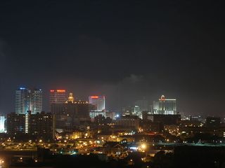
Atlantic City, New Jersey
From Geohashing
Revision as of 14:08, 25 March 2010 by imported>Jevanyn
| Allentown, Pennsylvania | Newark | New York, New York |
| Philadelphia, Pennsylvania | Atlantic City | 39,-73 |
| Salisbury, Maryland | Cape May | 38,-73 |
|
Today's location: geohashing.info google osm bing/os kml crox | ||
The Atlantic City graticule is at 39 N, -74 W. It encloses nearly all of South Jersey, including the majority of the Jersey Shore, from Dover Beaches and Seaside Heights to North Wildwood. Roughly a third of this graticule is in the Atlantic Ocean. A small chunk of Delaware Bay is also enclosed.
Contents
Daily Locations
Older locations have been archived.
For 2024-12-01: 39.8597163, -74.9438291
Places in this Graticule
Cities
- Atlantic City, NJ
- Toms River, NJ, technically the largest by population
- Vineland, NJ, the largest city in New Jersey by land area
- Ocean City, NJ
- Marlton, NJ (A suburb of Camden)
- near Philadelphia, PA
- Fort Dix, NJ (split)
State parks & wildlife areas
Local Geohashers
Jevanyn passes through on his way to Cape May.
Attempted geohashes
- October 15, 2009
- On Clarks Landing road, directly on front of the wildlife management area.
- October 14, 2009
- GreenSquirrel drove up to this geohash in Gabriel field, but it was right in the middle of girls soccer practice.
- September 5, 2008
- Jevanyn coulda woulda shoulda.
- August 23, 2008
- Jevanyn took a ride on his uncle's boat around Wildwood, and cruised right past a water geohash, not knowing it was there.
- August 16, 2008
- Jevanyn got within photo range of a water geohash near Exit 30 on the Parkway.
