2009-03-16 49 8
| Mon 16 Mar 2009 in Mannheim: 49.2662005, 8.5046215 geohashing.info google osm bing/os kml crox |
comment4, http://facingfortyforthrightly.com/ side effects of lamictal, http://fanocp.com/ cheap valtrex, http://iraqeyewitness.org/ viagra, http://saygoodbyetothepounds.com/ female version of viagra, http://e13production.info/ ambien, http://aqracing.com/ buy uk reductil,, http://sunnybraekennels.com/ buying cheap propecia, http://whodoyouknowthatiknow.com/ acomplia 180 pills, http://mnhsfencing.com/ accutane dopamine, http://honeypupcakery.com/ cialis super active 10 pills, http://cpmonster.com/ withdrawl symptoms of xanax, http://the-british-pantry.com/ antabuse, http://sebastien-pichon.com/ inderal adverse effects propranolol, http://gggrub.com/ nexium facts,
Expeditions
Koepfel
Planning
I'll take the Regionalbahn to Mannheim. It departs at Karlsruhe Hbf at 14:25 platform 2 or at Karlsruhe-Hagsfeld at 14:29. I don't know yet, where I get on the train, the Hagsfeld station is actually closer to my house, but as I'll write an exam again this day (let's hope it won't get delayed again), I might also go via Hbf. The train arrives in Waghäusel at 14:48, giving me plenty of time to walk to the Hashpoint.

Live from the Expedition
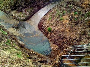
- coordinates reached :) it's not in water, which is about 2 meters away from the hash, though. --koepfel 14:30, 16 March 2009 (UTC)
- i'm now back on the train to karlsruhe. For some reason, the train is currently waiting in graben-neudorf, for now 15 mins. --koepfel 15:58, 16 March 2009 (UTC)
- and we're going again. Seems like a long distance ice train had to go past us. --koepfel 16:02, 16 March 2009 (UTC)
Afterwards
(all Pictures of the expedition)
Note: This is a just a short summary of the expedition. A more detailed description is included in the Image Gallery linked above.
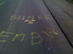
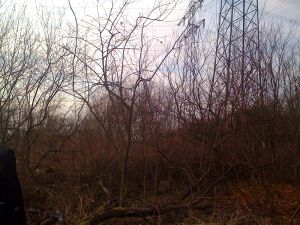
As planned, I took the 14:29 Regionalbahn from Hagsfeld to Waghäusel, arriving at 14:48. I then walked about 2.74km to the Hash. Based on my pre-expedition research, I expected the Hashpoint to be in some kind of recreational area, a swimming lake or something. Instead, I found lots of cut down-dead trees and bushes, very scenic electrical towers and powerlines righr above the Hash and lots of trash. With the knowledge of the Philippsburg Nuclear Power Plant only a few kilometers away (in fact, I saw it on the way, check the photo gallery), with all the trash lying around, when you actually expected a recreational lake, it felt kinda creepy for a moment. I stayed at the Hash for a while, then took some of the trash (only a hand full, since I couldn't find a bag) and headed back to the station.
Here's the GPS-Track (.gpx, .kmz, in Google Maps) of my 2.74km walk from the train station to the Hashpoint. I took the same way back to the station. You may notice, that there are parts of the track missing, that happened, when I quit the GPS-Tracking App to the a photo or check Google Maps for directions.
Koepfel earned the Public transport geohash achievement
|
Koepfel earned the Land geohash achievement
|
Koepfel earned the GeoTrash Geohash Achievement
|

